Dom pod Okićem - Okić (easy path)
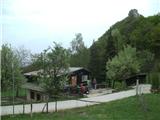
Starting point: Dom pod Okićem (411 m)
Route name: easy path
Walking time: 15 min
Difficulty: easy marked way
Elevation gain: 88 m
Elevation difference along the route: 88 m
Map:
Recommended equipment (summer):
Recommended equipment (winter):
Views: 1.513
 | 1 person like this post |
Access to starting point:
a) Via the Brežice / Bregana border crossing, we drive to Croatia, exiting the motorway at the Samobor exit. Upon arriving in the mentioned town, we head south towards Zagreb. At the petrol station at the southern town exit, we turn right and continue towards the villages of Mirnovec and Kladje. When the road reaches the pass with serpentines, we turn right into Konščica village and then drive west towards Terihaji village. Further along, we will notice signs for Dom pod Okićem by the road, directing us left (onto Starogradska ulica).
b) From Prekmurje and the Maribor area, we first drive to the Gruškovje / Macelj border crossing and continue on the motorway to the Jankomir junction, turning left towards Ljubljana and Samobor. We exit the motorway at the Samobor exit, then continue as per the above description.
Since the parking at the hut is too small for all visitors and reaching it is orientationally quite difficult, I recommend arriving at the hut on foot via the path from Novo Selo Okićko.
Route description:
At the junction east of the Maks Plotnik hut, go slightly left (straight Dragojlina and Žoharjeva path, right downhill to Podgrađe) along the fence. The path enters the forest. After the right bend, we will be in a belt of dense and dark forest, but only until the next left bend. Here the ground will be somewhat more rocky. We reach the entrance to the old Okić castle, which is unfortunately in ruins.
Behind the entrance, be a bit more careful, as a section through rocks and then a short exposed traverse awaits. Here the Dragojlina path joins from the right. Now we have only two minutes to the summit of Okić. It is located in the ruins of the old castle, increasingly overgrown by forest.
Since the Žoharjeva and Dragojlina climbing paths are quite demanding and descent on them is not recommended, this variant is suitable for descent.
Photos:
 1
1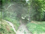 2
2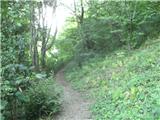 3
3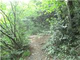 4
4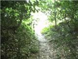 5
5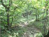 6
6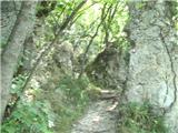 7
7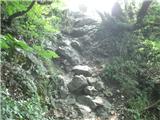 8
8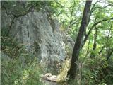 9
9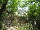 10
10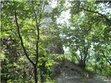 11
11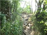 12
12
Discussion about the trip Dom pod Okićem - Okić (easy path)
To post a comment you must log in:
If you do not yet have a username, you must first
register.