Dom Planinka - Mariborska koča (via the Fram waterfall)
Starting point: Dom Planinka (890 m)
| Latitude/Longitude: | 46,4935°N 15,568°E |
| |
Route name: via the Fram waterfall
Walking time: 1 h
Difficulty: easy marked way
Elevation gain: 196 m
Elevation difference along the route: 250 m
Map: Pohorje 1:50.000
Recommended equipment (summer):
Recommended equipment (winter):
Views: 25.870
 | 1 person like this post |
Access to starting point:
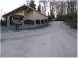
From the four-lane road between Maribor and Slivnica, at the traffic-light intersection we turn right in the direction of the village Hoče (from the Slivnica direction left). We follow the road ahead through Spodnje and Zgornje Hoče towards Slivniško Pohorje. In the upper part of the village Slivniško Pohorje, the road towards Dom Planinka branches off sharply to the right uphill. This road brings us after 100 m to an intersection at the bar Na Prepihu. Here we turn right towards Planinka and park on the parking lot by the road. At the parking lot in front of Planinka and the bar Na Prepihu only guests are allowed to park.
Route description:
From the parking lot, we return to the intersection and continue past the bar Na Prepihu to the next intersection, where signs for Mariborska koča direct us to the left road. After a few minutes of walking, the road ends and we continue on a cart track that leads into a dense spruce forest. There follows a 15-minute walk on a pleasant cart track, at the end of which we step onto an asphalt road. We continue right in the direction of the waterfall to an intersection, where signs for the waterfall Skalca direct us to the left, onto a footpath which starts descending. After 5 minutes of descent, the path brings us to the waterfall Framski slap (waterfall Skalca).
From the waterfall, we return to the intersection and continue on the road in the direction of the mountain hut Mariborska koča. Soon the blazes direct us to the left onto a meadow, where there are several paths. We carefully look where the blaze is and after a short ascent through the meadow we come into the forest, where the path steeply ascends for a short time and then brings us to the mountain hut Mariborska koča in a few minutes.

Photos:
 1
1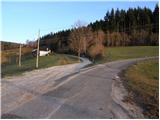 2
2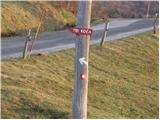 3
3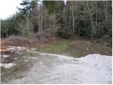 4
4 5
5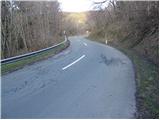 6
6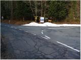 7
7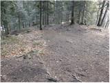 8
8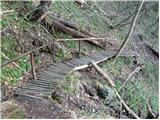 9
9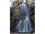 10
10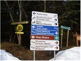 11
11 12
12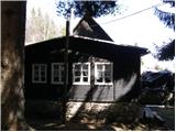 13
13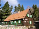 14
14
Discussion about the trip Dom Planinka - Mariborska koča (via the Fram waterfall)
|
| balon8. 06. 2014 |
I'm wondering if anyone has already gone on the path: Dom Planinka-Mariborska koča-Ruška koča and back, and how long it takes.
Thanks and best regards,
Balončki
|
|
|
|
| pohodnik388. 06. 2014 |
From Mariborska koča to Ruška koča on Areh it is about 2 hours depending on the walking pace.
|
|
|
|
| balon1. 07. 2014 |
Thanks for the info.
Balončki
|
|
|
|
| anazala20. 06. 2017 |
Hello. Can someone provide info where exactly tomorrow's hike FROM EAST TO EAST starts. If coming from Krško via Celje and where to turn near Maribor to reach the START point. I know it's not a competition, but still, to where the start will be.
|
|
|
To post a comment you must log in:
If you do not yet have a username, you must first
register.