Dom Planincev v Logarski dolini - Rjavčki vrh (Planinšca)
Starting point: Dom Planincev v Logarski dolini (837 m)
| Latitude/Longitude: | 46,3836°N 14,6216°E |
| |
Walking time: 2 h 55 min
Difficulty: partly demanding marked way, easy pathless terrain
Elevation gain: 1061 m
Elevation difference along the route: 1061 m
Map: Kamniške in Savinjske Alpe 1:50.000
Recommended equipment (summer): helmet
Recommended equipment (winter): helmet, ice axe, crampons
Views: 1.940
 | 2 people like this post |
Access to starting point:
A) Via the mountain pass Volovljek (Kranjski Rak) or from Mozirje we drive to Luče, and from there we continue driving towards Logarska dolina. A few kilometers after the settlement Solčava we will come to a crossroads, where we turn left towards Logarska dolina (toll payment). Further on, we drive through Logarska dolina to the Dom Planincev mountain hut in Logarska dolina. We park on the parking lot on the left side of the road. The parking lot on the right side is intended for guests of the Dom Planincev mountain hut.
B) Via the border crossing Jezerski vrh we drive to Austria, there in the Bela / Vellach valley we turn right towards the border crossing Pavličev vrh (Pavličevo sedlo) / Paulitchsattel. When we arrive on the Slovenian side we first descend to the valley, then at the crossroads a little before Solčava we turn right towards Logarska dolina (toll payment). Further on, we drive through Logarska dolina to the Dom Planincev mountain hut in Logarska dolina. We park on the parking lot on the left side of the road. The parking lot on the right side is intended for guests of the Dom Planincev mountain hut.
C) We drive to Črna na Koroškem (to here from Ravne na Koroškem or from Šoštanj via the mountain pass Spodnje Sleme), then we continue driving towards Luče. Initially still an asphalt road, higher up it becomes gravel and brings us to the crossroads of several roads at the mountain pass Spodnje Sleme. We continue on the main road, which begins to descend transversely towards the settlement Podolševa. Lower down at the crossroads we turn sharply left (right Solčava panoramic road - we can also reach the starting point via this road, in this case we join the road via the mountain pass Pavličev vrh) towards Solčava. When we descend to Solčava, at the crossroads where we join the main road we continue right. A few kilometers after the settlement Solčava we will come to a crossroads, where we turn left towards Logarska dolina (toll payment). Further on, we drive through Logarska dolina to the Dom Planincev mountain hut in Logarska dolina. We park on the parking lot on the left side of the road. The parking lot on the right side is intended for guests of the Dom Planincev mountain hut.
Route description:
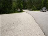
From the parking lot, we continue on the main road which leads us over a bridge, after the bridge signs for Klemenča jama direct us left onto the forest road, on which we continue the path, and it brings us in a few minutes to a crossroads, where we continue right in the direction of Klemenča jama. From the crossroads we walk on the road only a short time, as we then continue left on the initially wide and gentle mountain path. A few steps further, the path moves onto the slope and gradually begins to ascend steeper and steeper. The steep path continues ascending on the steep slope, then crosses a torrent gully and a little further a stream. After the stream, the path becomes even steeper and ascends on a very steep slope, which is especially dangerous for slipping when wet. After just under an hour of walking from the starting point, we arrive at a bench by a spring and just a little further to a junction, where we join the path from the starting point Na razpotju.
Here the steepness eases, and we continue slightly uphill on the wide path, which soon brings us out of the forest. From here only a short ascent follows on the grassy slope to the Koča na Klemenči jami mountain hut below Ojstrica.
From the hut, where a junction is marked, we continue straight in the direction of Ojstrica (left Strelovec and Krofička) on the path that enters the forest after some 10 meters. Through the forest we ascend moderately to steeply, and higher up the path brings us below rocky cliffs. The path soon moves away from the cliffs to the right and brings us to a junction, where we continue straight towards Škarje, while to the left branches the very demanding Kopinškova pot on Ojstrica. The path continues crossing slopes towards the west, then emerges from the forest and turns slightly left. Here it begins to ascend somewhat more steeply beside the scree, then turns right and climbs towards the saddle below Rjavčki vrh (1898 m).
On the saddle (or even a little before) we leave the marked path and continue the ascent right on easier pathless terrain. After approximately 10 minutes of ascent on the partly grassy slope, we reach the Rjavčki vrh overgrown with dwarf pines, from which a beautiful view opens onto the mountains above Logarska dolina.
Starting point - Koča na Klemenči jami 1:05, Koča na Klemenči jami - Rjavčki vrh 1:50.

Photos:
 1
1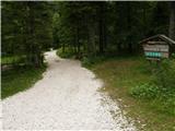 2
2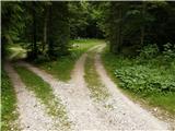 3
3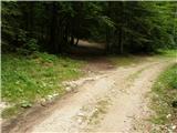 4
4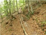 5
5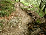 6
6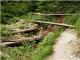 7
7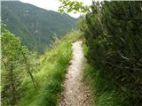 8
8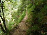 9
9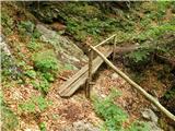 10
10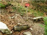 11
11 12
12 13
13 14
14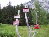 15
15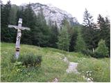 16
16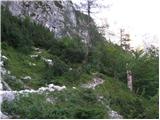 17
17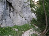 18
18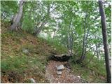 19
19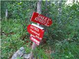 20
20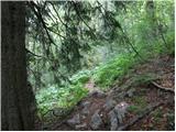 21
21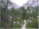 22
22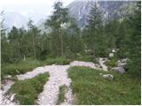 23
23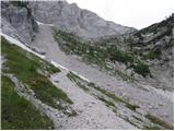 24
24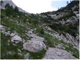 25
25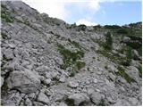 26
26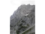 27
27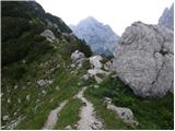 28
28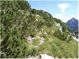 29
29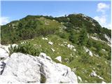 30
30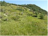 31
31 32
32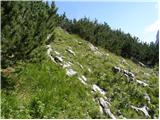 33
33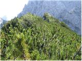 34
34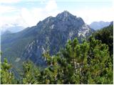 35
35
Discussion about the trip Dom Planincev v Logarski dolini - Rjavčki vrh (Planinšca)
|
| skiro1231. 08. 2024 18:24:30 |
The peak is popular enough that a fairly easy-to-follow path has already formed. Some parts might still be a bit less visible, but you quickly spot the path again. Perhaps the last part could be marked as "unmarked path" instead of "(easy) pathless".
Otherwise, it's a nice viewpoint worth visiting, especially for those who don't want to do more than 1100 vm or find the path to Krofička too demanding.
|
|
|
To post a comment you must log in:
If you do not yet have a username, you must first
register.