Starting point: Dom na Govejku (734 m)
| Latitude/Longitude: | 46,1148°N 14,3465°E |
| |
Walking time: 1 h
Difficulty: easy marked way
Elevation gain: 124 m
Elevation difference along the route: 200 m
Map: Ljubljana - okolica 1:50.000
Recommended equipment (summer):
Recommended equipment (winter): crampons
Views: 31.574
 | 1 person like this post |
Access to starting point:
From Medvode we drive to the village Sora, from where we continue driving towards the village Topol (Katarina). After a few km of driving from the village Sora, we come to the inn Legastja, and immediately behind it we turn right onto a steep macadam road in the direction of the mountain hut Dom na Govejku. We then follow the steep and often quite damaged by rain road to a marked parking lot near the mountain hut Dom na Govejku.
If the road seems too bad, we can park already in the valley at an appropriate place by the inn Legastja. This extends the path for approximately 45 minutes.
Route description:
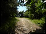
From the parking lot, we first walk to the mountain hut, and then continue on a marked footpath in the direction towards Osolnik (left Tošč). The path ahead on the right side of the sign (cross) crosses a panoramic grassy hayfield, and then passes into a dense forest, where it starts to descend gently. Next follows crossing the slopes towards the right, and then the footpath widens and only a little further joins a worse macadam road. We continue on the mentioned road, and we walk on it only for a few minutes, and then the blazes direct us to the left onto an ascending footpath. Next follows a traversing ascent towards the right, and then the path flattens and brings us to a junction of several paths.
We continue in the direction of Osolnik and continue the ascent on a steep macadam road which past the log cabin Osovnik (which is located a minute from our path) brings us to a smaller hamlet, where we join the road from the village Sora. Here we continue left, ascend on a steep road almost to the last house, and then continue right on a cart track which further moderately ascends over increasingly panoramic grassy slopes. Higher, the cart track turns to the left and after some 10 steps of further walking brings us to the summit of Osolnik, on which stands the church of St. Mohor and Fortunat.

Photos:
 1
1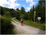 2
2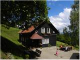 3
3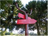 4
4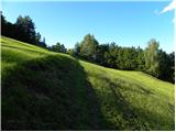 5
5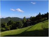 6
6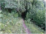 7
7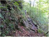 8
8 9
9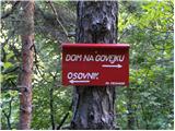 10
10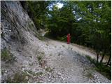 11
11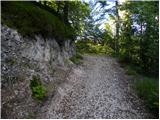 12
12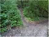 13
13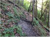 14
14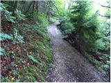 15
15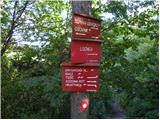 16
16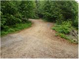 17
17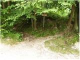 18
18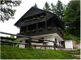 19
19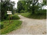 20
20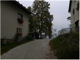 21
21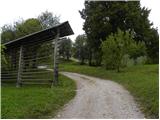 22
22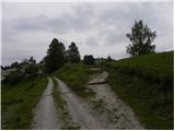 23
23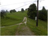 24
24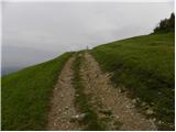 25
25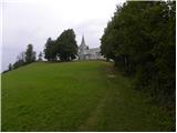 26
26 27
27
Discussion about the trip Dom na Govejku - Osolnik
|
| Gora Trma11. 04. 2014 |
This trail is one of the connections or the shortest connection between Miheličičev dom on Govejek and Osolnik.
Immediately after the glaze ice storm it was very difficult to pass, now it's great as members of PD Medvode have really nicely arranged it a few days ago.
|
|
|
To post a comment you must log in:
If you do not yet have a username, you must first
register.