Planina Dolnica/Dolinza Alm - Starhand
Starting point: Planina Dolnica/Dolinza Alm (1400 m)
| Latitude/Longitude: | 46,5741°N 13,4818°E |
| |
Walking time: 1 h 40 min
Difficulty: easy marked way
Elevation gain: 565 m
Elevation difference along the route: 565 m
Map: Tabacco 19
Recommended equipment (summer):
Recommended equipment (winter): ice axe, crampons
Views: 5.257
 | 2 people like this post |
Access to starting point:
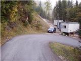
Access from Trbiž/Tarvisio: From Trbiž/Tarvisio we drive on the old road to Austria. After the village Vrata/Thorl, a road branches off to the left, which through the underpass crosses the railway. We follow the road ahead to the village Bistrica/Feistritz, where in the center of the village at the sharp right turn, a road branches off towards the village Blače/Vorderberg (at the crossroad we continue straight). In the village Blače/Vorderberg we turn left towards the church and follow the road ahead to the next crossroad, where we continue right in the direction of the mountain pasture Donice/Dolinza Alm. The asphalt road then runs past the cottage on Kočiška planina/Koutschitz Alm and only a little further brings us to the next crossroad, where we continue left on the lower road. The road then descends, crosses a stream and then again starts ascending. We park on one of the smaller parking lots by the road before the sign that prohibits all traffic.
Access from Beljak/Villach: On the old road we drive towards Trbiž/Tarvisio and after the village Megvarje/Maglern we turn right under the railway. Further, we follow the above description.
Access from Slovenia: Over the border crossing Rateče to Trbiž/Tarvisio, then follow the above description.
Route description:
From the parking lot, we continue on the road along which we parked. After approximately 15 minutes of walking, the path brings us to the mountain hut on the alpine pasture. Further, we continue on the road, which a few meters before the hut (in the direction of arrival) turns right and crosses a short stretch of forest and a small torrential stream. This is followed by traversing the alpine pasture to a path junction, where we continue sharply left to the hut standing alone on this part of the pasture.
The path then climbs gently in a traversing ascent and brings us to a grazing fence. Next, we cross the fence and continue through the forest. After a few minutes of walking through the forest, the path brings us again to the forest road, but we merely cross it. The path then, after a few steps, crosses the road again and continues through the forest, where we cross a small streamlet. Ahead, the path crosses a grassy clearing and enters the forest again, where it steeply ascends for a short time. This is followed by crossing a torrent bed, after which the path gradually emerges from the forest onto wide grassy slopes surrounded by larches. The path ahead is somewhat harder to follow and turns to the left. This is followed by a barely noticeable ascent to the grassy ridge, where the path makes a sharp right turn. Next comes traversing slightly below the summit grassy ridge to a path junction, where we continue in the same direction. Ahead, the path ascends a gentle grassy slope to the foot of steeper slopes. Here we notice markers directing us right below the steep slopes to the edge of the forest. This is followed by a short ascent through the forest, then the path ascends slightly below the ridge to the panoramic summit.

Photos:
 1
1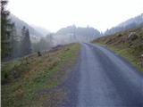 2
2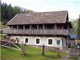 3
3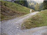 4
4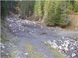 5
5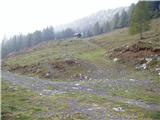 6
6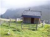 7
7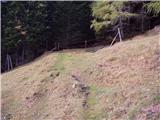 8
8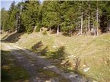 9
9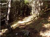 10
10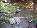 11
11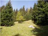 12
12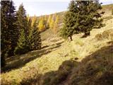 13
13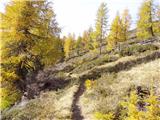 14
14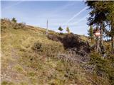 15
15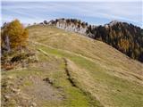 16
16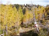 17
17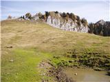 18
18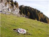 19
19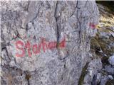 20
20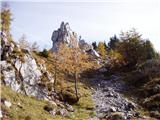 21
21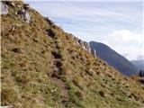 22
22 23
23
Discussion about the trip Planina Dolnica/Dolinza Alm - Starhand
|
| Acibujl15. 12. 2025 22:46:08 |
15.12.2025, on a beautiful Sunday, visit to Starhand from Ugovizza (Ukve) past the Nordio Deffar hut. Parked at P6, parking Ex rif. Defar (there was the old hut that burned down, now there's a new one higher up) private road from the valley up is arranged, drivable. Parking free. In summer we once paid 5€ toll, now no one collected. To the hut 40 min marked, another good 10 straight from the hut and you're at saddle Lom. There head towards Gorjaher planina, path 403. When you reach the saddle on this marked path, yellow Austrian direction signs point to Starhand summit. There's also a sign on a large rock along the path. Up we went on the marked path and track, down we took the slope directly to the path, on the footsteps we saw earlier but didn't dare up them as it was our first time and we stuck to markings. Path to summit ok, views fantastic, peaks, hills, mountains on all four sides of the sky, wonderful! We didn't go down to the cross on the ridge. Somehow didn't seem safest down there in the snow... Back to Lom, then to planina Bistrizza and on to Marija Snežna chapel. There continue to saddle Pleccia and back to the valley to the car on path 507. Loop closed, almost 17km and a bit over 1100m elevation. Deffar hut was open. Conditions ideal for winter rambling on sunny hills!
|
|
|
To post a comment you must log in:
If you do not yet have a username, you must first
register.