Planina Dolnica / Dolinza Alm - Sagranberg/Monte Sagran
Starting point: Planina Dolnica / Dolinza Alm (1400 m)
| Latitude/Longitude: | 46,5741°N 13,4818°E |
| |
Walking time: 1 h 30 min
Difficulty: easy unmarked way
Elevation gain: 531 m
Elevation difference along the route: 531 m
Map: Tabacco 19
Recommended equipment (summer):
Recommended equipment (winter): ice axe, crampons
Views: 4.469
 | 1 person like this post |
Access to starting point:
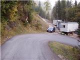
Access from Trbiž/Tarvisio: From Trbiž/Tarvisio we drive on the old road to Austria. Behind the village Vrata/Thorl a road branches off to the left, which through the underpass crosses the railway. We follow the road ahead to the village Bistrica/Feistritz, where in the center of the village at the sharp right turn the road branches off towards the village Blače/Vorderberg (at the crossroad we continue straight). In the village Blače/Vorderberg we turn left towards the church and follow the road ahead to the next crossroad, where we continue right in the direction of the mountain pasture Donice/Dolinza Alm. The asphalt road then runs past the cottage on Kočiška planina/Koutschitz Alm and only a little further brings us to the next crossroad, where we continue left on the lower road. The road then descends, crosses a stream and then again starts ascending. We park on one of the smaller parking lots by the road before the sign prohibited for all traffic.
Access from Beljak/Villach: On the old road we drive towards Trbiž/Tarvisio and after the village Megvarje/Maglern we turn right under the railway. Further, we follow the above description.
Access from Slovenia: Over the border crossing Rateče to Trbiž/Tarvisio, further follow the above description.
Route description:
From the parking lot, we continue on the road by which we have parked. After approximately 15 minutes of walking, the path brings us to the mountain cottage on the mountain pasture. Further, we continue on the road, which only a few meters before the cottage (in the direction of arrival) turns right and crosses a shorter strip of forest and a torrential streamlet. Next follows traversing of the mountain pasture to a junction of paths, where we continue sharply left to the hut, which stands alone on this part of the mountain pasture. The path then in a traverse ascent slightly ascends and brings us to a grazing fence. Ahead we cross the fence and continue the path through the forest. After a few minutes of walking through the forest, the path brings us again to the forest road, but we only cross it. The path then after a few steps again crosses the road and continues through the forest, where we cross a small streamlet. The path ahead crosses a grassy clearing and then goes again into the forest, where it steeply ascends for a short time. Next follows crossing of a torrent, then the path slowly passes from the forest to wide grassy slopes surrounded by larches. The path ahead is somewhat harder to follow and turns to the left. Next follows a barely noticeable ascent to the grassy ridge, where the path makes a sharp right turn. At this spot we leave the marked path and ascend over grass to the wide ridge. We continue left on the path, which ascends towards the summit among larches. A moderately steep path brings us after a few minutes to the main ridge of the mountain, where we turn right and in a few steps reach the panoramic summit.

Along the route: Planina Dolnica (1499m)
Photos:
 1
1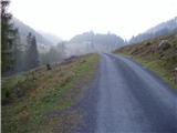 2
2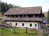 3
3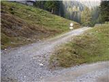 4
4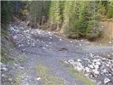 5
5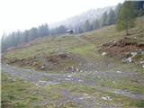 6
6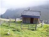 7
7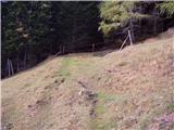 8
8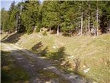 9
9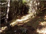 10
10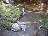 11
11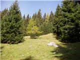 12
12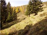 13
13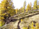 14
14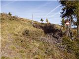 15
15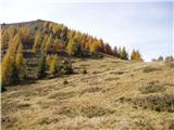 16
16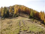 17
17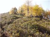 18
18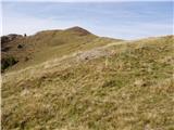 19
19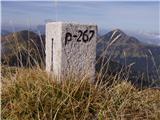 20
20
Discussion about the trip Planina Dolnica / Dolinza Alm - Sagranberg/Monte Sagran
To post a comment you must log in:
If you do not yet have a username, you must first
register.