Starting point: Dol (850 m)
| Latitude/Longitude: | 46,3826°N 14,4445°E |
| |
Walking time: 1 h 40 min
Difficulty: easy unmarked way
Elevation gain: 656 m
Elevation difference along the route: 656 m
Map: Karavanke - osrednji del 1:50.000
Recommended equipment (summer):
Recommended equipment (winter): ice axe, crampons
Views: 6.040
 | 4 people like this post |
Access to starting point:
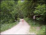
From the Ljubljana–Jesenice motorway, take the Kranj–East exit and follow the road ahead in the direction of Jezersko, but only to the Kanonir inn, where we turn left. Further on, we follow initially the still-asphalted road but only to the crossroads approximately 2 km away, where the road to Stegovnik branches off to the right. We head onto this road, which we follow for a few hundred metres to the barrier, where we park on a small parking area.
Route description:
From the barrier we follow the forest road, which after approximately 20 minutes brings us to a junction. We turn right and follow the road further to a larger grassy clearing on which a house stands. Here we go straight onto the footpath following the Stegovnik signs (left: Stegovnik through the window, unmarked path). The path ascends slightly and brings us to a cart track. Here we carefully watch for the blazes and make sure the cart track does not mislead us. The path then crosses the cart track a few more times and brings us to the Močnikovo sedlo saddle together with the cart track.
Here we leave the marked path to Stegovnik and turn right along the Bukovec ridge. We will notice a very poorly trodden and, in the initial part, also hard-to-see path. If we do not find the path, we stick to the ridge. Higher up, the path through the forest brings us to the ridge, which we follow alongside the wire towards the summit. In the upper part there are many fallen trees, so we will have to climb a little or avoid them with unnecessary detours. A little below the summit the ridge narrows and the forest becomes sparser. The last metres below the summit go through very high grass. When we reach the summit, a beautiful view opens up.
Walking on pathless terrain takes a good 30 minutes.
Orientation, despite the poor path, is not difficult since most of the route follows the ridge.

Along the route: Močnikovo sedlo (1315m)
Photos:
 1
1 2
2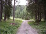 3
3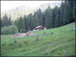 4
4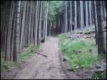 5
5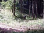 6
6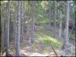 7
7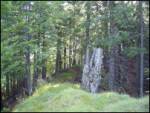 8
8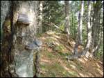 9
9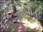 10
10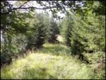 11
11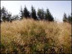 12
12
Discussion about the trip Dol - Bukovec
|
| Gost30. 08. 2006 |
This swing is an old fence that prevented wildlife from crossing to the Jezersko side. The first was erected by Baron Born from Jelendol or the then Putrhof. Later hunters, forest workers and others maintained it, today you can see its condition.
|
|
|
To post a comment you must log in:
If you do not yet have a username, you must first
register.