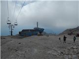
Starting point: D postaja (2202 m)
| Latitude/Longitude: | 46,3326°N 13,5384°E |
| |
Walking time: 50 min
Difficulty: difficult marked way
Elevation gain: 169 m
Elevation difference along the route: 185 m
Map: Julijske Alpe - zahodni del 1:50.000
Recommended equipment (summer): helmet
Recommended equipment (winter): helmet, ice axe, crampons
Views: 1.510
 | 1 person like this post |
Access to starting point:
a) From Kranjska Gora, we drive over the Vršič or Predel pass to Bovec, where we park at the lower station of the circular cable car to Kanin (the cable car is located near the gas station). Then we buy a ticket and take the cable car to the D station.
b) From the Primorska side, we first drive to the valley of the Soča river and then through Tolmin and Kobarid to Bovec, where we park at the lower station of the circular cable car to Kanin (the cable car is located near the gas station). Then we buy a ticket and take the cable car to the D station.
Route description:
At the D station of the Kanin cable car, continue slightly left towards the northwest (direction Visoki Kanin and Okno v Prestreljeniku, right Prestreljenik). Initially, walk on relatively flat terrain that is still part of the ski slope. The path leads past some information boards, then the markers direct to the trail towards Visoki Kanin and Okno v Prestreljeniku (slightly left Dom Petra Skalarja na Kaninu).
The path runs over rocky terrain for a short time, then in a gentle ascent crosses scree slopes and leads to a junction.
Here, the path to the window branches off to the right, while we continue straight on a gradually steeper and moderately difficult path, assisted by some fixed protections. When the steepness eases, we reach the pass south of Hudi Vršič, and the path begins to descend. After about 10 steps of descent, we reach a marked junction on the pass below Hudi Vršič, where we leave the path to Visoki Kanin and continue left on the path towards Dom Petra Skalarja na Kaninu.
The path further gradually leads onto an initially indistinct ridge, which soon becomes somewhat more pronounced, and in a moderate ascent after about 10 minutes from the last junction, we reach the panoramic Vrh Osojnic, where there is a cairn.
D station - junction to Dom Petra Skalarja 0:10, junction to Dom Petra Skalarja - junction to Prestreljeniško okno 0:10, junction to Prestreljeniško okno - junction below Hudi Vršič 0:20, junction below Hudi Vršič - Vrh Osojnic 0:10.

Along the route: Odcep k Domu Petra Skalaraja (2242m), Odcep k Prestreljeniškemu oknu (2302m), Razpotje pod Hudim Vršičem (2376m)
Photos:
 1
1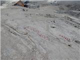 2
2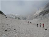 3
3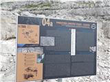 4
4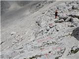 5
5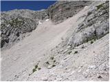 6
6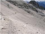 7
7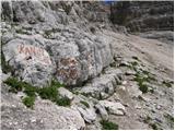 8
8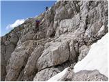 9
9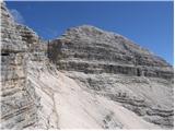 10
10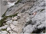 11
11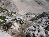 12
12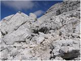 13
13 14
14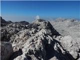 15
15 16
16 17
17 18
18 19
19 20
20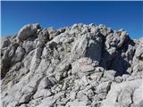 21
21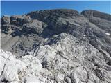 22
22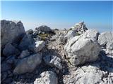 23
23 24
24
Discussion about the trip D postaja - Vrh Osojnic
To post a comment you must log in:
If you do not yet have a username, you must first
register.