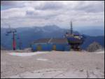
Starting point: D postaja (2202 m)
| Latitude/Longitude: | 46,3326°N 13,5384°E |
| |
Walking time: 5 h
Difficulty: partly demanding marked way
Elevation gain: 6 m
Elevation difference along the route: 550 m
Map: Julijske Alpe - zahodni del 1:50.000
Recommended equipment (summer):
Recommended equipment (winter): ice axe, crampons
Views: 42.405
 | 3 people like this post |
Access to starting point:
a) First, we drive to Kranjska Gora, then continue over the Vršič pass or through Italy and then over the Predel pass towards Bovec. When we arrive in Bovec, we drive along the bypass past the center, then on the other side of the town right towards the nearby gas station. At the gas station, we turn left and ascend to the nearby parking lot at the lower station of the circular cabin cable car to Kanin. Then we buy a ticket and take the cable car to the D station on Kanin.
b) First, we drive to Tolmin, then continue towards Bovec. At the beginning of Bovec, we leave the main road and continue straight towards the town center. We drive only a few dozen meters towards the center, then at the gas station turn sharply left onto the ascending road, along which we quickly arrive at the parking lot at the lower station of the circular cabin cable car. Then we buy a ticket and take the cable car to the D station on Kanin.
Route description:
From the D station, we first walk in a slight ascent to the nearby lower station of the Prevala quad chairlift, from there we continue right in the direction of Prestreljenik and Rombon. The path further leads along the quad chairlift and ascends along the edge of the ski slope. Higher up we arrive at Sedlo (2284 m), where there is an intermediate exit station of the Prevala quad chairlift and where there is a left branch path to Prestreljenik (2499 m).
From Sedlo we continue briefly along the ski slope, which descends towards the Prevala saddle, then we continue slightly left onto the marked footpath, which continues along the left side of the ski slope (continuation along the ski slope is also possible). The path, which further moderately to occasionally steeply descends, leads us past several larger sinkholes, then temporarily levels out. Further on the path turns somewhat to the left and gradually passes to steeper slopes, which are slightly exposed at some points. Lower the path turns sharply right and descends with the aid of a wire rope to the junction at the Prevala saddle (2067 m).
From Prevala, where there is a junction of five paths, we continue straight or slightly right in the direction of Rombon (sharply left to koča Gilberti, slightly left path 636, which leads to Nevejski preval, or to the Na Žlebeh saddle, right downhill to Planina Krnica and Bovec).
We continue east along the path, which gradually passes to the slopes of Lopa (2406 m), which we follow with some ascents and descents to a smaller saddle between Lopa and Kotel (1881 m). Here the path turns slightly left and continues along numerous sinkholes, which are characteristic of the Kanin range. The path further quickly brings us to a junction, where the left branch path to Črnelska špica (2332 m) branches off, we continue right in the direction towards Rombon and the Speleological bivouac. A shorter ascent follows and the path brings us to a smaller saddle between Črnelska špica and Vrh Ribežnov.
From the saddle we slightly descend to the junction near the Speleological bivouac. The right path leads across Rupa to Bovec, we continue along the left path in the direction of Rombon. The path then crosses the slopes below Prišna glava and brings us to a smaller spring with drinking water, which however dries up in the dry season. The path, along which remains from the First World War appear further on, initially still slightly descends, then an approximately one-hour long ascent towards the summit of Rombon follows. In the last part the path becomes increasingly steep and a little below the summit also somewhat exposed.
D station - Sedlo 0:15, Sedlo - Prevala 0:30, Prevala - Bregi 1:50, Bregi - junction below Vrh Ribežnov 0:40, junction below Vrh Ribežnov - spring Prišna glava 0:35, spring Prišna glava - Rombon 1:10.

Along the route: Sedlo (2282m), Prevala (2067m), Greben nad Kotlom (1998m), Odcep k jami Čehi 2 (1997m), Odcep za Hudi Vršič (2021m), Bregi (2010m), Jamarski bivak (1950m), Razpotje pod Vrhom Ribežnov (1955m), Izvir Prišna glava (1882m), Vrh Police (2108m)
Photos:
 1
1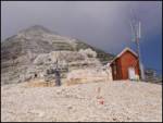 2
2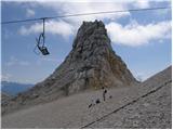 3
3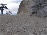 4
4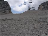 5
5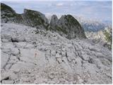 6
6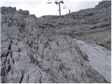 7
7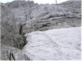 8
8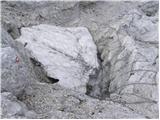 9
9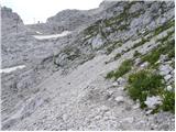 10
10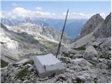 11
11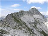 12
12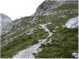 13
13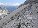 14
14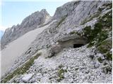 15
15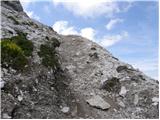 16
16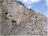 17
17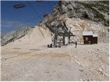 18
18 19
19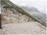 20
20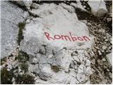 21
21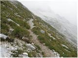 22
22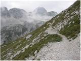 23
23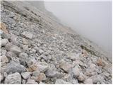 24
24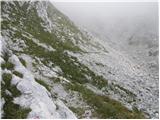 25
25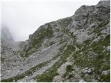 26
26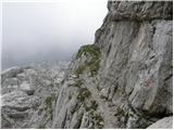 27
27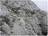 28
28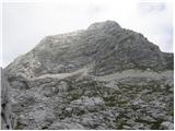 29
29 30
30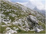 31
31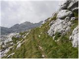 32
32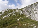 33
33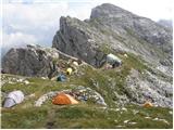 34
34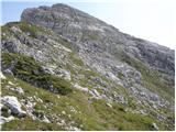 35
35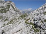 36
36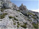 37
37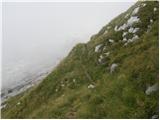 38
38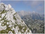 39
39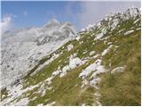 40
40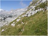 41
41 42
42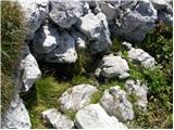 43
43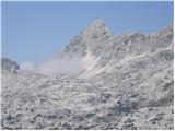 44
44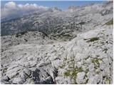 45
45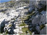 46
46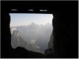 47
47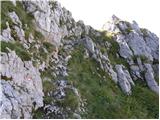 48
48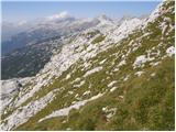 49
49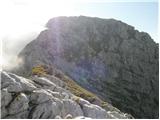 50
50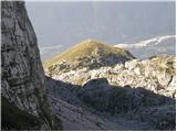 51
51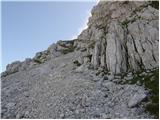 52
52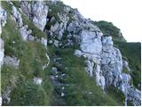 53
53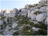 54
54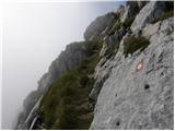 55
55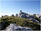 56
56
Discussion about the trip D postaja - Rombon
|
| Gost22. 08. 2007 |
I'm interested if the walking time assessment is realistic. In the literature we mostly find the information that for the path from the upper cable car station on Kanin to Rombon we need 5 to 6 hours.
|
|
|
|
| Rok22. 08. 2007 |
I corrected the walking time. Probably 5 hours is indeed more realistic.
|
|
|
|
| katty2. 10. 2011 |
Hey.
First time on Rombon on Saturday, from Kanin . The path took us about 5.5h including breaks. We got lost in between, as the markings disappear in many places . The path took us about 5.5h including breaks. We got lost in between, as the markings disappear in many places . I recommend local markers to renew them. But the cairns help here. Otherwise, on the path we saw a lot of remains of fortifications from WWI . I recommend local markers to renew them. But the cairns help here. Otherwise, on the path we saw a lot of remains of fortifications from WWI . On the path we met one group of hikers who went via Goričica to Loupo. But no one else until the summit . On the path we met one group of hikers who went via Goričica to Loupo. But no one else until the summit . The last part of the path is quite steep, just below the summit also slightly exposed. On the right just below the summit there is also a tunnel, but we don't enter it. Rombon has 4 hikers at the time of our arrival. In excitement, I first take photos and stamp the spot in Spp, look around the surrounding hills with Jalovec and Triglav in the lead, and only then have a small snack. The path led us to Čukla - we got lost again. Looking at Rombon we notice some more firing lines, tunnels and remains of fortifications. We head towards Bovec via planina Goričica. To the path leading in that direction, we got lost again, but with our ingenuity we soon find the path. We pass some mule tracks, near which there are some half-collapsed guard posts. Below Čukla we then notice some tunnels that could be about 15m long, and above them some firing lines. On planina Goričica there is a hunting hut, which we photograph and continue. After about 45min-1h we reach the village Zavrzelno, from there along the asphalt road to the center of Bovec and then to our starting point. The path from the village to the gondola takes 45min. From our starting point we start at 20:10 and via Log pod Mangartom, Predel, Kranjska Gora, Jesenice and Kranj we return home at 21:45 . The last part of the path is quite steep, just below the summit also slightly exposed. On the right just below the summit there is also a tunnel, but we don't enter it. Rombon has 4 hikers at the time of our arrival. In excitement, I first take photos and stamp the spot in Spp, look around the surrounding hills with Jalovec and Triglav in the lead, and only then have a small snack. The path led us to Čukla - we got lost again. Looking at Rombon we notice some more firing lines, tunnels and remains of fortifications. We head towards Bovec via planina Goričica. To the path leading in that direction, we got lost again, but with our ingenuity we soon find the path. We pass some mule tracks, near which there are some half-collapsed guard posts. Below Čukla we then notice some tunnels that could be about 15m long, and above them some firing lines. On planina Goričica there is a hunting hut, which we photograph and continue. After about 45min-1h we reach the village Zavrzelno, from there along the asphalt road to the center of Bovec and then to our starting point. The path from the village to the gondola takes 45min. From our starting point we start at 20:10 and via Log pod Mangartom, Predel, Kranjska Gora, Jesenice and Kranj we return home at 21:45 . .
Happy that we are finally home, alive and healthy and full of impressions, we tell our family about our adventures.
Really, it was nice, idyllic weather, wonderful views, the path not tiring, just too long. Next time to Rombon from Kluž, return to planina Karnica.
Best regards, Katy
|
|
|
|
| poluks31. 08. 2012 |
Hi
On Wednesday my girlfriend and I visited Rombon. We started from D station and took 5 hours 15 min for the trail, while unsuccessfully looking for Veliko Črnelsko brezno. The trail is very scenic and logical, in between you get the feeling you're alone in the world, you only hear some raven and get surprised looks from chamois. I think it's well marked, so we had no orientation problems. We descended past Čukla, to Planina Goričica and then towards Kaninska vas. When you reach the road to B station, the situation is such that if you follow the road, it takes you through Bovec center and then back to station A. Or you can find your way and cut straight through the thorn-infested forest, where a friendly local then directs you to the station.
The tour D station-Rombon-Bovec is not demanding in terms of fitness, but quite long, so I recommend well-worn hiking boots
best regards andraz
|
|
|
|
| slamca21. 05. 2013 |
Hello,
what's the current situation with the gondola? Is it running or not?
|
|
|
|
| IgorZlodej22. 05. 2013 |
It's not running, and the question is when it will, if at all 
|
|
|
|
| slamca22. 05. 2013 |
Igor, many thanks for the reply. I thought it would be like that. Money is found for every "nonsense", but for something useful there simply isn't any. But I won't go into that. Thanks again.
|
|
|
|
| marinka6725. 07. 2016 |
Today I read in SLONovicah that the cable car will start operating in August, but they don't know exactly when. Fingers crossed!!
One-way ticket 14 €, return 17. Not cheap, huh?
|
|
|
|
| darinka45. 07. 2019 |
Today we walked this path. There were five of us and all first-timers from Kanin. As described, quite demanding in terms of fitness. Only the markings are quite faded in places and luckily we had nice weather. Trip worth all the effort. We descended to Zavrzelno.
|
|
|
|
| britof8. 07. 2019 |
05.07.2019, from D station Prestrelnik to Prevala right along poorly marked path, in places markings very poorly visible need renewal, to Rombon 2208m.
Interesting path, plenty of remnants from WWI. Descent via Čukla 1767m to
Zavrzelno about 16 km.
Fairly fitness demanding.
|
|
|
|
| miri8. 07. 2019 |
Prestrelnik, Prevala, Čukla
|
|
|
|
| andrejf20. 07. 2022 18:12:01 |
A few days ago we did the trail in the opposite direction, arriving at Rombon from Bovec in a good 5 hours and heading towards D postaja. I warn about very poor markings, already from the top of Rombon (after the "D postaja" sign, keep left), then luckily the cairns helped for another good hour and a half. Then the markings are newer, but the trail dragged on against our expectations and mountain experience. The last gondola from D postaja to the valley is at 16:00, dom Petra Skalarja and bivouac are closed, latecomers can from Prevale detour in half an hour to Sella Neveo to the Italian koča Gilberti, where members can overnight for 20eur cash, and the last gondola to the valley is at 17:30.
|
|
|
|
| pclop31. 10. 2022 09:34:31 |
Yesterday went partly along the above mentioned path. The descent towards "D station" (traverse towards Kanin) is quite interesting. Markings very faded in this last ascent to Rombon or descent from Rombon, you can see that not many people go there, which is the charm of this path on one hand, problem on the other, as the path is sometimes hard to follow. Descent from Rombon towards Kanin could be quite dangerous if the path is wet, as there would be high risk of slipping. Fortunately some good people made quite a few "cairns", which at least from my experience help a lot and are in the right places. Below under Rombon markings are renewed, but I turned back there towards Čukla and towards Bovec. This "pathless" traverse from the path towards Kanin under Rombon towards Čukla is quite easy, as the gully up which you ascend if going to Rombon from Bovec past Čukla can serve for orientation.
Markacists though ... fix these markings from the foot of Rombon to its summit.
|
|
|
|
| BorStenar19. 11. 2022 17:57:28 |
cheers
but is the stamp at the summit in good condition?
on Mali Mojstrovka there are two, but neither is recognizable
|
|
|
|
| ločanka23. 08. 2023 05:38:24 |
No, we didn't think orientation relies on cairns. Markings are quite well renewed, maybe not in the last part, but still visible although a bit faded. So I would say no panic about getting lost! Otherwise we didn't see the bivouac or spring by the path, but true we didn't look for it either. It is true that once (a bit above the steps) we came across a fixed cable, which is not mentioned in this description.
|
|
|
|
| ločanka23. 08. 2023 16:52:34 |
simon16, I do remember those ruins, right by the path. But where would one overnight there? Once it was said that it's possible, but rather poor.
|
|
|
|
| B223. 08. 2023 22:58:26 |
And how good it would be in that cavern if a storm rages the whole night too.
Just think of a sudden thunderstorm with crackling lightning...
|
|
|
|
| lina1225. 08. 2023 08:53:33 |
Walked the path on 16.8., to the summit it took us 5 hours and 20 min with breaks. The path is initially easy to follow, markings renewed, and not difficult. An hour before the summit there's a large red cross on the rock instead of markings, which we assumed means end of markings. From there only faded old markings and even those sparsely. The last hour is also technically more demanding without protections, and airy, so it probably deserves the name "difficult (un)marked path". Descended to Kluž, which is more pleasant, easy to follow path (down ca. 3.5 hours). Otherwise it's a beautiful solitary tour, met not a single person, only a bunch of marmots and chamois
|
|
|
|
| lina1225. 08. 2023 09:00:05 |
Just adding: the Rombon stamp can be obtained at the restaurant at Kanin D station, where it's in much better condition. At the top of Rombon it's very old and consequently not well visible in the booklet.
|
|
|
To post a comment you must log in:
If you do not yet have a username, you must first
register.