Starting point: Cvetlin (255 m)
Walking time: 1 h
Difficulty: easy marked way
Elevation gain: 439 m
Elevation difference along the route: 435 m
Map:
Recommended equipment (summer):
Recommended equipment (winter): crampons
Views: 4.550
 | 2 people like this post |
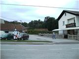
Access to starting point:
If we cross the border between Slovenia and Croatia at the Varnica crossing (near Leskovec), Cvetlin is the first place in Croatia.
If we arrive in Croatia from elsewhere, we drive to Trakošćan, then continue driving towards Donje Višnjice. We follow the road to the village of Cvetlin, where we park near the Cvetlin refreshment area.
Route description:
From the refreshment area or the nearby school, which is located a bit further north, we go uphill along the asphalt. The path initially ascends moderately, then levels out temporarily. Several steep serpentines follow, and the path leads us to the parking area below the Švec farm (you can also drive here by car, but there is space for only 4 vehicles). Up to this point, the path is unmarked but orientationally easy, as we follow the asphalt road the whole time.
We continue past the Švec farm (house numbers 165 and 167) and then uphill on a gentle cart track. Here, a view opens to the left towards Velike Pečine and Pohorje. The path enters the forest and leads us to a point where the path to Velike Pečine branches off to the left (here the climbing path via Velika Pečina joins us). We continue on the flat path to a junction where the path to Velika vrata pass branches off. We proceed slightly to the right on a steeper path, which levels out before the Pusti duh hut.
From the hut, we go downhill along the road, past the junction for Kotarščak and past the junction for Cimerplac. The path then climbs to the Pusti Duh church, from which it is just a minute's walk to the summit with the viewpoint tower.
Filićev dom is about 5 minutes' walk further from the summit along the road.

Photos:
 1
1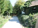 2
2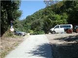 3
3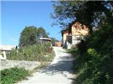 4
4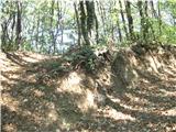 5
5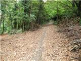 6
6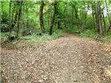 7
7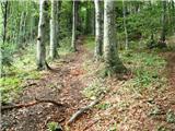 8
8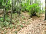 9
9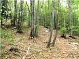 10
10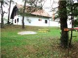 11
11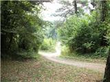 12
12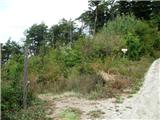 13
13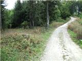 14
14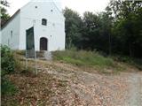 15
15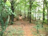 16
16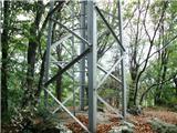 17
17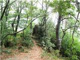 18
18
Discussion about the trip Cvetlin - Ravna Gora
|
| zdomec28. 09. 2012 |
Super description, but how is the approach from Kamenica?
And if you have a description of the trail to Ivanščica, especially from Prigorec. Ivanščica is a very interesting mountain in H. Zagorje and if you happen to have trail descriptions with pictures, post them on this forum.
|
|
|
|
| ba300328. 09. 2012 |
A friend writes a blog about hiking and at the following address you can find all the information
Ivanščica
|
|
|
To post a comment you must log in:
If you do not yet have a username, you must first
register.