Starting point: Črni hribi (400 m)
| Latitude/Longitude: | 45,8643°N 13,6646°E |
| |
Walking time: 2 h
Difficulty: easy marked way
Elevation gain: 243 m
Elevation difference along the route: 400 m
Map: Goriška 1:50.000
Recommended equipment (summer):
Recommended equipment (winter):
Views: 19.992
 | 1 person like this post |
Access to starting point:
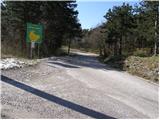
From the Razdrto - Nova Gorica highway, we take the Vogrsko exit and continue driving towards the village Volčja Draga. From Volčja Draga we continue towards the village Bilje, but only to the village Bukovica, where we turn left towards Renče. In Renče behind the church we turn right, and then we drive straight towards the village Temnica. When the road stops ascending, we will notice on the left side an information board of the municipality Miren - Kostanjevica. We park on the parking lot near the mentioned board.
From the Nova Gorica side, we can come to the village Volčja Draga also past Šempeter.
Route description:
From the board near which we have parked, we continue on the asphalt road for approximately 50 meters, then signs for Trstelj point us to the left into the forest. A quite overgrown path, after the first ascent, brings us to Vrtovka. From the top, the path descends, and then leads partly on footpaths, cart tracks and roads.
A well-marked path, which mostly runs through the forest over the already mentioned Vrtovka, Lešenjak, Stolovec and Stol, with a few descents and ascents after two hours of walking, brings us to Trstelj, from which a nice view opens up.
Photos:
 1
1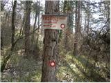 2
2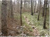 3
3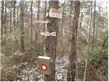 4
4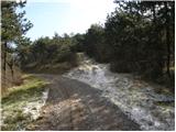 5
5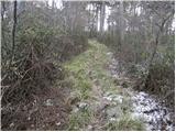 6
6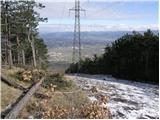 7
7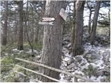 8
8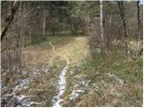 9
9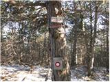 10
10 11
11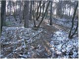 12
12 13
13
Discussion about the trip Črni hribi - Trstelj
|
| krsto712. 12. 2011 |
It looks like an interesting path... But is there another path (perhaps circular) from a different starting point that would include the mentioned peaks?
|
|
|
|
| mirank3. 12. 2011 |
There are paths everywhere around there, so no problem at all. The terrain is also so clear that you won't have any orientation issues, even if you go "all the way", since everything is easily passable.
|
|
|
|
| krsto713. 12. 2011 |
Great, thanks for the explanations... Which starting point is the best for visiting Trstelj, Stola and Stolovec, Vrtovka? The described path is interesting and appealing for a winter hike, but I don't want to go up and down the same path, so I'd like to visit all the peaks and make a circular route. I'd choose a starting point somewhere between Trstelj and the starting point mentioned in the path description...
|
|
|
|
| wolphgang4. 12. 2011 |
If you want a circular tour, I recommend leaving the car at the hunting lodge above Rence (Rence-Temnica road), at the bend before the lodge a marked path branches off the road. When you reach the top, do the entire traverse you mentioned. When you reach the asphalt road, go right on it, descend to the starting point. Walking on the road is about 15 min, the road is a bit busy.
|
|
|
|
| krsto715. 12. 2011 |
Thanks for the explanations, I'll try that variant, in any case a circular path seems more interesting to me than up and down the same... Thanks.
|
|
|
|
| ales505. 12. 2011 |
Here grenades and all heavier calibers were exploding, where the Austrian positions were during the Soča front, now it's grass and difficult terrain through the forest
|
|
|
|
| anazala19. 10. 2017 |
Črni hribi is a fantastic route. For younger children and older adults. Not a demanding route. You'll enjoy it. There are some views. From every hill you can see into the valley. 
|
|
|
|
| Anči114. 01. 2026 21:10:41 |
Great hike, after 4h of summits you reach the hut, friendly staff, great atmosphere, you can pay by card. Less than two hours of leisurely walking, we went back by road.
|
|
|
To post a comment you must log in:
If you do not yet have a username, you must first
register.