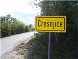
Starting point: Črešnjice (512 m)
| Latitude/Longitude: | 46,3261°N 15,3492°E |
| |
Walking time: 1 h 25 min
Difficulty: easy marked way
Elevation gain: 500 m
Elevation difference along the route: 500 m
Map:
Recommended equipment (summer):
Recommended equipment (winter):
Views: 11.675
 | 2 people like this post |
Access to starting point:
A) From the highway Ljubljana - Maribor, take the Celje exit and follow the road ahead towards Vojnik. From Vojnik, continue on the main road towards Slovenske Konjice, but only to the spot where the road branches off to the right towards the village Črešnjice. Follow this road to the mentioned village. In the center of the settlement, there are some spots for safe parking.
B) From the highway Maribor - Ljubljana, take the Tepanje exit and follow the road ahead towards Draža vas and Žiče. In Žiče, turn right in the direction of Špitalič, Žička kartuzija, Sojek and arrive in Črešnjice (municipality Vojnik). In the center of the settlement, there are some spots for safe parking.
Route description:
From the center of the settlement Črešnjice, we set off along the asphalt road past the cemetery and the pilgrimage church of Our Lady of the Rosary, where the mountain path from Frankolovo joins from the left. We continue higher straight ahead, where the path runs for a few meters along a grassy cart track, which quickly enters the forest. More or less wide forest paths alternate and practically the entire path ascends in the safe shelter of the forest. Directly below the summit, there is a funny sign that warns of the 1000-meter altitude. A few more steps and the summit with the lookout tower is reached.
Photos:
 1
1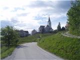 2
2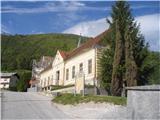 3
3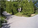 4
4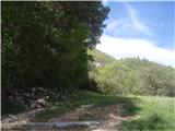 5
5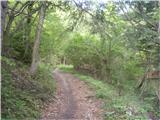 6
6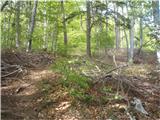 7
7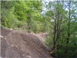 8
8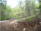 9
9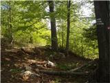 10
10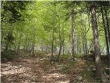 11
11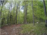 12
12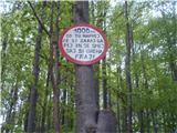 13
13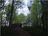 14
14 15
15
Discussion about the trip Črešnjice - Stolpnik
|
| jvali30. 07. 2017 |
It's my goal many times. Idyllic village Črešnjice, and a nice hike that ascends appropriately and gets the heart pumping. Today only a breeze and the scent of cyclamen accompanied me.
|
|
|
|
| grega_p3. 03. 2021 |
For me the most beautiful viewpoint in Styria!
|
|
|
|
| rinča29. 01. 2024 14:04:39 |
Today I went on this trail to Stolpnik. The trail and everything around in the forest is destroyed by motorbikes. Hard to imagine the noise they made judging by the tracks left on the ground and snow. In warmer months cyclists are also active. You have to be quite careful to jump aside in time.
I don't understand why at least signs prohibiting bicycle and motorbike riding are not put along the trail. Damage is being done to the trails and people and animals are disturbed and endangered.
|
|
|
To post a comment you must log in:
If you do not yet have a username, you must first
register.