Cenc - Špičasti vrh (on marked path)
Starting point: Cenc (850 m)
| Latitude/Longitude: | 45,9087°N 14,0236°E |
| |
Route name: on marked path
Walking time: 1 h 30 min
Difficulty: easy marked way
Elevation gain: 278 m
Elevation difference along the route: 325 m
Map: Nanos 1:50.000
Recommended equipment (summer):
Recommended equipment (winter): crampons
Views: 7.042
 | 1 person like this post |
Access to starting point:
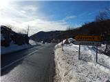
A) From the road Logatec - Idrija at the settlement Godovič we turn onto the road in the direction of Črni Vrh and Ajdovščina. After Črni Vrh the road starts ascending in a few hairpin turns, and then it flattens a little. On this less winding part we will come to a crossroad, where the road to Javornik branches off to the left, and at the same spot we will notice on the right side a macadam road and next to it mountain signposts for Špičasti vrh. Here we turn right and then we park at a suitable place by the road.
B) From Vipava Valley we drive to Col, and then we continue driving towards Idrija. At the spot where the road towards Javornik branches off to the right, we continue sharply left onto a macadam road, next to which we notice hiking signposts. Alongside the mentioned road we park at a suitable place by the road.
Route description:
From the crossroad at Cenc we continue on the macadam road in the direction of Špičasti vrh. The ascending road first leads us under the power line, and then turns a little to the right. On this part a marked cart track branches off to the left, which we continue on. On the cart track we first ascend diagonally through the forest, then the forest thins out and from the path a nice view opens up towards Nanos, western peaks of Hrušica, and a little higher also on Malo Polje. After a few minutes the path turns right and brings us to a macadam road, which we reach right on a smaller saddle, where there is a marked crossing.
From the crossing we go right in the direction of Špičasti vrh (slightly left Špiček (Špečk)) and continue on a narrower road which starts to descend lightly. After a short descent we arrive at a smaller wooden cottage, which we bypass on the left side. From the cottage we descend a little more, then we arrive at an older house, in front of which we continue right upwards. Behind the house the path enters the forest, through which it ascends gently to moderately on a cart track. Higher the cart track flattens out completely and turns left. There follows some light descent, then we step out of the forest onto a clearing, across which we walk in a few dozen steps to the macadam road, which we follow to the right. We walk along the road to the first crossroad, from there we continue straight to the nearby cross (right leads the road to Cenc), where the road turns left. A little further ahead the road brings us out of the forest, a little further also to the homestead Gornji Žgavec, which we bypass on the left side. There follows a short descent, then, when the road starts ascending again, it takes us into a narrower belt of forest. After a few minutes of light ascent we arrive at the next crossroad, where an unmarked path over Novina joins from the right.
From the crossroad, by which a wooden cross stands, we continue straight and on the path which continues across the meadow we ascend in a few minutes to the homestead Na Kobilici, or only to the road a few dozen meters before the homestead.
When we step onto the road we follow it to the right, and it brings us with nice views of the surrounding hills to a less distinct saddle. Here we continue left on the cart track in the direction of Špičasti vrh. After a few dozen steps the cart track splits into two parts, we continue on the right one (the left cart track leads to the top of a smaller ski lift), which passes into the forest, where we already notice the blazes. There follows a few minutes of traversing to the right, then on one of the trees we notice a mark which directs us left onto the slope. On the marked path we ascend in a few minutes to the ridge, where the marked path turns right. For a short time we walk along the forested ridge, then we already step onto the summit part of Špičasti vrh, where the path ascends somewhat more steeply. There follows a few more minutes of ascent and we reach the summit, on which there is a wooden lookout tower, from which a nice view opens up in all directions.
Description and pictures refer to the condition in 2015 (January).

Photos:
 1
1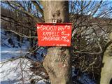 2
2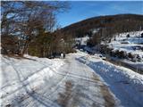 3
3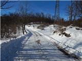 4
4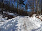 5
5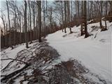 6
6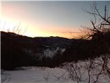 7
7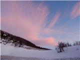 8
8 9
9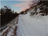 10
10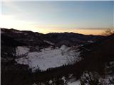 11
11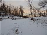 12
12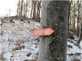 13
13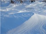 14
14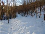 15
15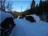 16
16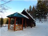 17
17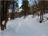 18
18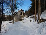 19
19 20
20 21
21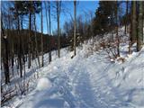 22
22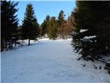 23
23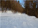 24
24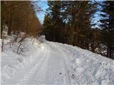 25
25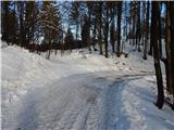 26
26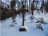 27
27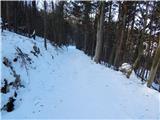 28
28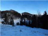 29
29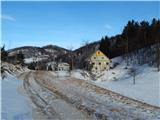 30
30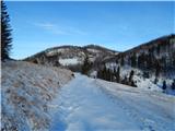 31
31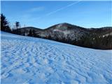 32
32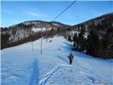 33
33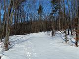 34
34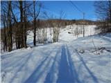 35
35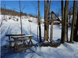 36
36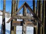 37
37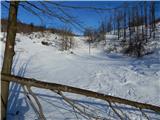 38
38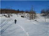 39
39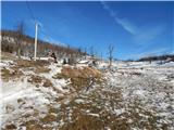 40
40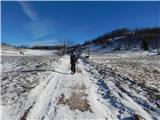 41
41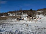 42
42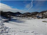 43
43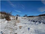 44
44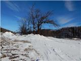 45
45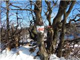 46
46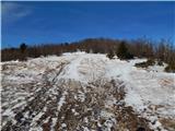 47
47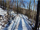 48
48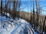 49
49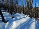 50
50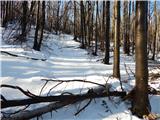 51
51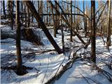 52
52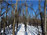 53
53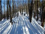 54
54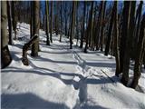 55
55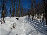 56
56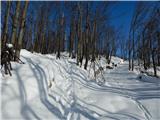 57
57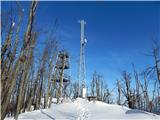 58
58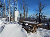 59
59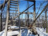 60
60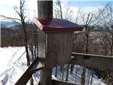 61
61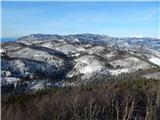 62
62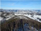 63
63 64
64
Discussion about the trip Cenc - Špičasti vrh (on marked path)
|
| BT8814. 01. 2017 |
Ju3 I'm heading to this Špičasti vrh
|
|
|
|
| donat15. 01. 2017 |
If you're going for the first time, it's a bit poorly marked. Went there 1 week ago. Regards.
|
|
|
|
| BT8815. 01. 2017 |
You are right, if you don't know where, especially in snow it's hard to find the path or there's a bit of getting lost.
Otherwise I've been there many times, or every time I drive by there I visit it also in summer. And every year in June there's also a mountain run to this summit and it's very nice.
|
|
|
|
| soraya200222. 11. 2020 |
Given that the last comment is from 2017.... one correction.
Very nice outing, also with children. The entire trail excellently marked (thanks to the markers), view from the tower divine. Instead of overcrowded classic destinations from Vipava Valley (Čaven, Mali Golak, Otliško okno....) ideal choice in these strange times of corona and restrictions.
|
|
|
|
| akvarij18. 01. 2021 |
Summit I didn't know until yesterday, now I will visit it more often.
The entire path is trodden, but of course still sinks in quite a bit.
At the start the signpost indicates 1 hour 10 minutes walking, in snow we needed 1:30.
The path is nicely marked, of course the track helped so no doubts where to turn.
Views from the summit were not quite perfect (due to weather), but I imagined how incredible they are in clear weather.
|
|
|
To post a comment you must log in:
If you do not yet have a username, you must first
register.