Pokopališče Radenci - Viewpoint Kapela
Starting point: Pokopališče Radenci (220 m)
| Latitude/Longitude: | 46,62881°N 16,03916°E |
| |
Walking time: 25 min
Difficulty: easy marked way
Elevation gain: 92 m
Elevation difference along the route: 92 m
Map:
Recommended equipment (summer):
Recommended equipment (winter):
Views: 865
 | 1 person like this post |
Access to starting point:
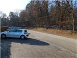
A) We leave the Maribor - Lendava highway at the Sveti Jurij ob Ščavnici exit, then follow the road towards Radenci. After the settlement Paričjak and still before the start of Radenci, we turn left in the direction of the Radenci cemetery. There follows approximately 100 meters of driving and we arrive at the cemetery, where we park on the arranged parking lot.
B) We leave the Lendava - Maribor highway at the Vučja vas exit, then follow the road towards Radenci. When we arrive in Radenci from the roundabout, we take the exit towards Sveti Jurij ob Ščavnici and Kapelski Vrh, just a little after Radenci we go right in the direction of the Radenci cemetery. There follows approximately 100 meters of driving and we arrive at the cemetery, where we park on the arranged parking lot.
C) From Gornja Radgona or Gederovci we drive to Radenci, then follow the road towards Sveti Jurij ob Ščavnici and Kapelski Vrh, just a little after Radenci we go right in the direction of the Radenci cemetery. There follows approximately 100 meters of driving and we arrive at the cemetery, where we park on the arranged parking lot.
Route description:
At the end of the parking lot, immediately after the road sign which marks the beginning of the settlement Radenski vrh, we head onto the slightly left road, by which there are signs for Atilova pot. Further on, besides the mentioned signs, we are also accompanied by Knafelc blazes, and we walk on a gently sloping asphalt road which runs through the forest. When we leave the forest, we go past houses and a shrine, when the driving road turns right, we go straight on an increasingly steep footpath, which is also further asphalted or partly paved. The steep part of the path is short, and we quickly arrive at the edge of the main road, where we walk on the sidewalk, bypassing the Kapela playground on the left side. Only a little further ahead, the marked path towards Gornja Radgona turns right, and we continue along the main road and carefully cross it at the pedestrian crossing.
Also on the other side of the road we still gently ascend, then we cross a side road, on the other side we go right and then immediately left onto a steeper narrower asphalt path, along which with increasingly beautiful views we climb to the church of St. Mary Magdalene on a 312-meter-high hill.
Description and pictures refer to the condition in January 2021.

Photos:
 1
1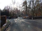 2
2 3
3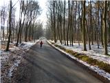 4
4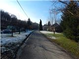 5
5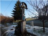 6
6 7
7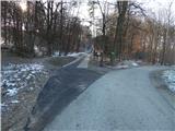 8
8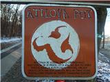 9
9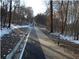 10
10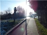 11
11 12
12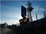 13
13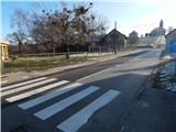 14
14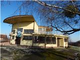 15
15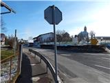 16
16 17
17 18
18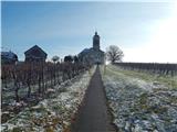 19
19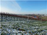 20
20 21
21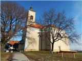 22
22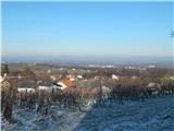 23
23
Discussion about the trip Pokopališče Radenci - Viewpoint Kapela
To post a comment you must log in:
If you do not yet have a username, you must first
register.