Cave del Mole - Viš/Jof Fuart (Anita Goitan)
Starting point: Cave del Mole (1035 m)
| Latitude/Longitude: | 46,4023°N 13,5105°E |
| |
Route name: Anita Goitan
Walking time: 5 h 30 min
Difficulty: very difficult marked way
Elevation gain: 1631 m
Elevation difference along the route: 1800 m
Map: Julijske Alpe - zahodni del 1:50.000
Recommended equipment (summer): helmet, self belay set
Recommended equipment (winter): helmet, self belay set, ice axe, crampons
Views: 40.082
 | 3 people like this post |
Access to starting point:
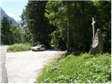
From Kranjska Gora over the border crossing Rateče we drive to Trbiž/Tarvisio. In Trbiž we continue left in the direction of Bovec and we follow the road to the crossroads near Rabeljsko jezero. Here we continue right in the direction of Nevejski preval/Sella Nevea. This road, which is mostly ascending, we follow to the spot where a macadam road branches off to the right. At the turn-off is a monument with a cross and on a tree a signpost with the caption “Corsi”. We then follow the macadam road for a few turns, after that a little before the gate we park on a parking lot by the road.
From Bovec, we drive to the border crossing Predel, from which we descend to the Italian side. Just a little after Rabeljsko jezero we come to a crossroads, where we continue left in the direction of Nevejski preval/Sella Nevea. Further, we follow the description above.
Route description:
From the parking lot, we continue on a macadam road which in zig-zags starts ascending. The road runs through the forest, so there is not much of a view. Only occasionally a view opens up towards the south and southeast. The road then turns to the left and starts ascending even a little steeper towards the north. A steep concrete-paved road then brings us out of the forest onto Viška planina (1530m). Near the bottom station of a cargo cableway we will notice signposts, which point us to the right into the forest on the “German path” (sentiero dei tedeschi). At first, the path descends a little, turns to the right and crosses a few torrents. The path then starts ascending through the forest and later through dwarf pines. More frequently also beautiful views are opening up mainly towards Viška planina below us and in the direction towards Rombon and Črnelska špca. On the path, there are also some steel cables, but the path isn't too hard on any part. More caution is needed mainly in the time when there are snow fields on the path. We soon notice in front of us the mountain hut Corsi and when we come out of the dwarf pines, to the hut follows only a few meters on a grassy slope.
From the mountain hut, we continue towards the north, where we start ascending on partly grassy and partly rocky terrain. The path then brings us to a crossroads, where we go left on path 627, and right leads path 625 towards Krniška škrbina (Ital. Forcella del Vallone) and further towards bivouac Gorizia. After a short ascent, we come again to a crossroads, where we continue right on path 627, and left leads the normal path to Viš. After that, the path runs on grassy terrain and in a gentle ascent crosses slopes below Mala špica and Divja koza. When we come to a steep gully which leads directly to Trbiška škrbinica, our path turns a little right and soon starts ascending steeper left upwards. We soon come to a junction where the path branches off to the right towards the mountain hut Pellarini. Here we continue left upwards and a well-marked path brings us to Trbiška škrbinica (Forcella di Riofreddo) where path Anita Goitan starts. On the notch there is otherwise also a junction, but both paths which lead through gullies downwards are closed and extremely dangerous (marked with the caption »NO!«).
From the notch, we continue on the south side of Divja koza and we start ascending steeper. The path then brings us to a ledge which crosses precipitous slopes towards the west. The ledge further is becoming narrower and on a short part it even vanishes. Here with the help of a steel cable we cross the wall above a deep precipice. Further, the path on the ledge brings us on the west side of Divja koza and crosses a few short gullies, then it ascends a little steeper towards the notch between Mala špica and Divja koza.
On the notch where there is a junction we can continue on the northern side and cross the slope below Mala špica. But because on this part there is often a snow field, we can from the notch continue also left on the south side of Mala špica. This path is otherwise harder, but if there is still snow on the north side it is much safer. If we continue on the south side we first steeply ascend by the steel cable upwards all the way to a short grassy slope below the summit of Mala špica, where the path turns a little to the right. Next follows an almost vertical descent on a narrow groove with the help of a steel cable and some pegs towards the notch between Mala špica and Turn. This is also the most difficult spot on the path Anita Goitan.
On the notch where from the right joins the path from the north side we continue left on the south side of Turn. Here we steeply ascend a few times also with the help of a few pegs all the way to the grassy slope where the path becomes less steep. Further, we again cross slopes on ledges towards the west. At the end on precipitous ledges we cross also the wall of Gamsova matera, then we join the normal path to Viš.
After a short ascent, we come again to a junction where we continue right upwards towards the summit of Viš, and left continues path Anita Goitan. Next follows a moderately steep ascent on rocky and somewhat gravelly terrain. A little below the summit from the right also joins the northeastern path Gola Nordest. From here follows only a shorter ascent towards a very panoramic summit.
We can descend on the normal path to Viš past the mountain hut Corsi or continue on path Anita Goitan past Koštrunove špice to Škrbina prednje Špranje where path Anita Goitan ends. From there then over Viška planina we descend back to the starting point.

Photos:
 1
1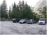 2
2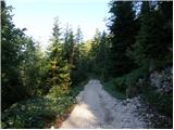 3
3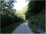 4
4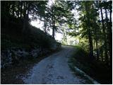 5
5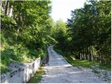 6
6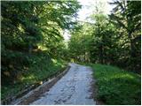 7
7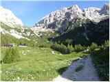 8
8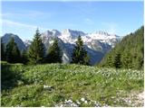 9
9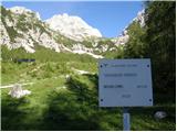 10
10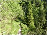 11
11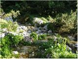 12
12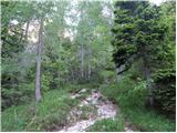 13
13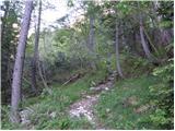 14
14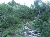 15
15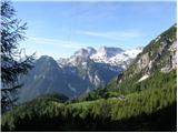 16
16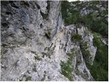 17
17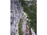 18
18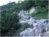 19
19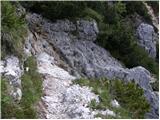 20
20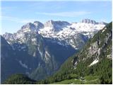 21
21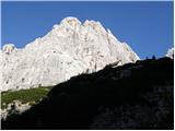 22
22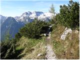 23
23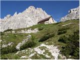 24
24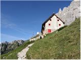 25
25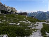 26
26 27
27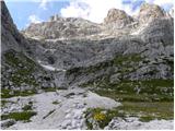 28
28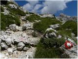 29
29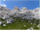 30
30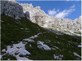 31
31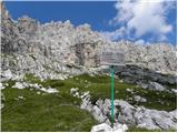 32
32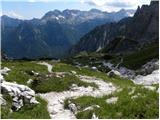 33
33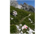 34
34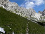 35
35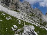 36
36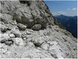 37
37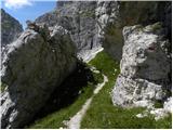 38
38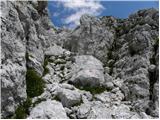 39
39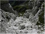 40
40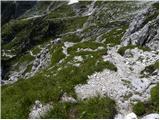 41
41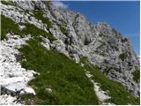 42
42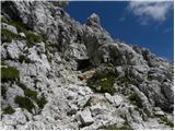 43
43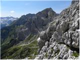 44
44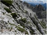 45
45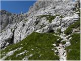 46
46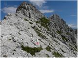 47
47 48
48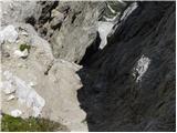 49
49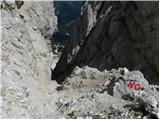 50
50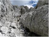 51
51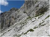 52
52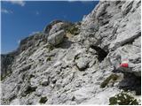 53
53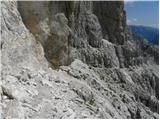 54
54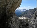 55
55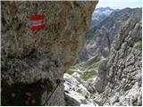 56
56 57
57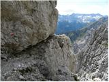 58
58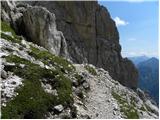 59
59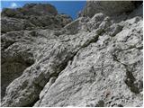 60
60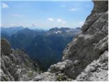 61
61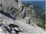 62
62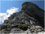 63
63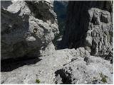 64
64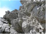 65
65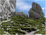 66
66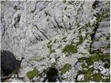 67
67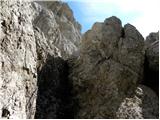 68
68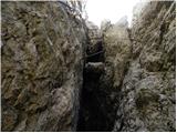 69
69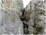 70
70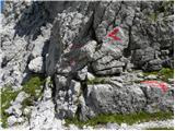 71
71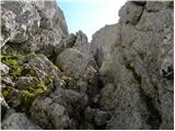 72
72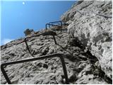 73
73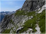 74
74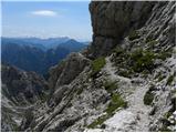 75
75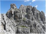 76
76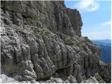 77
77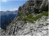 78
78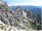 79
79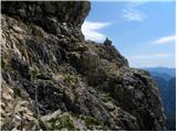 80
80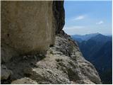 81
81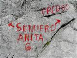 82
82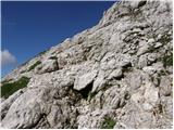 83
83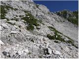 84
84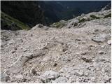 85
85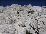 86
86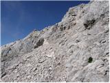 87
87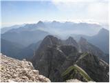 88
88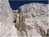 89
89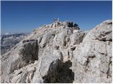 90
90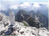 91
91 92
92
Discussion about the trip Cave del Mole - Viš/Jof Fuart (Anita Goitan)
|
| jac22. 08. 2010 |
I'm wondering if for Anita Goitan I need a mandatory self-belay kit.
|
|
|
|
| Gorazd G22. 08. 2010 |
At least on some secured and exposed sections, the use of a self-belay kit is highly recommended.
|
|
|
|
| jac22. 08. 2010 |
OK. Which ledges did you mean?
|
|
|
|
| Gorazd G22. 08. 2010 |
One is below Divja koza, another below Mala špica (southern route), then below Gamsova matra and some more could be found, but probably you won't haul the whole kit up and down, but will keep it on all the time where it belongs. Of course it's possible without, but a responsible mountaineer doesn't do that. And don't forget the helmet!
|
|
|
|
| MarkoKomar3. 08. 2013 |
Hi! Does anyone have more recent data on conditions on Anita Goitan path. Thanks in advance! Best, Marko
|
|
|
|
| IgorZlodej3. 08. 2013 |
Newer data, what would that even mean, learn to ask what interests you.
|
|
|
|
| veoniq3. 08. 2013 |
Is the ascent direction also suitable for descent, or is it recommended to continue the path via Gamsova matere, Divja koza to Trbiška škrbina and then down? Are there snowfields on the Anita Goitan path?
|
|
|
|
| IgorZlodej3. 08. 2013 |
Some suit one direction, others the other, some have no problems with it. The A. Goitan path actually runs along the southern slopes of Gamsova matere, Mala špica, Divja koza, I hope you know the course of the path, because otherwise the snow information won't be of much use to you, but there is none
|
|
|
|
| cat enchanter13. 08. 2014 |
The path is passable without winter gear, the protections are in perfect condition. There are just slightly fewer than we're used to on Slovenian secured paths.
The most annoying is the initial and especially the final walk on concrete, which covers about 200 vertical meters.
Otherwise a nice tour, especially nice is sentiero tedeschi, where there are also some streams. 
|
|
|
|
| Tikej23. 09. 2015 |
I was there yesterday, cables renewed, rock quite compact.... fantastic views, but it's a long and quite strenuous tour.
|
|
|
|
| malimiha19. 07. 2016 |
Hi, I'm interested in the condition of the restricted path and if there's still any snow. Thanks and best regards
|
|
|
|
| zeti19. 07. 2016 |
We were there on Saturday, completely snow-free, some markers are a bit faded, a signboard wouldn't hurt either. First time in these parts and it's really insanely beautiful best regards
|
|
|
|
| lazo122. 07. 2016 |
Please, does anyone know the price of overnight stay with membership card at Rifugio Corsi?
|
|
|
|
| barbara.hribi8. 08. 2016 |
Yesterday I went up via A. Goitan path, many people on the summit because nice day. Markings for the path to Viš are really sparse. From Rifugio Corsi continue north, after a few meters first junction, right (left goes to Sella Neveo and easier path to Viš). Path 627 not marked there yet, follow 625. Later marked 625-7 and only later (as in description above A.G.)
Anyway, A. Goitan path is really interesting, but more for experienced..
|
|
|
|
| MI&DA22. 08. 2016 |
Probably a bit late, but maybe useful for someone...
Overnight price at Corsi hut (shared room with 20 beds-II floor) was 10 euros per person. Alpine cards not required.
Took path A.G. on 14.08. - wonderful sunny day.
|
|
|
|
| falcon4. 04. 2017 |
Beautiful ascent. I mean in summertime.
|
|
|
|
| miratan1. 07. 2019 |
Hello,
has anyone been to Viš these days via Anita Goitan? I'm interested in winter conditions. We would descend via the normal route. Thanks, best regards.
|
|
|
|
| ŠpRo291. 07. 2019 |
I'm also interested. Thanks.
|
|
|
|
| velkavrh2. 07. 2019 |
On Saturday we passed the entrance to the protected path -Anita Goitan, which is above Rifugio Corsi, when descending from Krniška škrbina. From below no snow was visible anywhere. Unfortunately the hut is closed-they always knew about the condition of this path. Even from the top of the saddle no snow was visible. Snow only below -tongues.
|
|
|
|
| SilvestrO18. 07. 2019 |
On Anita Goitan's path (16.7.2019) there is no snow, all fixed protections are good, in short all good.
|
|
|
|
| veja513. 04. 2020 |
Which path in Slovenia can be compared to Anita Goitan?
Best regards. Venčeslav.
|
|
|
|
| JORDAN13. 04. 2020 |
Hard to find a comparison in Slovenia but my comparison is the following. Through Turski žleb to Turska gora and through Kotliče towards Kamniško sedlo.
|
|
|
|
| veja513. 04. 2020 |
Jordan, thanks for the information. Now it's clearer to me. I've been through Turski žleb to Turska gora many times. And the other part of the path to Kotliče and onwards over Boštanjca is also known to me. A very beautiful and varied path.
Regards. Venčeslav.
|
|
|
|
| miranm11. 09. 2023 20:47:18 |
Hello,
I would like an answer:
The Anita Goitan path is officially closed, what happens in the case of a rescue on this path and is there also a fine from the Italian Alpine Association if you are on a closed path (allegedly about 700€).
Thanks for the information
|
|
|
|
| 2061alessio12. 09. 2023 09:39:46 |
as far as I know there is no fine (who is this info from about 700€?), possibly a bill would be issued in case of rescue by GRS/Soccorso Alpino ONLY if it takes place on an officially closed path; the amount would probably be charged based on the time of the rescue (I don't know how many € per minute for the helicopter and rescue unit); otherwise rescue is still free so far if you are a member of CAI-PZS-OAV-DAV etc. mainly as I already posted once in one topic if a hiking path is officially closed it means it's no longer a path but becomes an alpine route at your own risk, in case of rescue on an officially closed path GRS/Soccorso Alpino will probably charge you the costs even if you are a member.
|
|
|
|
| Jakacius12. 09. 2023 12:34:40 |
But you only get the information about the closed path on the internet. Just yesterday I went to Viš via the Anita Goitan path and there is no notice of closure anywhere there. By the way, the safety gear is in good condition, many cables completely new. Only the markings are so-so.
|
|
|
|
| 2061alessio13. 09. 2023 19:49:42 |
it's true, basically you get on www.cai-fvg.it link "sentieri" or "ferrate" or on PZS (closed paths in FJK or something similar), if the path is marked with a number the PD should put up warning signs (I do that in the case of the path under CAI Tarvisio, I don't "touch" the path under Trieste, Udine, Gorizia because they already have some in our Kanalska dolina), if it's "via ferrata" then mountain guides should install it (specialized unit because CAI has that job/repair), now since Rifugio Corsi is closed and there's no more caretaker because the situation involved is unfortunately  the one you saw. the one you saw.
|
|
|
|
| Zlatiprinašalec1. 07. 2024 10:06:34 |
Hello,
Does anyone know how the snow is on the path? Thank you
|
|
|
|
| Jernej96810. 07. 2025 22:11:19 |
I took the described route on 2.7.2025. Ascent past Viška planina, Rifugio Corsi, and along the panoramic via ferrata Anita Goitan. Descent via the normal route back to the starting point at the monument at the beginning of the road to Viška planina. No peculiarities on the route. I bypassed Mala Špica on the south side. When I descended the gully to the notch, I walked back along the northern bypass and saw that there is no more snow. So anyone who wants to avoid the steep gully can use the easy northern variant. From Viška planina to Rifugio Corsi, a friendly couple from Ljubljana kept me company. We three were the only ones on the summit that beautiful day.
|
|
|
|
| LISAC11. 07. 2025 08:23:42 |
Jernej968, approximately how much time did you spend on your route? Thanks and have a nice day.
|
|
|
|
| dprapr11. 07. 2025 13:23:21 |
Mala Špica is a beautiful peak. It's worth climbing it too. Short and steep.
|
|
|
|
| LISAC12. 07. 2025 11:55:36 |
dprapr, is rope technique necessary for the ascent to Mala Špica or can it be done on scree? Thanks.
|
|
|
|
| dprapr12. 07. 2025 12:53:57 |
It can be done without, but one rappel from the top is recommended.
|
|
|
|
| LISAC12. 07. 2025 17:26:09 |
dprapr thanks. I'm exploring because these are still unknown areas for me that promise much.
|
|
|
|
| turbo12. 07. 2025 17:37:07 |
|
|
|
|
| LISAC12. 07. 2025 18:29:28 |
turbo thanks. I need to study how to sensibly start scree terrain.
|
|
|
|
| turbo12. 07. 2025 19:53:12 |
|
|
|
To post a comment you must log in:
If you do not yet have a username, you must first
register.