Brod - Rudnica (via Široka polica)
Starting point: Brod (512 m)
| Latitude/Longitude: | 46,2741°N 13,9302°E |
| |
Route name: via Široka polica
Walking time: 1 h 25 min
Difficulty: easy marked way
Elevation gain: 434 m
Elevation difference along the route: 460 m
Map: TNP 1:50.000
Recommended equipment (summer): helmet
Recommended equipment (winter): helmet, ice axe, crampons
Views: 1.890
 | 1 person like this post |
Access to starting point:
We drive to Bohinjska Bistrica, and then we continue driving in the direction of Bohinj Lake. Soon after that, when Bohinjska Bistrica ends, we turn right in the direction of the settlement Brod. Next follows driving over a bridge across Bohinjska Bistrica, and then we already get to the village Brod, where the described path begins. At the starting point, there are no arranged parking spots.
Route description:
Soon after the bridge, we get to the village Brod, where we go left and then we walk through the village. At the end of the settlement, where on the other side of Sava Bohinjka we already see the neighbouring village Savica, the signs for Rudnica point us to the right, behind the "last" house we then go two more times right in the direction of Rudnica. Next follows a steeper ascent on a cart track, and the path in a few minutes of ascent brings us to a marked junction, where we continue on the slightly left path in the direction of Široka polica (slightly right direct path).
Next follows some ascent through the forest and then we get to scree, over which we ascend diagonally, and during the ascent on the scree a nice view opens up for us. After the scree we get below the cliffs, where there is a possibility of falling stones, and we continue ascending diagonally towards the left. Higher the path flattens and brings us to a marked junction, from which we continue right in the direction of Rudnica (left Ribčev laz and Stara Fužina).
Next follows a moderate ascent through the forest, where we ascend on Široka polica, a little further a nice view opens up again for us, and by the path a bench awaits us, where we can rest.
A little further we get to hayfields, where from the left another path from Stara Fužina joins us, and we continue to the edge of the forest, where we choose the slightly left path. A little further we join the direct path, and only a short gentle ascent separates us from the top.
The description and pictures refer to the condition in February 2020.

Photos:
 1
1 2
2 3
3 4
4 5
5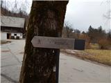 6
6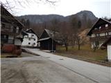 7
7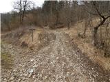 8
8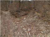 9
9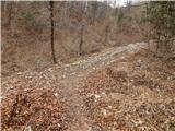 10
10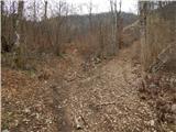 11
11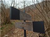 12
12 13
13 14
14 15
15 16
16 17
17 18
18 19
19 20
20 21
21 22
22 23
23 24
24 25
25 26
26 27
27 28
28 29
29 30
30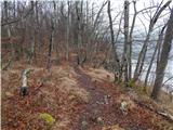 31
31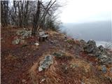 32
32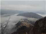 33
33 34
34
Discussion about the trip Brod - Rudnica (via Široka polica)
To post a comment you must log in:
If you do not yet have a username, you must first
register.