Brinje - Borovje (ridge path)
Starting point: Brinje (1040 m)
| Latitude/Longitude: | 46,47490°N 13,95660°E |
| |
Route name: ridge path
Walking time: 1 h 15 min
Difficulty: partly demanding unmarked way
Elevation gain: 436 m
Elevation difference along the route: 436 m
Map: Karavanke - osrednji del 1:50.000
Recommended equipment (summer):
Recommended equipment (winter): ice axe, crampons
Views: 15.885
 | 3 people like this post |
Access to starting point:
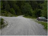
We leave the Gorenjska motorway at the Jesenice - west exit (Hrušica) and continue driving towards Kranjska Gora. After approximately 5 km of driving from the place where we left the motorway, signs for Dovje direct us to the right. We drive into the mentioned settlement, through which we follow the signs for Kepa and Dovška Baba. Soon above Dovje the asphalt ends, and the road only about 100 m further brings us to the marked intersection, where signs for Kepa direct us sharply to the left (straight Dovška Baba). We drive ahead for quite some time, thereby "overlooking" all smaller intersections. Higher up, we arrive at a somewhat larger intersection, where a road branches off to the left towards Rovt Vrse, and straight ahead the road continues towards Erjavčev Rovt (signs by the road for Kepa). We park on the parking lot by the mentioned intersection, or we can continue driving on the left road for some time.
Route description:
From the parking lot, we head onto the left road, which first ascends moderately, then flattens entirely and crosses the slopes towards the left. The road, from which occasionally nice views open up on the Julian Alps, after approximately 15 to 20 minutes brings us to the spot where on the right side we will notice a smaller cairn, from which a footpath branches off that leads to Borovje.
Here we continue right on the mentioned footpath (possible also straight over Rovt Vrse); it first ascends steeply, then passes into fern, where it slowly starts to disappear, higher up joining a forest track which we follow to the right. When the slope flattens, we turn slightly to the left and ascend to the nearby well (trough with water), above which we quickly arrive at a smaller, initially still indistinct ridge (to here possible also over Rovt Vrse).
When we step on the ridge the footpath becomes more visible and gradually steeper. The path ahead continues along the occasionally slightly exposed ridge (mainly in wet conditions and snow greater caution is needed), from which beautiful views open up here and there. The path ahead leads us past a bench, then signs for Borovje (on a sign to the cross) direct us left onto the slope over which we start to ascend steeply. The fairly steep path, running through the forest, gradually flattens higher up and turns slightly to the right. Here the path from the saddle between Planica and Borovje joins from the left, we continue right and for some time cross towards the right. After a shorter traverse we step out of the forest into more rocky terrain, over which via a slightly exposed slope we ascend to the cross on Borovje.

The trip can be extended to the following destinations: Planica (1 h)
Photos:
 1
1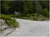 2
2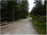 3
3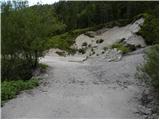 4
4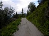 5
5 6
6 7
7 8
8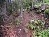 9
9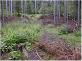 10
10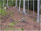 11
11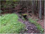 12
12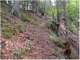 13
13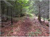 14
14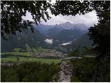 15
15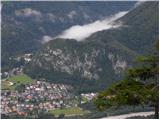 16
16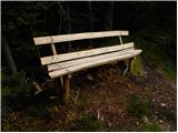 17
17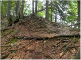 18
18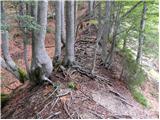 19
19 20
20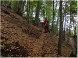 21
21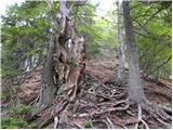 22
22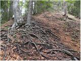 23
23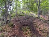 24
24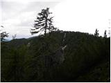 25
25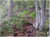 26
26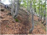 27
27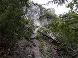 28
28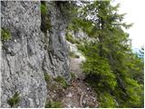 29
29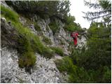 30
30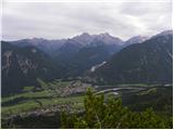 31
31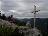 32
32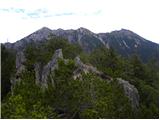 33
33
Discussion about the trip Brinje - Borovje (ridge path)
|
| heinz8. 05. 2009 |
Nice trip with wonderful view at the destination!
Access or path is not so innocently easy, as I imagined how in wet one could "slip" on countless roots in the already almost extremely steep western, forested slope. (Well, not to scare anyone), the thing is overall o.k. Only for large groups it would be a bit awkward, as there is not much space at the top.
For those going for the first time (like me) the trip is somewhat orientationally difficult, as it's hard to know where Brinje are (third "intersection" of three forest roads; quite high above Dovje), and which of the two tracks at the bend is the right one (the second), how to the ridge path on the other side of the meadow (I myself got on the path that goes down. Correct is - behind the spruce with table and benches into the forest approx. 20 m, then left uphill to the ridge or edge).
As I learned from locals, one can also reach Borovje via the right (straight) road in Brinje, where one goes to Kepo. Apparently the path there is even more interesting and nicer. Next time.
|
|
|
|
| grega_p5. 09. 2009 |
First, I'd like to question this description a bit or maybe I just don't understand it best..
From the Vrse pasture, we head north, not south, where you have to find a path along the stream, which is currently covered with fallen trees in some places. Higher up (before the saddle) it is more pronounced.
Likewise, we head right upwards to the ridge (towards the east), not to the left (?)...
I agree with Heinz regarding orientation, the best is to take a map.
If you go in wet conditions (like me), just be careful on the summit part, otherwise it's not difficult but caution is the mother of wisdom.
With the view, everything is forgotten anyway.
Good luck!
|
|
|
|
| heinz6. 09. 2009 |
It's meant like this: when you arrive at the Vrse hollow and there spot (approach) the hut or weekend house from photo 8 (by Hartman), you head a bit back towards south and look for the ridge path, which ascends to the left towards the goal.
Instead of towards south-literally, it would be more accurate to say SE, for even better orientation I suggest from the hut head right towards the bench with table, which is nearby under the direction, from there continue in the same direction towards the forest. Once in it, it's just a few steps to the ridge, along which the path goes left upwards.
grega p - I have a feeling you took it in the other direction (but still reached the goal).
|
|
|
|
| grega_p6. 09. 2009 |
It seems it will really be like that, I considered the path drawn on the map along the stream to the ridge between Planica and Borovje...
(From the houses on the pasture we continue straight up the valley. The path quickly takes us into the forest, where the trail continues on the right side of the torrent. The initially gentle trail starts to climb steeper and after 20 minutes brings us to the saddle between Planica and Borovje)
No problem, one more option...
|
|
|
|
| ben30. 05. 2010 |
Well, today was just such a day to catch some dry before the rain so I tried your two variants, but a bit differently. I admit that a few years ago I already roamed around Borovje and remembered a signpost on the road in Brinje before reaching Rovt Vrse. And look, that signpost is still there and I also take it upwards. The somewhat poorly visible path can be followed to the place where foresters felled trees, there it completely disappears, but with a bit of intuition I soon find it and I'm already in front of the bench on the rovta. Then steeply along the ridge (it's quite steep  ) but without problems. At the top unfortunately fog, so visibility was poor, but I decide to check out Planica too. So a bit back from the top and at the first opportunity right downwards without major issues to Sedlo Šija saddle, which is quite an important junction. Here grega p came up, I down from Borovje, straight we can go on the path through Kurjeke to Kepa (upper part pathless), or left upwards to Planica 1508m. The path up here is less steep than to Borovje, but quite nice, easy to follow and without special difficulties. Shame that there was fog here too and so no views into the valley. Interestingly, at the top there's a summit book from 2008, but only a few pages of entries. Follows return to Sedlo Šija then along the stream downwards on a poor trail over quite a few fallen trees to Rovt Vrse and by road to the car. Nice short tour that washed me a bit at the end but what can you do... ) but without problems. At the top unfortunately fog, so visibility was poor, but I decide to check out Planica too. So a bit back from the top and at the first opportunity right downwards without major issues to Sedlo Šija saddle, which is quite an important junction. Here grega p came up, I down from Borovje, straight we can go on the path through Kurjeke to Kepa (upper part pathless), or left upwards to Planica 1508m. The path up here is less steep than to Borovje, but quite nice, easy to follow and without special difficulties. Shame that there was fog here too and so no views into the valley. Interestingly, at the top there's a summit book from 2008, but only a few pages of entries. Follows return to Sedlo Šija then along the stream downwards on a poor trail over quite a few fallen trees to Rovt Vrse and by road to the car. Nice short tour that washed me a bit at the end but what can you do...
Best regards B
|
|
|
|
| Parkeljc7. 06. 2010 |
Truly beautiful views of the entire upper Sava valley, Alps and Karavanke with nearby Kepa. Shame that the path is not marked, because you can easily go astray (like me, heh). Nice
|
|
|
|
| Parkeljc14. 01. 2011 |
Due to the snowy and icy road, today we had to leave the car a few hundred m lower. Even if the road were clear, you couldn't drive more than about 500 m due to landslides that triggered across the road.
The trail is really dog-steep in the last 200m of elevation. From Hartman the trail along the ridge is nice and dry for a while, then you have to enter the gully and wade through up to 30 cm of south-facing snow. Just below the summit the trail is covered with snow and dangerous for slipping. At noon it was really windy for this time of year.
|
|
|
|
| Jure71117. 07. 2013 |
Today I popped up to the summit, the trail is relatively short, but I'd warn that it's hard to follow due to leaves on the path
|
|
|
|
| ljubitelj gora30. 12. 2013 |
On Sunday after a less demanding summit in the Julian Alps, I head to Borovje, starting a little above Dovje at the intersection where there are signs for Kepa and Baba. I cross the meadow, forest and higher up along the road that goes past the cairn, from there along the hunting trail to idyllic huts and along the ridge to the top. I descend via another path and return to the huts and back to the starting point. Pictures: https://plus.google.com/photos/114400986607884783562/albums/5962477224913969809?sort=1
|
|
|
|
| ljubitelj gora25. 05. 2014 |
Again at Borovje, on the descent to the saddle I also go to Planica peak, followable path and further to Na Šiji peak, this peak is overgrown, then I return my way to the forest path and back to the start. These peaks are mostly visited by locals, at least judging by the logbook.
|
|
|
|
| aditaker27. 07. 2018 |
I just ask if there's also a stamp at Borovje summit?
|
|
|
|
| bumbi27. 07. 2018 |
There was; if there is now, I can't say.
|
|
|
|
| Majdag25. 10. 2018 |
... Not exactly as described, already at the beginning I missed the right path. In the forest the trees have already shed their leaves. The path at the transition from the ridge is not visible. Crossing the steep slope if you don't know where the path goes is dangerous for slipping. But at the top wonderful views. Stamp and logbook are at the top.
https://jelenkamenmajdag.blogspot.com/2018/10/borovje-lep-razglednik-nad-dovjem.html
|
|
|
|
| J.P.2. 06. 2024 18:56:18 |
The path is now much more visible. At the beginning we only missed the junction from the road, to the right. The junction is 1km from the intersection in the first picture. Luckily we noticed the mistake right away, returned just a few steps and followed the path to the top of Borovje. At Rovt Vrse we passed the first house on the right, turned into the forest and soon met the ridge path at the sign "to the cross 30 min). On the way back we went over the small saddle Šija. Nice steep and short tour, solitary with beautiful views. Stamp and logbook are stored in a very nice "hut".
|
|
|
To post a comment you must log in:
If you do not yet have a username, you must first
register.