Brezje pri Tržiču - Lešanska planina (Po robu)
Starting point: Brezje pri Tržiču (677 m)
| Latitude/Longitude: | 46,3589°N 14,2787°E |
| |
Route name: Po robu
Walking time: 2 h 5 min
Difficulty: easy marked way
Elevation gain: 773 m
Elevation difference along the route: 773 m
Map: Karavanke - osrednji del 1:50.000
Recommended equipment (summer):
Recommended equipment (winter):
Views: 8.357
 | 1 person like this post |
Access to starting point:
From the highway Ljubljana - Jesenice, we take the exit Ljubelj and follow the road ahead in the direction of Tržič. Just before the gas station at Tržič, we turn right (direction Tržič) and then immediately left (direction Begunje) and drive ahead to the village Brezje pri Tržiču, where we park on a parking lot near the church.
Route description:
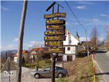
From the parking lot, we continue on the road towards Begunje, but only to the spot where it starts descending. Here, the road that leads to the mountain pasture Bistriška planina branches off to the right (by the crossroad there are also signposts for Dobrča); we walk along it for only a few minutes, then at the crossroad we go left in the direction of Dobrča (the right road leads to the mountain pasture Bistriška planina).
From the crossroad, we continue on a somewhat rougher road, on which we walk for approximately 1 minute, then the blazes lead us right onto a footpath that continues along the fence. For some time, we ascend moderately along the fence, then after approximately 20 minutes of walking from the starting point, we arrive at a wide but steep cart track. On the cart track, we ascend to a somewhat thinner forest, where the blazes direct us sharply right upward. We then ascend steeply through the forest, and after 15 minutes of further walking, we arrive at an abandoned trough for animals. Here, the path turns left and ascends gently below the indistinct peak Vaško. A little further, we arrive at a smaller saddle between the already mentioned peak on the right and the slopes of Dobrča on the left.
A short ascent follows, and the path brings us to the spot where we cross the nearby forest road (we cross the road right at the spot where it ends). Further on, we ascend for some time along a wide and forest-covered ridge, which we follow all the way to the paragliding takeoff site, located on the southern slopes of Dobrča.
Here, we continue right in the direction of Lešanska and Bistriška planina (straight to Koča na Dobrči and Dobrča - direct path) and continue on the rougher road, which soon brings us to the next junction. This time, we continue slightly left (slightly right to Bistriška planina) and begin to ascend more steeply along a wide cart track. Since the cart track has several junctions further on, we carefully follow the blazes so as not to stray from the correct path. After approximately half an hour of ascent from the paragliding takeoff site, we step out of the forest onto the expansive Lešanska planina, in the middle of which stands an open-type shepherd hut.

Photos:
 1
1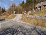 2
2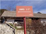 3
3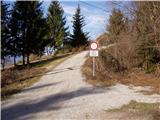 4
4 5
5 6
6 7
7 8
8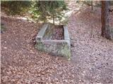 9
9 10
10 11
11 12
12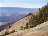 13
13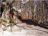 14
14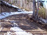 15
15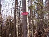 16
16 17
17 18
18 19
19 20
20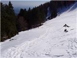 21
21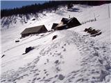 22
22
Discussion about the trip Brezje pri Tržiču - Lešanska planina (Po robu)
|
| Gost13. 05. 2007 |
The trail in the picture is very demanding and especially in summer too hot, as the hot sun beats on this trail all day, so I recommend the trail via Bistriška planina to Lešanska planina!!!
Best regards, Tržičan
|
|
|
|
| Gost15. 05. 2007 |
This trail is considered an easy marked trail. Very demanding trails are usually equipped with safety devices and are usually in high mountains (cliffs, walls, narrow paths, difficult passages...). In summer, it is entirely in the shade. Just put one foot in front of the other and you will experience a nice hike.
|
|
|
To post a comment you must log in:
If you do not yet have a username, you must first
register.