Breginj - Stol (Julian Alps) (via Muzec)
Starting point: Breginj (550 m)
| Latitude/Longitude: | 46,262°N 13,4259°E |
| |
Route name: via Muzec
Walking time: 4 h 45 min
Difficulty: partly demanding marked way
Elevation gain: 1123 m
Elevation difference along the route: 1300 m
Map: Julijske Alpe - zahodni del 1:50.000
Recommended equipment (summer):
Recommended equipment (winter): ice axe, crampons
Views: 18.601
 | 3 people like this post |
Access to starting point:
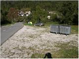
First, we drive to the center of Kobarid, and then we continue driving towards the border crossing Robič. Near the village Staro selo, we leave the main road which runs towards the border crossing Robič and we continue driving right in the direction of Breginj. Further, we follow a mainly ascending road to Breginj, where we park on a parking lot near the church.
Route description:
From the parking lot, we continue past the church (we bypass it on the right side) and we continue the ascent on an asphalt road in the direction of Stol and Muzec. The road at first ascends through the village, at the crossroads we follow it in an already known direction. Higher, the road loses its asphalt surface and past an old mill brings us to a marked junction, where we continue slightly right (left church of Marija Snežna). The road which continues to moderately ascend, soon brings us to a marked crossing, where a marked footpath to Muzec (Musc) branches off to the left.
We go on the mentioned path, which further moderately ascends through the forest. Further, the path brings us to a smaller spring (source of drinking water), then turns a little to the left and starts ascending steeper. Higher, the path flattens and brings us to a smaller crossing, where we continue right (straight Plazi). The path ahead again starts ascending steeper through the forest and then brings us on a sharp and crumbly ridge. On the mentioned ridge leads an exposed footpath, over which in a few minutes we pass into a belt of forest. When we step out of the forest, the path brings us on grassy slopes, where in a few minutes of additional walking we arrive at a marked crossing.
We continue left (slightly right Klatnica - source of drinking water) on an increasingly steep mountain path. Higher the path passes on a panoramic and very steep side ridge, on which we then ascend for quite some time. Higher, we come to a smaller unmarked crossing, where we continue on the left less steep path (right extremely steep path leads directly to Muzec). The left path then ascends diagonally and past a smaller chasm brings us on the main ridge of Muzcev. Here we continue right (left bivak pod Muzcem 2 minutes) and on a panoramic ridge path in 10 minutes of additional walking we arrive at the summit of Muzec.
From Muzec we continue on a marked mountain path, which starts descending steeply towards the east. The path, which is especially dangerous for slipping when wet, soon flattens, then continues on a very panoramic ridge. Further, the path crosses a belt of bushes, then for a short time steeply descends over a partly rocky slope. The descent ends on a smaller saddle, the path then passes for some time on the northern side of the ridge, where it runs through a belt of bushes. Further, the path starts ascending steeper and after a few minutes of additional walking brings us to an indistinct summit Ribežnov (1518 m).
The path ahead continues on a ridge partly overgrown with dwarf pines, which offers nice views on all sides. Higher, the path brings us to the next indistinct summit (Puntarčič), from which a nice view opens up on Kobariški Stol.
A short descent follows and from the right the path from svete Marjete joins us (we will return to the valley on the mentioned path later). We continue straight in the direction of Stol on the path which first ascends gently, then steeply for a short time. We follow this still panoramic path to the summit of Stol, which we reach after 15 minutes of additional walking.

Photos:
 1
1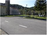 2
2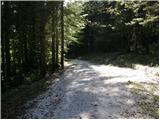 3
3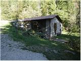 4
4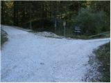 5
5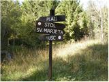 6
6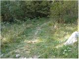 7
7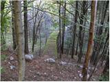 8
8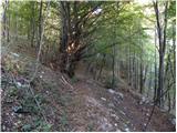 9
9 10
10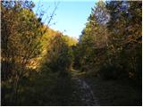 11
11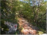 12
12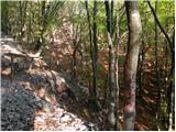 13
13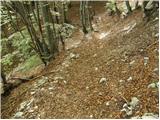 14
14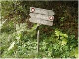 15
15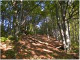 16
16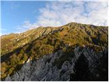 17
17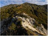 18
18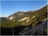 19
19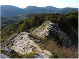 20
20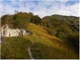 21
21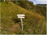 22
22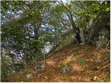 23
23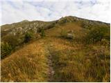 24
24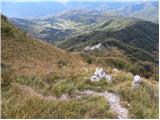 25
25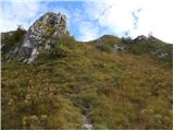 26
26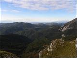 27
27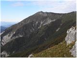 28
28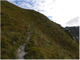 29
29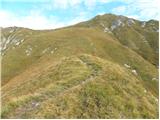 30
30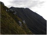 31
31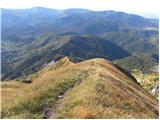 32
32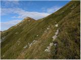 33
33 34
34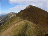 35
35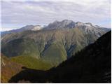 36
36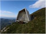 37
37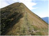 38
38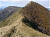 39
39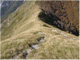 40
40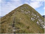 41
41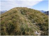 42
42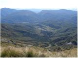 43
43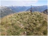 44
44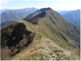 45
45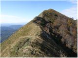 46
46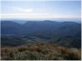 47
47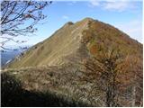 48
48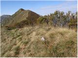 49
49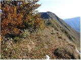 50
50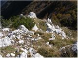 51
51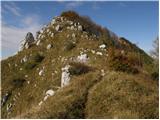 52
52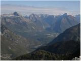 53
53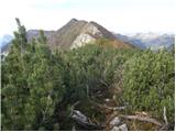 54
54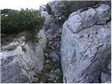 55
55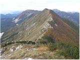 56
56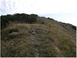 57
57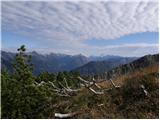 58
58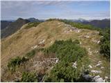 59
59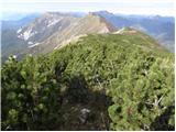 60
60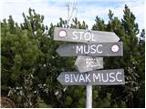 61
61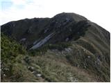 62
62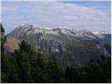 63
63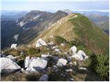 64
64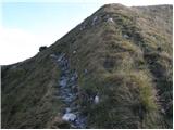 65
65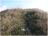 66
66 67
67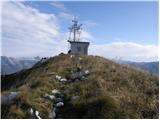 68
68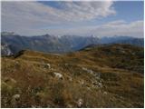 69
69
Discussion about the trip Breginj - Stol (Julian Alps) (via Muzec)
|
| cebelca6. 04. 2011 |
Has anyone hiked this trail recently and could tell more about the condition of the path?
|
|
|
|
| IgorZlodej8. 04. 2011 |
I didn't hike it, but I looked at it from above. The southern slopes are completely dry, including the ridge; you might find some snow patches in places, but more on the northern side. Highly recommended. lp
|
|
|
|
| AnaR18. 07. 2016 |
This weekend we went in the opposite direction Srol-Muzec. I want to warn that this area is quite untidy and unpleasant - the grass is high and thus hides holes in the ground. If you go on this tour, be really careful and watch where you step ... good trip  ! !
|
|
|
|
| PUHIPUHI19. 07. 2017 |
I'm wondering if anyone has hiked the Muzec Stol ridge in the last few days? Tall grass? Well-trodden path?
|
|
|
|
| ločanka22. 04. 2019 |
On Friday we hiked this trail, but in the opposite direction. First to Stol, then along the ridge to the summit of V. Muzec (Gabrovec) and then down the steep path described here into the valley. The best view for me right on V. Muzec summit, so it's essential to climb up there too.
|
|
|
|
| Enka22. 04. 2019 |
Ločanka, which route do you think is better? Yours or the one from the description?
|
|
|
|
| ločanka22. 04. 2019 |
I'd almost dare say that our route was the better variant. If I were to go for the first time again, I'd do the same. If I go again sometime, I'd try something else, maybe another starting point or some other part of the ridge, or something in
combination with overnighting in the bivouac. There at the saddle it seemed very pleasant to me.
|
|
|
|
| ločanka22. 04. 2019 |
Enka, have you also looked at my description in current conditions?
|
|
|
|
| Enka24. 04. 2019 |
Ločanka, of course, first of all . We have also looked at this route, so I took the opportunity to ask. From the sofa like this, your descent path from the ridge looks somewhat steeper than the ascent path.
|
|
|
To post a comment you must log in:
If you do not yet have a username, you must first
register.