Bosljiva Loka - Krokar (Kočevje mountain trail)
Starting point: Bosljiva Loka (253 m)
Route name: Kočevje mountain trail
Walking time: 3 h 15 min
Difficulty: partly demanding marked way, easy unmarked way
Elevation gain: 869 m
Elevation difference along the route: 1050 m
Map:
Recommended equipment (summer):
Recommended equipment (winter): helmet, ice axe, crampons
Views: 6.060
 | 4 people like this post |
Access to starting point:
We have to come to the upper course of the Kolpa valley, either through the mountain pass Strma reber or through Kočevje and Brod na Kolpi. We park between villages Bosljiva Loka and Mirtoviči.
Route description:
The path starts by the power line pole and at first runs on a cart track. After 100 meters we turn right up on a cart track which soon becomes steep. On the saddle or already a little before it we notice several footpaths, which lead left on the ridge. When we come to the power line pole on a ridge, we are on the right path. The ridge is rising gently, and in parts before peaks we need to step over a high step. The path isn't well-beaten, but it is marked and easy to follow.
After every peak follows a shorter descent. To Kobila the peak is permanently in front of our eyes. From here on we steeply descend and we notice the peak only when we are next to it. After the descent, we continue a little left and avoid the ridge tooth. Pine trees are here higher and they veil the view.
The path soon joins the one that starts in Mirtoviči (and it continues through the valley of the stream). The footpath in parts steeply rises into the ridge and after about 200 altitude meters we are on the traverse to Kremparsko sedlo. In parts it is quite narrow, especially we need to pay attention when crossing the torrents. Almost horizontally it brings us to a crossroad of the path from Borovec pri Kočevski Reki, where we continue left.
We continue on an increasingly steep path which leads us on and by the ridge of Borovška gora. Higher marked path turns right, and we continue left on an unmarked path, which is steeply ascending for some time, and then it brings us to an indistinct viewpoint, where it flattens. The path ahead crosses slopes towards the right, and then it turns slightly to the left and after a short ascent, it brings us on a small saddle between Krokar on the left and Cerk on the right. Here we continue left and on a poorly visible footpath which continues by the edge of precipitous cliffs, in a few minutes we get to the top.

Along the route: Vršak (605m), Kobila (705m), Kremparsko sedlo (869m)
Photos:
 1
1 2
2 3
3 4
4 5
5 6
6 7
7 8
8 9
9 10
10 11
11 12
12 13
13 14
14 15
15 16
16 17
17 18
18 19
19 20
20 21
21 22
22 23
23 24
24 25
25 26
26 27
27 28
28 29
29 30
30 31
31 32
32 33
33 34
34 35
35 36
36 37
37 38
38 39
39 40
40 41
41 42
42 43
43 44
44 45
45 46
46 47
47 48
48 49
49 50
50 51
51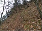 52
52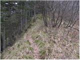 53
53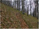 54
54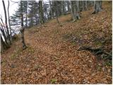 55
55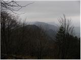 56
56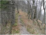 57
57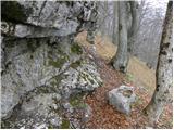 58
58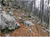 59
59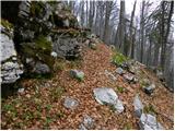 60
60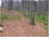 61
61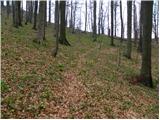 62
62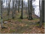 63
63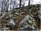 64
64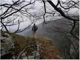 65
65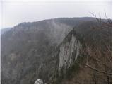 66
66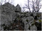 67
67 68
68
Discussion about the trip Bosljiva Loka - Krokar (Kočevje mountain trail)
|
| cico16. 02. 2016 |
Nice, solitary paths, walked with wife to the junction
towards Mirtoviče, followed by short canyoning
in Blaubach (Blaubah), tributary of Mirtoviški
stream, two rappels, three pools, and you're already
in the icy stream, one of the last Slovenian
otter habitats, which I have also seen personally
at the confluence with Kolpa, when I was kayaking!
According to the story, Kočevarji went
for water across Inlauf during drought, because Blaubach never dried up, and otters
are rarely seen anymore, since for years there
at the confluence with Kolpa there is a summer mountaineering
camp over the summer! Every plus also makes its minus!
Just lots of ticks, and sun in the back, LP
|
|
|
|
| Krokarus9. 05. 2020 |
Nice path along the ridge, where most of the time there are not many trees and you are exposed to the mercy of the scorching sun. If the steepness doesn't take your breath away, the magnificent views of the vast Dinaric forests and rocky walls above the Kolpa valley certainly will.
|
|
|
|
| Alenka Marinč3. 10. 2023 11:50:42 |
Ascent to Krokar is no longer allowed, as it lies within the Krokar primeval forest. Let's respect the rules and visit nearby Krempa instead.
Otherwise, the path from Bosljiva Loka is not maintained in terms of marker renewal and is not part of Kočevska planinska pot. The KPP section is only the descent from Krempa and walk along Kremparsko sedlo to the information board, then KPP descends along Krokar downward and turns sharply left toward Cerk.
|
|
|
|
| kolpa2. 11. 2023 21:25:37 |
It is true that we must not walk in the primeval forest, nevertheless hikers could renew the waymarks, as the ascent from the Kolpa valley to the saddle between Krokar and Krepa is quite a demanding feat.
The places along the Kolpa are very lonely and if any hiker strays there, after the ascent to the edge of Borovška gora he will be rewarded with beautiful views of the Zgornje Kolpe valley and numerous peaks of Gorski kotar. In spring, the hiker can also observe interesting plants and admire mighty stands of black pine.
The rare locals also rejoice at travelers, they like to chat with them, as these places along the Kolpa are really lonely.
|
|
|
|
| Alenka Marinč6. 02. 2025 16:10:13 |
Regarding the path from Bosljiva Loka, the markers hesitate whether to abandon the path or renew it and attach a stamp at the top of Kobila. It is considered the path that branches off into the forest right behind the village sign. The one leading from Mirtoviški potok, however, they plan to abandon.
|
|
|
To post a comment you must log in:
If you do not yet have a username, you must first
register.