Bohinjsko sedlo - Lajnar (unmarked way)
Starting point: Bohinjsko sedlo (1277 m)
| Latitude/Longitude: | 46,2409°N 14,01°E |
| |
Route name: unmarked way
Walking time: 45 min
Difficulty: easy unmarked way
Elevation gain: 272 m
Elevation difference along the route: 272 m
Map: Škofjeloško in Cerkljansko hribovje 1:50.000
Recommended equipment (summer):
Recommended equipment (winter): ice axe, crampons
Views: 6.059
 | 4 people like this post |
Access to starting point:
From the highway Ljubljana - Jesenice we take the exit Lesce and follow the road towards Bled and further towards Bohinjska Bistrica. From Bohinjska Bistrica we continue left in the direction of Tolmin and Soriška planina. We then follow this road to a large parking lot near the ski center Soriška planina.
From Železniki we drive towards Podbrdo or vice versa, but only to the spot where signs for Soriška planina direct us onto an ascending road. We then follow this road to a large parking lot at the foot of the ski area Soriška planina.
Route description:
From the parking lot, we head onto a macadam road which in 5 minutes in a gentle ascent brings us to the mountain hut Koča na Soriški planini.
From the mountain hut, we continue on the road which turns to the left (marked path goes straight by the cableway). We then follow this relatively gentle road to an artificial lake, which is intended for snowmaking.
From the lake, we continue slightly towards the left, so that all cableways are on the right. We continue on the side ski track, which we recognize by the fact that it is quite narrow and also quite gentle. Right on this track runs the unmarked path. We then follow this path to the ridge on which there is a fence. Here we turn right (left Dravh) and in a moderate ascent without any bigger problems in less than 10 minutes of additional walking we reach the peak.
The trip can be extended to the following destinations: Dravh
Photos:
 1
1 2
2 3
3 4
4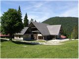 5
5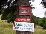 6
6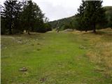 7
7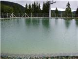 8
8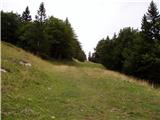 9
9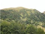 10
10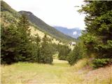 11
11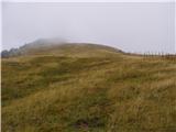 12
12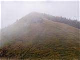 13
13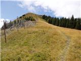 14
14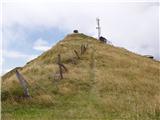 15
15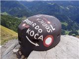 16
16 17
17
Discussion about the trip Bohinjsko sedlo - Lajnar (unmarked way)
To post a comment you must log in:
If you do not yet have a username, you must first
register.