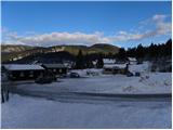
Bohinjska Bistrica - Krevl (on ski track)
Starting point: Bohinjska Bistrica (520 m)
| Latitude/Longitude: | 46,2673°N 13,9586°E |
| |
Route name: on ski track
Walking time: 2 h 45 min
Difficulty: easy unmarked way
Elevation gain: 995 m
Elevation difference along the route: 1000 m
Map: TNP 1:50.000
Recommended equipment (summer):
Recommended equipment (winter): ice axe, crampons
Views: 7.037
 | 2 people like this post |
Access to starting point:
From the highway Ljubljana - Jesenice, we take the Lesce exit, and then continue driving in the direction of Bled and Bohinj. When we arrive in Bohinjska Bistrica, we continue left in the direction of Soriška planina, and then at the left turn go straight onto a side road in the direction of the village Ravne and the Kobla ski slope. We drive only a few more 10 meters ahead and then park on the large parking lot at the foot of the Kobla ski center.
Route description:
From the starting point, we first carefully cross the road, and then past the bottom station of the ski lift Kozji hrbet we walk to the bottom station of the two-seater chairlift Kobla 1, to which there is a short descent. From the two-seater chairlift, over the bridge we cross a smaller stream and behind it we continue slightly left and then begin to ascend along the ski slope. After a few shorter steep ascents, the ski slope flattens and we arrive at the bottom station of the two-seater chairlift Kobla 2. Here we cross the road which leads from Ravne towards the former hut Koča dr. Janeza Mencingerja and continue the ascent slightly right on the increasingly panoramic grassy slope. After a while we come to the bottom station of the two-seater chairlift Kobla 3, where we also step onto the next forest road. We follow the road to the left, and we walk along it for a good 10 minutes, to a smaller junction west of Mali vrh. Here the road continues straight, and we continue right on the narrower ski slope (worse road), which ascends steeply a few times. The path along which we walk gradually turns more and more to the right and gradually changes from the worse road into a wide and gentle ski slope. We continue along the worse road, which ascends moderately across the ski slope, and it brings us, with a view of Šavnik, Možic, Slatnik and Lajnar, to the gentle saddle between Krevl on the left and Kravjo Črna gora on the right.
From the saddle, from where a nice view opens towards Črna prst, we continue left on the marked path in the direction of "Vrh Koble - žig". Here the path first ascends through a strip of forest and then brings us to the panoramic ridge. We continue on and along the panoramic and on the Primorska side also precipitous ridge, which with ever better views we follow to the summit of Krevl (on the summit log box it says Kobla), which we reach after a few minutes of further walking.

The trip can be extended to the following destinations: Črna prst
Photos:
 1
1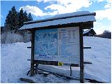 2
2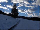 3
3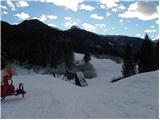 4
4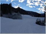 5
5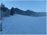 6
6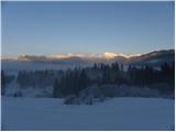 7
7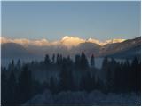 8
8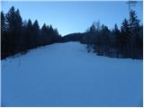 9
9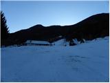 10
10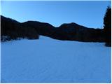 11
11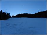 12
12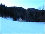 13
13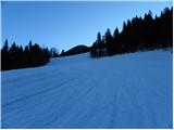 14
14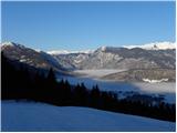 15
15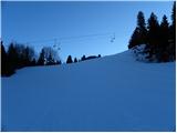 16
16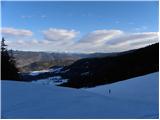 17
17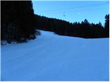 18
18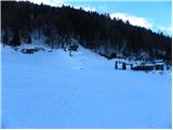 19
19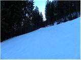 20
20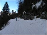 21
21 22
22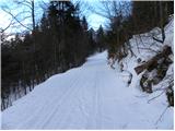 23
23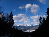 24
24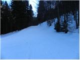 25
25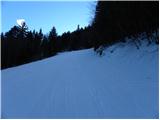 26
26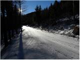 27
27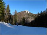 28
28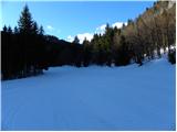 29
29 30
30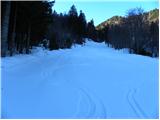 31
31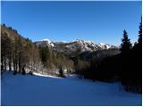 32
32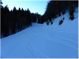 33
33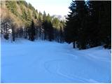 34
34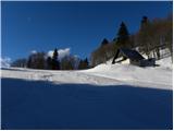 35
35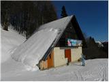 36
36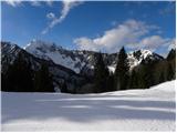 37
37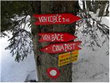 38
38 39
39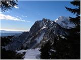 40
40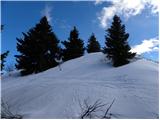 41
41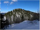 42
42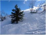 43
43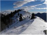 44
44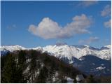 45
45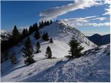 46
46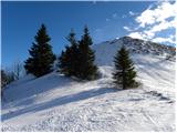 47
47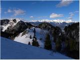 48
48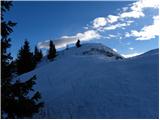 49
49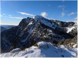 50
50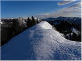 51
51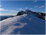 52
52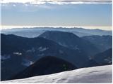 53
53
Discussion about the trip Bohinjska Bistrica - Krevl (on ski track)
|
| Hribovc8813. 12. 2010 |
Nice tour with beautiful views and photos  
|
|
|
|
| marinka6719. 03. 2014 |
In early autumn we plan a trip by train from Boh. B through the tunnel to Podbrdo and on foot back via Krevl or Koblo. Since from Koblo to Bistrica it's unmarked, I'm worried we might get lost, especially since we have children. What do you think?
|
|
|
|
| kabe20. 03. 2014 |
If you study the map well and have at least some sense of orientation, you can hardly get lost. If you already have doubts now, what will it be like then, I suggest you choose an easier, especially marked trail to start with. As for the kids, even if you stray somewhere, don't panic... that only makes everything worse! Good luck and have fun
|
|
|
|
| kabe20. 03. 2014 |
And one more thing...it's harder to get lost on the ski slope, unless you're 
|
|
|
|
| Gora Trma20. 03. 2014 |
Down the ski slope towards Bohinjska Bistrica is very easy orientation-wise. Regarding the suitability of the terrain for safe walking, I can tell you that along the ski slope downhill in the direction of your planned route there is a path all the way.
Happy trails!
|
|
|
|
| mrak.miša@gmail.com20. 03. 2014 |
I walked this path the year before last - without a map! No chance to get lost or stray, just follow the ski slope towards Bistrica...and keep left...
|
|
|
|
| marinka6721. 03. 2014 |
Thanks, you've reassured me. Maybe I wrote it a bit awkwardly, I'm not panicky, nor is our start, my children also climb if needed, so that's not a problem. I was more worried about wandering in the forest where you can't even help yourself with a map.(unless you're )
But if you say it's no problem.... OK. I can't help much with the above pictures though, otherwise they're great, terrain not visible well.
Anyway: thanks everyone!
|
|
|
|
| KarmenT9. 07. 2025 10:05:09 |
I don't understand why there's a stamp for Kobla peak at the top of Krevl? Also on the direction sign 15 min below the summit it says Kobla peak and not Krevl.
|
|
|
|
| Hribo Vanja10. 07. 2025 06:39:36 |
Tadej explained it in the comments of the Podbrdo-Krevl trip like this:
"The description was made with the help of the TNP 1:50,000 PZS map, the Škofjeloško and Cerkljansko hribovje 1:50,000 Kod&Kam map, and the Atlas okolja web application (ARSO - Ministry of the Environment and Spatial Planning RS).
In all the mentioned sources, the peak at 1515 m is named Krevl, while the peak Kobla is marked at 1492 m, which is not the highest point of the Kobla ridge (the highest peak of Kobla is located slightly NW of the 1492 m contour and rises to 1498 m).
Therefore, the error most likely occurred when installing the direction signs and stamp.
I hope I helped somewhat."
On the Bohinj (Sidarta) map, this peak is not even shown...
|
|
|
|
| KarmenT11. 07. 2025 14:18:33 |
Thanks.
|
|
|
To post a comment you must log in:
If you do not yet have a username, you must first
register.