Bohinjska Bela (sv. Marjeta) - Mlina peč
Starting point: Bohinjska Bela (sv. Marjeta) (468 m)
| Latitude/Longitude: | 46,3499°N 14,0695°E |
| |
Walking time: 15 min
Difficulty: easy marked way
Elevation gain: 38 m
Elevation difference along the route: 38 m
Map: TNP 1:50.000
Recommended equipment (summer):
Recommended equipment (winter): ice axe, crampons
Views: 765
 | 2 people like this post |
Access to starting point:
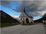
From the road Bled - Bohinjska Bistrica we drive in the direction of Bohinjska Bela, where we park on a parking lot near the parish church of St. Margaret.
Route description:
From the parking lot, we continue on the asphalt road which starts lightly ascending through the settlement. The road soon entirely flattens and past the post office and Mercator store brings us to a crossroad, where we continue slightly right in the direction of apartments pr Klemuc. After a small pond, we go right in the direction of Mlina peč, Slamnikov and Galetovec (slightly left Iglica and Široka peč) and we start ascending on a cart track, by which we are accompanied by signs of a learning trail. At the smaller crossing, we go slightly left and we diagonally ascend to a smaller saddle, where we go right in the direction of Mlina peč (straight Slamniki, Galetovec and Rčitno). There follow a few minutes of steep ascent on an increasingly steep and especially in snow slippery slope and with nice views we reach the peak of Mlina peč.
Description and pictures refer to the condition of the year 2019 (November).
Photos:
 1
1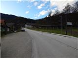 2
2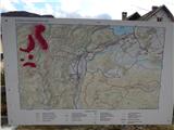 3
3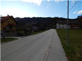 4
4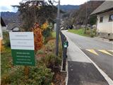 5
5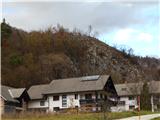 6
6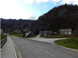 7
7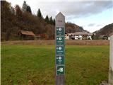 8
8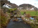 9
9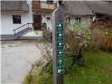 10
10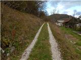 11
11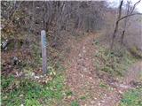 12
12 13
13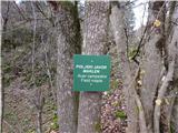 14
14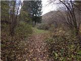 15
15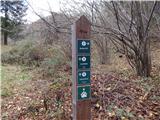 16
16 17
17 18
18 19
19 20
20 21
21 22
22 23
23
Discussion about the trip Bohinjska Bela (sv. Marjeta) - Mlina peč
To post a comment you must log in:
If you do not yet have a username, you must first
register.