Bodešče - Sveti Lenart (Bodešče)
Starting point: Bodešče (445 m)
| Latitude/Longitude: | 46,3452°N 14,1368°E |
| |
Walking time: 10 min
Difficulty: easy marked way
Elevation gain: 40 m
Elevation difference along the route: 40 m
Map: Karavanke - osrednji del 1:50.000
Recommended equipment (summer):
Recommended equipment (winter):
Views: 1.548
 | 3 people like this post |
Access to starting point:
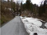
From the highway Ljubljana - Jesenice we go to the exit Lesce, and then we continue driving towards Bled. In Bled we turn left onto Koritenska cesta and we continue driving in the direction of the settlement Koritno and later settlement Bodešče. When we get to Bodešče we turn into the second street on the left and then we gradually start descending through the village towards the bridge Bodeški most. Before we get to the bridge Bodeški most over Sava Bohinjka, we will get to the sign, which marks the end of the settlement Bodešče. We park at an appropriate place by the mentioned sign.
Route description:
From the starting point, we return a few steps back, and then we continue on a narrower road in the direction of Šobec, which continues past the house. The road soon passes into the forest through which it moderately ascends, and after approximately 5 minutes brings us to the second hamlet in the settlement Bodešče, where at the smaller crossroads we continue right in the direction of the church of St. Martin and Gradišče. Next follows only a short walk and we are already at the church of St. Lenart, which is situated by the edge of the village.
Photos:
 1
1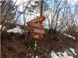 2
2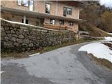 3
3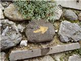 4
4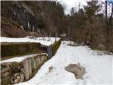 5
5 6
6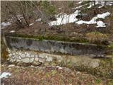 7
7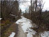 8
8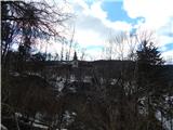 9
9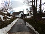 10
10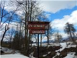 11
11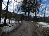 12
12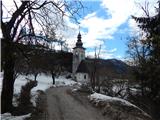 13
13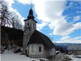 14
14
Discussion about the trip Bodešče - Sveti Lenart (Bodešče)
To post a comment you must log in:
If you do not yet have a username, you must first
register.