Starting point: Bevški vrh (1080 m)
| Latitude/Longitude: | 45,96137°N 13,84531°E |
| |
Walking time: 1 h 35 min
Difficulty: easy marked way
Elevation gain: 415 m
Elevation difference along the route: 455 m
Map:
Recommended equipment (summer):
Recommended equipment (winter): ice axe, crampons
Views: 484
 | 1 person like this post |
Access to starting point:
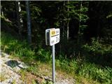
a) Drive to Col, then follow the road towards Otlice and Predmeja. This leads across the Gora plateau, passing through several villages. At Predmeja, join the road from Ajdovščina and turn right towards the Lokve settlement. The road continues through a small valley, where one of the marked paths to Golaki branches right first. Slightly further, the road turns left, leaving the valley for the slope. Higher up, where the road turns right, drive another approx. 3.5 km to the road marker; suitable parking is first on the left, 50 m further on the right. Mountaineering signs for Čaven and Golaki are nearby.
b) Drive to Ajdovščina, then follow signs to Lokavec and Predmeja. A fairly steep road climb follows to Predmeja, then continue straight to Lokve settlement. The road continues through a small valley, where one of the marked paths to Golaki branches right first. Slightly further, the road turns left, leaving the valley for the slope. Higher up, where the road turns right, drive another approx. 3.5 km to the road marker; suitable parking is first on the left, 50 m further on the right. Mountaineering signs for Čaven and Golaki are nearby.
Route description:
On the north side of the road we spot signs for Iztokova koča and Mali Golak (on the south side the path continues to Koča na Čavnu), directing us onto a cart track that soon becomes a footpath through the forested karst landscape of Trnovski gozd. A short overgrown section follows, then we reach a gravel road, which we follow right, initially descending slightly. As we begin a gentle ascent, signs for Mali Golak and Iztokova koča direct us slightly left; we ascend through forest, higher reaching another road and following it right towards Iztokova koča. A few minutes along the road brings us to the Strgarija pass, where the path from Male Lazne joins from the left, and from the right the path from Kozarnica or Predmeja.
At the pass, an intersection of several roads, head onto the footpath towards Iztokova koča and Mali Golak; after another five minutes' ascent we reach Iztokova koča pod Golaki.
Bypass the hut on the right and continue towards Mali Golak (approx. 40 min). The path ascends through forest, splitting at an information board and small chapel into two: straight steep or left gentle. Both join after ca. 10 min, then veer more right with a steep ascent. A short steep climb leads to a forested ridge, where the path from Predmeja (via Koča Edmunda Čibeja in Tihi dolini) joins from the right. Continue straight along the moderately steep path to a minor pass west of the main summit. Turn right here; the path quickly exits forest into dwarf pine belt, ascending to Mali Golak summit in minutes.
Starting point - Iztokova koča 0:55, Iztokova koča - Mali Golak 0:40.

Photos:
 1
1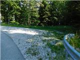 2
2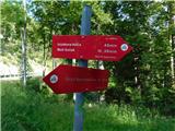 3
3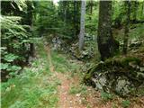 4
4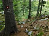 5
5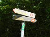 6
6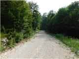 7
7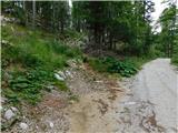 8
8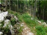 9
9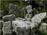 10
10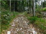 11
11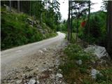 12
12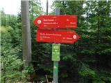 13
13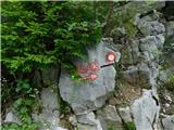 14
14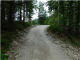 15
15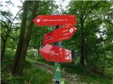 16
16 17
17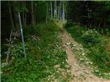 18
18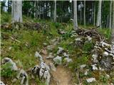 19
19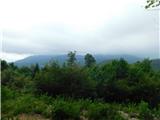 20
20 21
21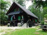 22
22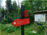 23
23 24
24 25
25 26
26 27
27 28
28 29
29 30
30 31
31 32
32 33
33 34
34 35
35 36
36 37
37 38
38 39
39
Discussion about the trip Bevški vrh - Mali Golak
To post a comment you must log in:
If you do not yet have a username, you must first
register.