Belopeška jezera - Capanna Ponza
Starting point: Belopeška jezera (929 m)
| Latitude/Longitude: | 46,4733°N 13,6713°E |
| |
Walking time: 2 h
Difficulty: easy marked way
Elevation gain: 728 m
Elevation difference along the route: 728 m
Map: Julijske Alpe - zahodni del 1:50.000
Recommended equipment (summer):
Recommended equipment (winter): ice axe, crampons
Views: 21.529
 | 2 people like this post |
Access to starting point:
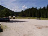
From Kranjska Gora over the border crossing Rateče we drive towards Trbiž / Tarvisio. Soon after the border crossing, the road in the direction of the Belopeška lakes / Laghi di Fusine branches off to the left, which we then follow in a moderate ascent to the large parking lot at Zgornje Mangartsko (Belopeško) lake.
Route description:
From the parking lot, we continue on the left side of the inn in the direction of the mountain hut Zacchi. The path at first runs along the forest road, which we leave after a few minutes, as the blazes direct us to the left onto a wide cart track. The cart track on which we walk changes a little higher into an ascending footpath. The relatively wide and well-marked path then brings us in a moderate ascent through the forest in about an hour of walking from the starting point to the mountain hut Zacchi (to here also possible on the forest road).
From the hut we continue on the left path, which after a few steps of ascent enters the forest. The path ahead first in a gentle, then in a moderate ascent crosses the slopes towards the north, meanwhile crossing a larger number of gullies. Some gullies we cross with the help of small bridges, others along a nicely arranged path. The forest path then brings us higher to a vantage point, from which a view opens onto the Belopeška lakes and the surrounding hills. The path then goes back into the forest and after a few more minutes of easy walking brings us to a poorly marked path junction, where a short path to the shelter branches off to the right. Here we turn right and after a minute of ascent arrive at the shelter pod Ponca.
Starting point - mountain hut Zacchi 1:15, mountain hut Zacchi - shelter pod Ponca 45 minutes

Photos:
 1
1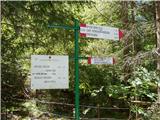 2
2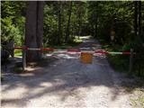 3
3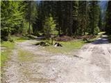 4
4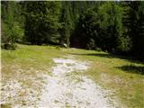 5
5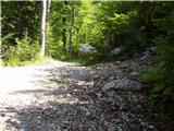 6
6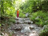 7
7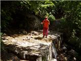 8
8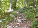 9
9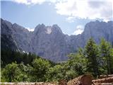 10
10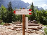 11
11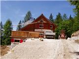 12
12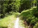 13
13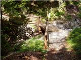 14
14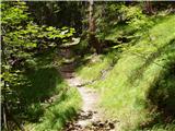 15
15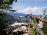 16
16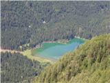 17
17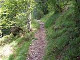 18
18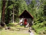 19
19
Discussion about the trip Belopeška jezera - Capanna Ponza
|
| slavko11. 07. 2012 |
A bit before the bivouac there's a viewpoint. Great view of Belopeška lake and surrounding mountains.
|
|
|
|
| panda12. 07. 2012 |
I assume the upper lake. 
|
|
|
|
| Jg11. 10. 2021 20:20:50 |
Yesterday I passed by this shelter. I started directly from the small parking lot at the lower lake. The signpost somewhat misleadingly says "Rif. Zacchi". Actually, the path first climbs up to this shelter, then descends to the Zacchi hut and from there to the large parking lot at the upper lake (this last part is also written on hribi.net). Recommended for lovers of views and circular paths 
|
|
|
To post a comment you must log in:
If you do not yet have a username, you must first
register.