Beli Potok pri Frankolovem - Stenica
Starting point: Beli Potok pri Frankolovem (435 m)
| Latitude/Longitude: | 46,3484°N 15,323°E |
| |
Walking time: 1 h 45 min
Difficulty: easy marked way
Elevation gain: 656 m
Elevation difference along the route: 700 m
Map:
Recommended equipment (summer):
Recommended equipment (winter): ice axe, crampons
Views: 14.198
 | 2 people like this post |
Access to starting point:
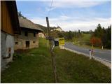
From the highway Ljubljana - Maribor, we take the exit Celje - center, and then we continue driving towards Vojnik, Frankolovo and Zreče. At the end of Frankolovo, we will notice signs for Lindek Castle, which direct us to the left onto a narrower and ascending asphalt road. Along the mentioned road, we then park at an appropriate place.
Route description:
We walk for a few minutes along the asphalt road, then we arrive at a smaller junction, where we do not continue either left or right, but straight ahead on a marked cart track in the direction of Lindek Castle, Kislica and Stenica. The path ahead ascends along the cart track, which runs along the bed of Belski potok stream. Higher up, we cross the mentioned stream, and the path leads us to the 9 m high Lindeški slap waterfall. Above the waterfall, the path transitions to somewhat steeper slopes, then levels out and turns slightly to the right. There follow a few minutes of gentle ascent through the forest, then the path leads us to the nearby macadam road. We follow the road to the right, which after a few steps brings us to a small saddle, where there is a marked junction.
Here we continue left along the asphalt road (right Lindek Castle 10 to 15 minutes), which after a few meters brings us to the next junction. This time we continue along the right road in the direction of the path to Stenica. At the next junction, we again continue right, we follow the asphalt road for a short time longer, then, when we arrive at a larger hayfield, we leave it and continue the ascent left (an arrow on the asphalt directs us left) along the edge of the forest, relatively steeply upwards. For some time we ascend along the edge of the forest, then we arrive at a grassy cart track, which we follow to the right to the nearby farm.
Here we walk across the yard of a residential house (watch out for the fierce dog!), behind which we step onto a smaller junction, where we continue along the left upper cart track. For a short time we continue along the cart track, then we arrive at a poorer macadam road, which we reach right at its end, we merely cross it and continue the ascent along the steeper marked hiking path. (We can also reach here if along the road, instead of turning left onto the hayfield, we continue straight ahead and then after a few minutes continue left - thus avoiding the dog).
We ascend relatively steeply through the forest for a few minutes, then we arrive at a cart track, which we follow to the left, but we walk along it only for a short time, as the signs for Stenica then direct us right onto the again steeper footpath. For some time we continue through the forest, then we arrive at a macadam road, which we follow to the left. With a view of Pohorje we walk to the right bend, we leave the road right at the bend and ascend past the nearby garage into the forest. The path ahead steeply ascends along the eastern ridge of Stenica, then leads us to the forepeak, where it levels out. A short descent follows, then we follow the marked path, which continues along and beside the ridge of Stenica, all the way to the main peak, which we reach after a good 20 minutes of further walking.

Photos:
 1
1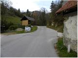 2
2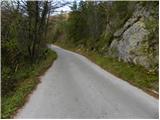 3
3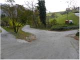 4
4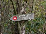 5
5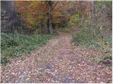 6
6 7
7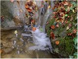 8
8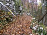 9
9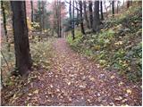 10
10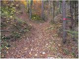 11
11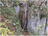 12
12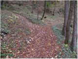 13
13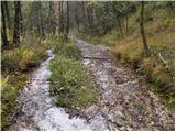 14
14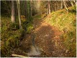 15
15 16
16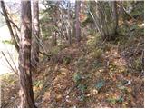 17
17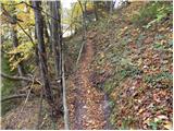 18
18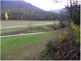 19
19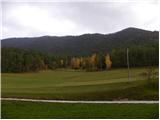 20
20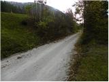 21
21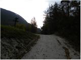 22
22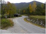 23
23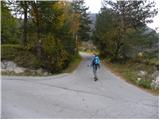 24
24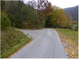 25
25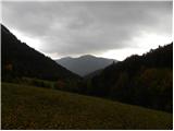 26
26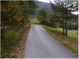 27
27 28
28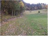 29
29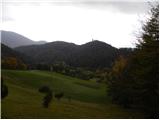 30
30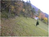 31
31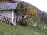 32
32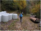 33
33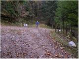 34
34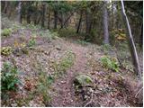 35
35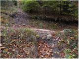 36
36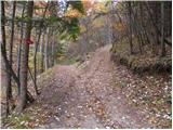 37
37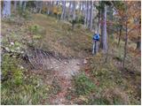 38
38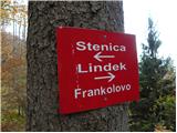 39
39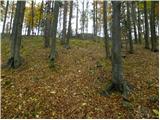 40
40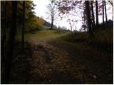 41
41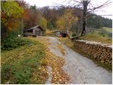 42
42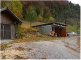 43
43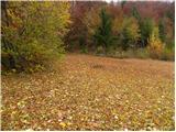 44
44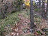 45
45 46
46 47
47 48
48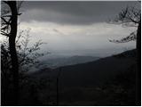 49
49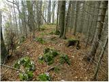 50
50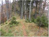 51
51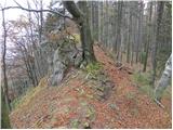 52
52 53
53 54
54 55
55 56
56
Discussion about the trip Beli Potok pri Frankolovem - Stenica
|
| pohodnik3815. 11. 2011 |
On St. Martin's Saturday I walked this path, very well maintained and marked, it's true there's no view from the top but still satisfied with the hike as I had very nice weather... I'd also mention that on photo 28 it says to turn left up, that's now changed, go straight on along the road under the farmhouse and then in the bend up through the meadow into the forest.... some snapshots from the hike you can see here.
|
|
|
|
| Marx24. 11. 2011 |
I'm very glad that Stenica has also found its place on that web. It should also be mentioned that there is a path from Vitanje which is partly quite steep and attractive (short description is in current conditions)
One more thing - if on picture 11 you go left past the markers, and after about 50 meters right along the track slightly uphill, you would reach a partially difficult unmarked path which in about an hour reaches the viewpoint at Kislica. As I say, the path is unmarked, but it is well trodden and there are pušćice at a couple of places.
|
|
|
|
| wolphgang24. 11. 2011 |
Marx, by the way, everyone has the option to enter their own destination and paths to it
|
|
|
|
| pohodnik3824. 11. 2011 |
@Marx I'll try this path next time, I know that Kislica-Špičast vrh is very scenic
|
|
|
|
| aonuk18. 02. 2012 |
Some fresh photos from the top of Stenica, unfortunately visited too little (poor view) Nice tour, either from Beli Potok or Vitanj (need to build a lookout tower)
lp Vinko
|
|
|
|
| pohodnik3812. 03. 2012 |
This time same starting point because Špičast vrh (Kislica)-994m which is neighboring peak of Stenica doesn't have a description yet on this portal so a few words here. Nice easy and short path the summit has enviable view considering Stenica...especially towards south to Celje all the way to Kum...nice weather only in the morning looked worse then clouds dispersed. Path is easy to follow well trodden sometimes cairns some ribbon or such on tree so impossible to get lost...some snapshots at this link.
|
|
|
|
| pohodnik3830. 12. 2012 |
Yesterday 29.12. again to Kislico-Špičasti vrh weather top-notch view breathtaking especially due to the endless whiteness of clouds covering the lowlands
VIDEO-Špičasti vrh
Regards! Tone
|
|
|
|
| pohodnik3820. 01. 2013 |
In winter conditions to Kislica-Špičasti vrh-994m
PICTURES
Regards! Tone
|
|
|
|
| pohodnik388. 10. 2013 |
Saturday "adventure" on pathless terrain from Kislice to Stenica in pictures and words.
POST
Regards! Tone
|
|
|
|
| marinka6731. 05. 2014 |
Today conquered Stenica in very windy weather. Nice trip, just the right length for spring "warm-up" before the high mountains
|
|
|
|
| artur11. 08. 2016 |
Today walked this path.
For information I can say only that the marking change is from picture 28 to 32. Namely, you no longer go past the farm but below along the road.
It's probably nicer hike in autumn than now in summer.
But it's worth seeing castle Lindek too, as it doesn't take more than 20 min.
lp
|
|
|
|
| redbull12. 08. 2016 |
better not to go, because a really very friendly dog awaits you there
|
|
|
|
| Hribolazec8129. 05. 2018 |
I would make a route from Frankolovo to grad Lindek - Stenica - Kislica and back to the valley, is this route described somewhere?
I know the path to the castle and Stenica, but further to Kislica I don't know, and back to the starting point Beli Potok I would be glad for help
|
|
|
|
| homoAlpinus30. 05. 2018 |
Hribolazec81. Best to follow the description for ascent to Kislica and then a bit further along the ridge from Špičasti vrh turn right on the forest road to the meadow at farm Vrhivšek. Go past it on tarmac and when you spot Vitanje head steeply to the ridge to Stenica. Descent via marked path leading east to Lindek.
|
|
|
To post a comment you must log in:
If you do not yet have a username, you must first
register.