Beli Potok pri Frankolovem - Špicasti vrh (Kislica)
Starting point: Beli Potok pri Frankolovem (440 m)
Walking time: 1 h 20 min
Difficulty: partly demanding unmarked way
Elevation gain: 554 m
Elevation difference along the route: 554 m
Map:
Recommended equipment (summer):
Recommended equipment (winter):
Views: 33.298
 | 2 people like this post |
Access to starting point:
a) Leave the Maribor - Ljubljana motorway at the Celje exit and continue on the old road Celje - Slovenske Konjice until, after Frankolovo, you see signs directing to Lindek Castle. Turn left there and park the vehicle in a suitable place.
b) You can also exit the motorway at Tepanje / Slovenske Konjice, then drive through Slovenske Konjice to Dolnje Stranice and further to Beli Potok. From this side, the turnoff from the main road is hard to notice. Continue as in the description above.
Route description:
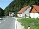
From the place where we left the old road Slovenske Konjice - Celje, we go uphill on the asphalt road through the village Beli Potok near Frankolovo. After a few minutes we reach the entrance to the forest. At the beginning of the forest an arrow helps us, as this part of the path is marked. After entering the forest, we cross the Lindeški potok (to the left there are some free climbing routes), and our path begins to climb quite steeply on partly stony ground. Soon we reach the Lindeški waterfall. Behind the waterfall, the stream and the marked path (which also flattens) "turn" right, but here we leave the marked path and go left (unfortunately this junction is not marked).
We climb about fifty metres, then turn sharply right (straight ahead the path would lead further to Frankolovo). At this bend we will see a cairn, overgrown with vegetation. The path now begins to climb moderately along the slope, and along the path we will notice another cairn.
After some time, the path leads us to a well-maintained wider forest road. Here we will see an aluminium arrow directing us slightly left uphill. We walk along the road to a sharp bend to the right, where there is another mark, but it can easily be overlooked. At the bend we go uphill into the forest. Here our path begins to climb very steeply to the next narrower cart track, which we only cross (another cairn helps us), then we soon climb to the ridge of Kislica.
From here the path is no longer orientationally difficult, as it runs along the ridge of Kislica and is very well trodden. It is characteristic that flat and steep sections alternate.
When we climb a short ascent over roots, the demanding part of this path comes next. In this demanding section we are in a rocky world, where we climb over three rock jumps to the viewpoint Špicasti vrh.
Skilled and experienced hikers may pass this part even without using their hands, but if we use hands this part is much easier. When we reach Špicasti vrh, the demanding part is over and we are rewarded with an exceptional view to the south. In front of us will be Celje with its surroundings and the surrounding hills. The view to the east would also be exceptional (Kislica is visible from Čakovec and higher buildings in Varaždin), but the forest obstructs this view. There is also a logbook and stamp at the viewpoint.
From the viewpoint we continue west along the marked path. At the beginning we are in partly rocky terrain, but after a minute of walking the path enters the forest again. To the summit of Kislica there are another ten minutes along the ridge and one smaller steep ascent. The summit of Kislica is in the forest and has no view, but on the path to the summit at one place the forest is thinned and you can see north (view towards the neighbouring Mala gora and Stenica).
I advise against the path in rain, as it is quite slippery on roots and rocks. Those who are not good at orientation should take this path with someone who knows it.

Photos:
 1
1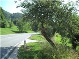 2
2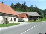 3
3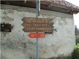 4
4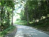 5
5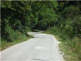 6
6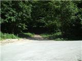 7
7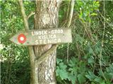 8
8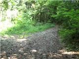 9
9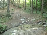 10
10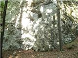 11
11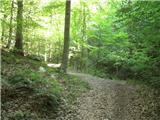 12
12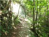 13
13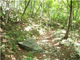 14
14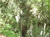 15
15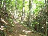 16
16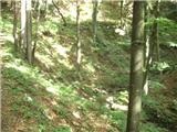 17
17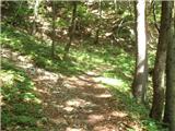 18
18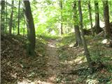 19
19 20
20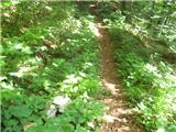 21
21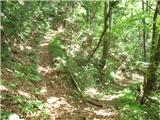 22
22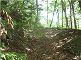 23
23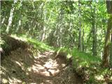 24
24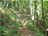 25
25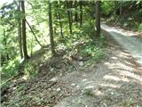 26
26 27
27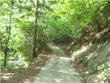 28
28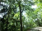 29
29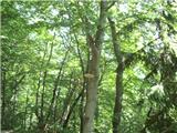 30
30 31
31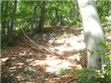 32
32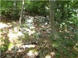 33
33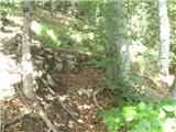 34
34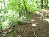 35
35 36
36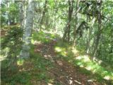 37
37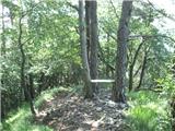 38
38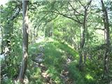 39
39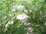 40
40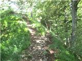 41
41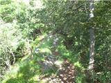 42
42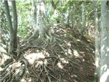 43
43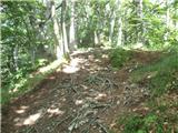 44
44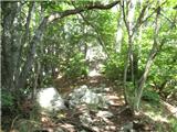 45
45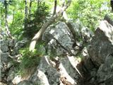 46
46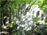 47
47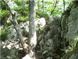 48
48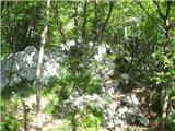 49
49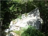 50
50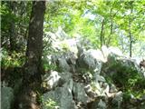 51
51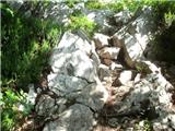 52
52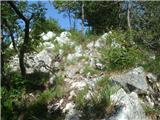 53
53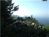 54
54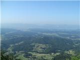 55
55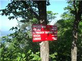 56
56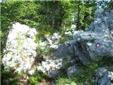 57
57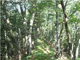 58
58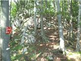 59
59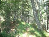 60
60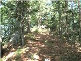 61
61 62
62
Discussion about the trip Beli Potok pri Frankolovem - Špicasti vrh (Kislica)
|
| redbull1. 10. 2013 |
You described it well with words and pictures. I walk or run this path several times a week. There's also a nice path from Socka, which has been marked since last year,, that should be added here too.
lp
Dejan
|
|
|
|
| redbull1. 10. 2013 |
from the start of the forest to the summit (number 8) I have 22 min 17 sec.
|
|
|
|
| pohodnik386. 10. 2013 |
Yesterday's ramble through the pathless areas of Kislica and Stenica.
VIDEO
Best regards! Tone
|
|
|
|
| marinka676. 10. 2013 |
redbul, is there a marked path from Socka to Kislica?? Where does it start? Is it demanding and how long does it take? Thanks for the answers.
|
|
|
|
| redbull10. 10. 2013 |
a bit late reply:
You can start already at the fire station in Socka. The place is so small it's hard to miss it. Or you can drive further along the main road and park on the left side (small quarry), cross the road there and here starts a nice marked path through the forest to the summit.
I'll put this path with description up here on this page, because many don't know this path.
Path length, based on time, I run it in 37 minutes. The marked path would be around 1h45min.
For more info, just ask me as I'm local right in front of this path.
best regards
Dejan
|
|
|
|
| marinka6711. 10. 2013 |
Thanks, hope we conquer Kislica with the little one soon
|
|
|
|
| dija12. 10. 2013 |
Špicasti vrh was conquered, unfortunately no stamp or logbook at the summit.
|
|
|
|
| pohodnik3813. 10. 2013 |
On Kislica there really is no logbook and the stamp is on Špicasti vrh which is a few meters further, last week I signed it,picture.
|
|
|
|
| redbull24. 10. 2013 |
hello
On this route B.Potok-Kislica a Labrador (wheat-yellow color) got lost or rather it's hard to say he got lost, as he might know the way home. It has often happened here that animals disappear. I politely ask, if someone took him along it would be nice if they bring him back or call the number below.
mobi: 031207672
|
|
|
|
| redbull24. 10. 2013 |
Lars has already been found after three days.
regards
|
|
|
|
| dija26. 10. 2013 |
the green collector was empty
|
|
|
|
| aonuk126. 10. 2013 |
On Kislica summit, miscreants emptied the (military) box. No stamp no logbook, one bench burned (spoiled gang stay in the valley)
Safe steps to the rest Vinko
|
|
|
|
| redbull26. 10. 2013 |
I told you so, hope we find out who did this
|
|
|
|
| homoAlpinus27. 10. 2013 |
Wonderful path. I'm on the summit several times a year. This vandalism is unprecedented.. no stamp, no book and they even burned the bench
|
|
|
|
| nincokl28. 10. 2013 |
pohodnik38 I have to thank you for your detailed descriptions of unmarked trails and video clips, just yesterday I did the tour-Kislica-Stenica exactly by your description AMAZING!! by your description this year I also did tours to Mrzla gora via Hudi prask - hunter's path to Krofičko and to Planjava via Jermanca you describe each tour so nicely that I can repeat them without worry following you, I just print your description and take it with me, once again very praiseworthy and I think there are more such people for whom your pathless descriptions are useful. Congratulations keep going!!!
|
|
|
|
| klavdipo6. 03. 2014 |
Thanks and best regards!]]>
|
|
|
|
| marinka6725. 05. 2014 |
Is there a stamp yet? Even if there isn't, no big deal, but it would be nice....
|
|
|
|
| jvali14. 08. 2014 |
Kislica or Špicasti vrh is also my "house mountain". So close to home, just the right length and steepness to do something useful for yourself. It always enchants again with the picturesque path; green forest, the murmur of the waterfall, roots like no other, rocky summit and view of the hills, valley and of course all the way home. We often continue the path with my husband over the ridge, so a circular tour is done. I've taken many friends to the top, but it's also very pleasant to go alone....
|
|
|
|
| redbull15. 08. 2014 |
I agree, you start almost at our house or from the girl's place
|
|
|
|
| tuna.iris9. 11. 2014 |
Today I went from Socka to Špicasti vrh, fog in the valley but sun on the top and wonderful view. Priceless :-).
|
|
|
|
| navdušena10. 11. 2014 |
Could you please write a bit more about the path from Socka, Tuna.iris? Does the path go along the road at the beginning, to Lipe pri Frankolovem or where? I'm really interested... And how is it at the top? Is the bench already suitable for sitting and snacking? And the stamp, book? Is it known which mountaineering association maintains this path?
|
|
|
|
| redbull10. 11. 2014 |
markings start at the fire station in Socka.
the bench is spacious, i.e. 2 benches for 5 people.
best regards
|
|
|
|
| tuna.iris10. 11. 2014 |
Above redbull described the path, I drove by car past Socka along the main road, on the left there is a small quarry and parking, on the right a sign for Kislica. The path is well marked and leads through the forest first to Strnadov travnik, where there is a mountain hut, from there a steep path to the top. At Kislica there is nothing, the plaque marking the summit is broken and on the ground, continue the path and after cca. 10 min arrive at Špicasti vrh, where there are benches, logbook, stamp and wonderful view. Total path length 11 km, I walked 2 hours with three short stops.
|
|
|
|
| redbull10. 11. 2014 |
Iris has said everything nicely, if you are still interested in something, contact me on ZS, as I am home at the starting point.
best regards
Dejan
|
|
|
|
| navdušena11. 11. 2014 |
Thanks tuna.iris and redull for the friendliness and descriptions. I think it's soon time to conquer this Kislica and Špicasti vrh. I'm already excited!
|
|
|
|
| navdušena11. 11. 2014 |
Thanks tuna.iris and redull for the friendliness and descriptions. I think it's soon time to conquer this Kislica and Špicasti vrh. I'm already excited!
|
|
|
|
| redbull11. 11. 2014 |
this path from Socka will also need to be posted here and described with photos.
|
|
|
|
| pohodnik3811. 11. 2014 |
Probably soon and if there's time..... good that you reminded me.
|
|
|
|
| navdušena16. 11. 2014 |
I highly recommend the path from Socka. Verified today, in sunny weather, nice view but not quite flawless. From the parking at the quarry to the top around two hours - maybe a bit less than tuna.iris wrote. Iris, thanks for the encouragement! The stamp is still there...
|
|
|
|
| tuna.iris3. 05. 2015 |
Yesterday again from Socka to Špicasti vrh, the day was wonderful, the view priceless. Next time I'll try from Frankolovo.
|
|
|
|
| redbull3. 05. 2015 |
From Frankolovo it's nice, but only if you go circular. Otherwise it's too short as it has good 2 km
|
|
|
|
| aonuk13. 05. 2015 |
Yes only ascent...
|
|
|
|
| tanajaj28. 03. 2016 |
Hello.
Is there a path from the summit also towards Vrhivški prelaz? On the path from the viewpoint summit to the actual Kislica summit we noticed a well-trodden branch to the right (towards NW).
|
|
|
|
| redbull29. 03. 2016 |
What do you mean Vrhivški prelaz? To the right downhill you go to Lindeški Travnik, from there you can also climb to Stenica, or down the road back to Beli Potok. There are many options.
|
|
|
|
| jvali28. 07. 2017 |
Yesterday again after a short break to Kislica and Špicasti vrh, from Socka or the parking lot by the road at the quarry. For years I've visited the summit from the Beli potok direction, due to its picturesqueness. Now the steep ascent from the Socka direction is becoming ever dearer to me. Yesterday I met only two roe deer on the path, at Strnadov travnik, otherwise peace and the whisper of nature up on the summit and on the descent. One can't wish for more. I only surprise myself that I need less than an hour for the ascent up. Running down, perhaps somehow like Dejan up? Greetings, Val. Greetings, Val.
|
|
|
|
| francf1929. 01. 2018 |
Can someone tell me where the last picture is from, which doesn't belong to Kislica, I guess: Kamniti lovec Julijci, or something else, Franci
|
|
|
|
| Franziska2. 10. 2018 |
A bit confused! I'm planning a hike to Kislica... but on the map (Pohorje 1:40.000) there is a marked path from Lindeški slap to the left. Here you write about an unmarked path? Is the map wrong? First time to Kislica, if it's really unmarked, I'll go from Socka instead. Best regards and thanks for the reply F.
|
|
|
|
| karibu3. 10. 2018 |
The trail is indeed unmarked but well trodden. If you follow the path description, you can't miss it
Best regards and happy trails!
|
|
|
|
| jvali3. 10. 2018 |
Franziska@ to the waterfall the path is completely followable, no chance to get lost. Then there are quite a few cairns along the path guiding you. The trail is well trodden, higher up there are signs on the trees. The path is very picturesque, you won't regret taking it. Good luck. Valerija
|
|
|
|
| Franziska14. 10. 2018 |
Valerija and karibu, thanks for the encouragement, today I went to Špicasti vrh and it was just as you wrote! Picturesque and interesting peak, definitely worth the drive from Mozirje..and it will see me again, because I put it among my "10 favorites under 1000m". Next time maybe a circular route: Beli p.-Kislica-Vrhivški prelaz-Beli p....yes and Stenica still to do, I admired it today. Lots of praise to everyone who creates hribi.net, sets up signposts and advises..especially for me, who is just a "naturalized Slovene", this is invaluable. I wouldn't even know about many gems! Thanks and best regards.
|
|
|
|
| Lisica15. 01. 2021 |
This Kislica completely charmed me today. I went a bit my own way... past the waterfall to the right to the castle and then further along the road and through the forest to the one described above, along the ridge to the summit and down to Strnadov travnik and again around the road and past the waterfall back to the car. I will definitely come back. The trail is currently traceable due to snow and tracks even though it's unmarked. Locals on the way helped me a bit with directions. Wonderful!
|
|
|
|
| plaNinaPirsMajcen6. 02. 2025 21:22:37 |
https://youtu.be/2ObkFWwegbQ?si=TL4L4y5UXnQn3oB6
I was thinking where in our area to go for a nice sunset and I thought of Kislica, hoping I wasn't wrong that it has an open view to the west. I persuaded my husband to join me and to record this unmarked path from Beli potok together. Maybe it will be useful for someone who doesn't know the path. The video shows all unmarked junctions.
Although you almost chew your knees to the top, the path is interesting, ridge-like through the forest, where rocks and pronounced roots alternate. At the top, our training was rewarded with an epic sunset that accompanied us almost halfway back 🤩 We recommend it!
Best, Nina
|
|
|
To post a comment you must log in:
If you do not yet have a username, you must first
register.