Starting point: Belca (1007 m)
| Latitude/Longitude: | 46,5041°N 13,9179°E |
| |
Walking time: 5 h 15 min
Difficulty: difficult unmarked way
Elevation gain: 1070 m
Elevation difference along the route: 1275 m
Map: Kranjska Gora 1:30.000
Recommended equipment (summer): helmet
Recommended equipment (winter): helmet, ice axe, crampons
Views: 11.405
 | 2 people like this post |
Access to starting point:
We leave the Gorenjska highway at the Hrušica exit and follow the road ahead in the direction of Kranjska Gora. When we get to the settlement Belca we park on a marked new parking lot at the sawmill.
Route description:
We park on a marked parking lot at the sawmill. We return a few meters back to the beginning of the marked path, which we follow past the barrier. The path then goes directly into the riverbed (right - cart track towards the abandoned border building). In the middle of stones from the rockfall, on a bigger rock we notice a blaze. To here and then to the other side of the stream's riverbed we look for the best passages. This part is short. We follow the path on sand, which is already quite well-beaten; we also get help from a trail blaze on the tree, there where the path turns into the forest. The path then steeply rises in the forest and we get to the road. On the left there is a tunnel; if we walk through it we can see how the rockfall swept away the road. We continue on the road to the right. Next follows a long walk on an almost constantly flat road, which is at several spots also buried or sunken, closer to the gate almost entirely swept away, but there are no problems with passages. After approximately one hour and 15 minutes we are at the former starting point at the gate. We follow the sign for Kepa (picture 2); the path descends into the riverbed of the stream, crosses it and turns left uphill, big trail blaze and signpost. The path starts ascending steeper. Ahead we ascend through the forest, which is occasionally interrupted by some shorter clearing covered with bushes. The marked path then twice crosses a forest road; when we step onto it the third time, we follow it to the right to a somewhat larger parking lot at the border ridge.
From the parking lot, we ascend in a few steps to the border ridge and follow the path ahead towards the east. A relatively gently sloping path, which runs along the border ridge, quickly brings us to a smaller bivouac (2 mattresses), which is situated on the Slovenian side of the ridge.
From the bivouac, we still continue on a marked footpath to which soon joins the path from Austria. The path then ascends a little steeper and further leads us along an ever narrower ridge. The increasingly panoramic path then crosses some slightly exposed gullies and then turns right (entirely on the Slovenian side). The path ahead ascends diagonally across a steep and well-secured slope, which is very exposed to falling stones. Higher, the path turns left and then ascends along the steep summit slope of Kepa. The steep and gravel-filled path then again brings us higher to the border ridge, where there is the next junction.
We continue right (left Kepa 2 minutes) on the path that gently descends along panoramic grassy slopes. The path, which runs along the edge of the ridge, then starts descending steeper and soon brings us to a smaller saddle, where the path from Austria joins. We continue straight on the path, which still runs on the Austrian side of the ridge. The path, which further crosses very steep slopes, soon brings us to the saddle between Kepa and Dovška Mala Kepa.
Here the path returns to the Slovenian side and further crosses very steep and crumbly slopes. The path then starts ascending and with the help of fixed safety gear brings us to the eastern side of Dovška Mala Kepa. The marked path then again brings us to the main ridge, which we leave. We continue sharply left and continue the ascent along the ridge, which is partly overgrown with dwarf pines. A somewhat nicer passage we find on the Austrian side of the ridge, where along a very steep "path" we ascend to a little visited peak.
Belca - gate 1:15, gate - bivouac 1:15, bivouac - Kepa 1:45, Kepa - Dovška Mala Kepa 0:45.

Photos:
 1
1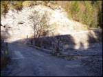 2
2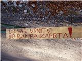 3
3 4
4 5
5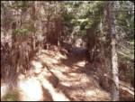 6
6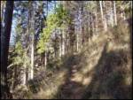 7
7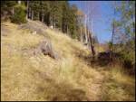 8
8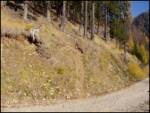 9
9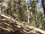 10
10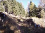 11
11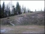 12
12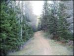 13
13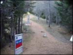 14
14 15
15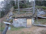 16
161122000.th.jpg) 17
17 18
18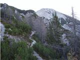 19
19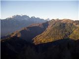 20
20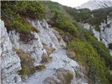 21
21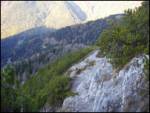 22
22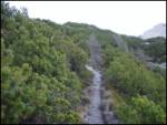 23
23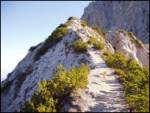 24
24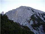 25
25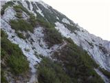 26
26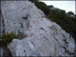 27
27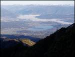 28
28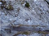 29
29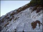 30
30 31
31 32
32 33
33 34
34 35
35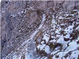 36
36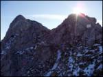 37
37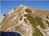 38
38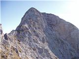 39
39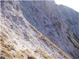 40
40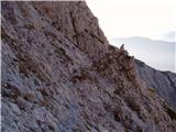 41
41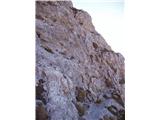 42
42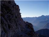 43
43 44
44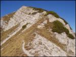 45
45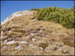 46
46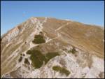 47
47
Discussion about the trip Belca - Dovška Mala Kepa
|
| andrej jerina12. 10. 2008 |
If you're already at Kepa, it's definitely worth extending the route to Dovška Mala Kepa. When crossing the south side, I think it's very smart to put on a helmet, as there's scree on the path which testifies to the fragility of the rocks. Best regards Andrej
|
|
|
|
| ljubitelj gora12. 04. 2017 |
On Sunday, when returning from Kepa, climbed the ridge (picture 38) to the top. Geopedia has the grassy summit marked, where the marked path goes right under the summit.
|
|
|
|
| Darxta20. 08. 2018 |
It seems to me that Dovška Mala Kepa is marked incorrectly on all maps, or the wrong peak is listed here.
|
|
|
To post a comment you must log in:
If you do not yet have a username, you must first
register.