Begunje (Krpin) - Sankaška koča (by cart track)
Starting point: Begunje (Krpin) (585 m)
| Latitude/Longitude: | 46,3821°N 14,203°E |
| |
Route name: by cart track
Walking time: 1 h
Difficulty: easy marked way
Elevation gain: 282 m
Elevation difference along the route: 282 m
Map: Karavanke - osrednji del 1:50.000
Recommended equipment (summer):
Recommended equipment (winter):
Views: 20.767
 | 1 person like this post |
Access to starting point:
From the motorway Ljubljana - Jesenice, take the exit Radovljica (from the Gorenjska side, exit Lesce) and follow the road ahead in the direction of Begunje. In Begunje (just a little after the junction where the road branches left towards Žirovnica), continue left towards the recreation centre Krpin (straight on for Draga and Tržič). Park on the large parking lot next to the recreation centre Krpin.
Route description:
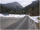
From the parking lot, we continue on the asphalt road which, higher up, crosses the Blatnica stream over a small bridge and then changes into a macadam road. We follow the road further, and it soon brings us to a marked junction, where we continue on the left road in the direction of St. Peter (right: St. Peter longer path and saddle Kališča). The road, which is getting worse, then quickly brings us to the next junction, where we continue right on the cart track (marked). The cart track then starts ascending more steeply and brings us higher out of the forest on grassy slopes over which we ascend to the church in a few minutes, from which a beautiful view opens up.
From the church, we continue past the eponymous take-off site on the path, which soon goes into the forest and then continues in a gentle ascent all the way to Sankaška koča.
Photos:
 1
1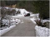 2
2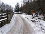 3
3 4
4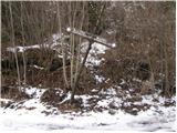 5
5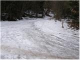 6
6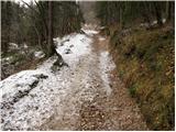 7
7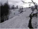 8
8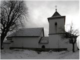 9
9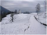 10
10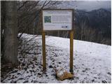 11
11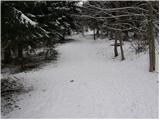 12
12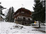 13
13
Discussion about the trip Begunje (Krpin) - Sankaška koča (by cart track)
To post a comment you must log in:
If you do not yet have a username, you must first
register.