Bavšica - Zavetišče pod Špičkom
Starting point: Bavšica (698 m)
| Latitude/Longitude: | 46,3699°N 13,6299°E |
| |
Walking time: 5 h 20 min
Difficulty: very difficult marked way
Elevation gain: 1366 m
Elevation difference along the route: 1600 m
Map: Julijske Alpe - zahodni del 1:50.000
Recommended equipment (summer): helmet, self belay set
Recommended equipment (winter): helmet, self belay set, ice axe, crampons
Views: 10.261
 | 1 person like this post |
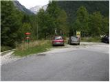
Access to starting point:
From the Bovec - Predel road, an asphalt road branches off to the right into the Bavšica Valley at Fort Kluže. Head onto this road and follow it with a moderate ascent to the parking lot in Bavšica (the parking lot is located by the TNP sign).
Route description:
From the parking lot, head left onto the poorer road towards Zavetišče pod Špičkom and Planina Bala (right Bavški Grintavec) and follow it for just under 5 minutes to the point where the markers direct left onto an initially wide footpath. The path soon narrows and leads to a small junction, where the markers direct sharply right onto a gradually steeper trail. The path soon flattens and leads to the abandoned hamlet of Logje (drinking water is just a few meters off the path).
From the hamlet of Logje, continue on the marked trail, which proceeds across a gentle grassy slope. Further ahead, the path ascends somewhat more steeply and transitions into partly rocky terrain (scree overgrown with tall grass). The path then flattens again and enters dense forest, continuing all the way to the abandoned Planina Bala.
From the alpine pasture, continue further on the marked path, which then leads through a belt of forest to the last spring along the path. Just a few tens of meters beyond the spring, notice the Bala hunting hut.
At the hunting hut, continue straight ahead and then ascend through the forest for some time. Follow a short ascent across the grassy slope (Jezerce, 1389 m) and then another ascent through the forest. When emerging from the forest for the last time, only a short ascent remains to the indistinct saddle Prevala, 1560 m.
From the saddle, where there is also a poorly visible junction, continue straight along the valley, while to the right a less trodden path branches off towards Vrhu Osojnika. Here, first descend a few steps and then continue along the initially very flat valley ahead. Further on, the path becomes steeper and begins ascending towards the saddle Čez Brežice.
At the saddle, continue right where a sign on the rock reads “Špička”. First ascend left upward along the cable, then the path leads to a grassy slope which is ascended for a while. When reaching below the walls of Mali Ozebnik, continue right and cross the precipitous slopes with a slight ascent along the cable. In some places, there is a lot of scree on the path, so extra caution is required. The path then leads to a short very demanding section. With the aid of the cable and a few pegs, ascend vertically, then cross a vertical slope to the right for a few meters. Further on, the path ascends a somewhat less steep but unprotected slope, followed by an ascent through very scree-covered terrain to Škrbina za Gradom.
From the notch, descend across the scree under the walls of the peak Pelc nad Klonicami (2442 m). The path then leads through shattered terrain past numerous rocks and boulders. In the final section, the path turns left and after a short descent leads to Zavetišče pod Špičkom.
Bavšica - Logje 0:25, Logje - Planina Bala 1:05, Planina Bala - hunting hut 0:20, hunting hut - Prevala 0:45, Prevala - Čez Brežice 1:10, Čez Brežiče - Škrbina Za gradom 0:55, Škrbina Za gradom - Zavetišče pod Špičkom 0:40.

Photos:
 1
1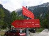 2
2 3
3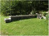 4
4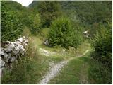 5
5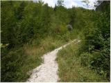 6
6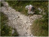 7
7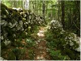 8
8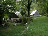 9
9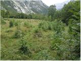 10
10 11
11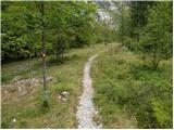 12
12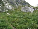 13
13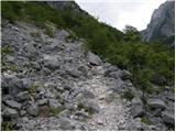 14
14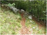 15
15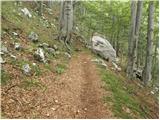 16
16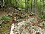 17
17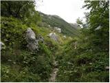 18
18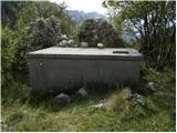 19
19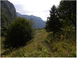 20
20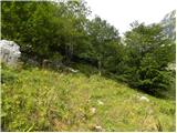 21
21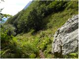 22
22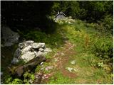 23
23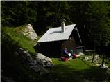 24
24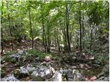 25
25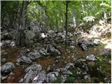 26
26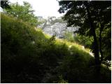 27
27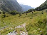 28
28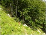 29
29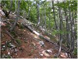 30
30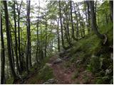 31
31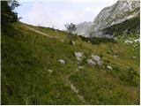 32
32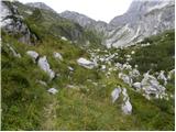 33
33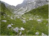 34
34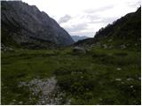 35
35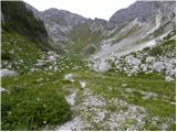 36
36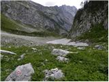 37
37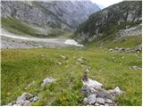 38
38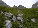 39
39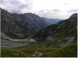 40
40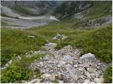 41
41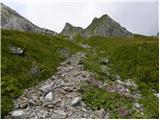 42
42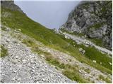 43
43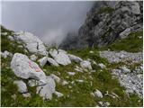 44
44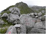 45
45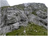 46
46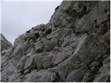 47
47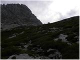 48
48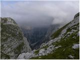 49
49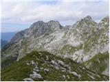 50
50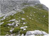 51
51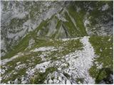 52
52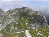 53
53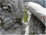 54
54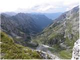 55
55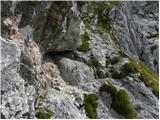 56
56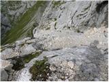 57
57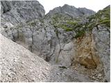 58
58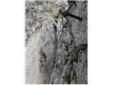 59
59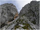 60
60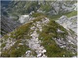 61
61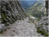 62
62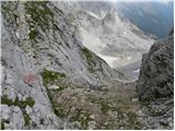 63
63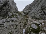 64
64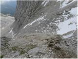 65
65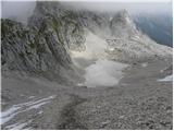 66
66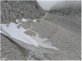 67
67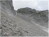 68
68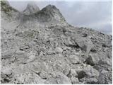 69
69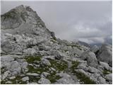 70
70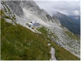 71
71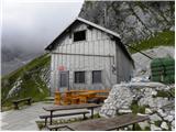 72
72
Discussion about the trip Bavšica - Zavetišče pod Špičkom
|
| darinka49. 07. 2019 |
I somewhat doubt anyone has walked here this year, but hope remains that I'll get some tip about the path if it's still okay.
|
|
|
|
| mirank9. 07. 2019 |
During the ascent to Zadnji Pelc we crossed the mentioned path, on the descent we walked for a while (about half an hour) towards Špička and then descended on a half-overgrown path directly to the bottom. The impression is that the path you're asking about in this section is little or not walked, the markers are still nicely traceable, so in my opinion most of this path is in that condition. Anyway, I think it's sufficiently traceable for your "caliber"
|
|
|
|
| darinka49. 07. 2019 |
We would go only along the ascent path. Overnight at Špička and the next day to Jalovec and to Zapoden, because we would go with two vehicles. I have been to Plešivec, but don't know the path further. Thanks for the info.
|
|
|
|
| mirank9. 07. 2019 |
Oh sorry I got it wrong...; I thought it was about the path through Bukovec, sedlo Kanja and further.
|
|
|
|
| darinka49. 07. 2019 |
There was a landslide through Kanja, I don't know how the path is. Is it safe to walk there at all?
|
|
|
|
| djimuzl9. 07. 2019 |
The landslide is marked from Kanja towards Grintavec, Kanja itself should be accessible (passable).
|
|
|
|
| jax9. 07. 2019 |
Wait, now you're talking about the path through Kanja and then along the slopes to the path from Trenta. The one mentioned here is the path through Bala and Škrbina za Gradom. Regarding the latter - a couple of years ago there was a landslide on the Brežice-Škrbina za Gradom section, lots of scree, and on one section had to climb a vertical wall with damaged protections. But with sufficient caution it was passable. If the situation has worsened in the meantime, I don't know.
|
|
|
|
| darinka49. 07. 2019 |
I'm interested in that path from Plešivec to the shelter under Špičak. But I know that few people go there.
|
|
|
|
| mirank10. 07. 2019 |
Everything jax writes is true, I caused the confusion. Darinka, the path you're interested in has nothing to do with Plešivec, which is off the path and unmarked. At the Brežice saddle and towards Škrbina behind the castle and further down to Špičak, you can't get lost. When we were near there last year, we heard a helicopter and already thought the worst; then I read somewhere that they were delivering material to the path markers for fixing this path. I don't know what was done - ask the relevant PD...
|
|
|
|
| darinka410. 07. 2019 |
Good that you reminded me, they really renewed the markings last year. I think Božo V. was among them.
|
|
|
|
| B211. 07. 2019 |
Last year, the technical group of the PZS Commission for Mountaineering Paths repaired a difficult passage in the vertical rock on the path. There were some pegs ripped out there, hanging freely on the wire rope. The passage was possible, but only with a lot of arm strength and considerable effort, because it kept "pulling" you away from the vertical and slightly overhanging about four-meter-high wall (picture 58 - Difficult vertical ascent and 59 - View of the climbed path). Directly before this critical spot, there is a very dangerous crossing over a smooth slab about six meters wide (100-meter drop below us), covered with scree from active rockfall (picture 57 - Dangerous crossing over scree). However, grip pegs are hammered into the slab to help overcome the difficulties (rope belay recommended). Picture 62 shows the spot where several meters of new wire rope were completely newly added, which wasn't there before. This section of the path is still somewhat annoying and awkward, and dangerous, especially on descent due to the scree...
For this action, an SV helicopter was used, which delivered material, tools, and the necessary team to the location, which carried out the urgent and necessary work on the path.
|
|
|
|
| rok.si11. 07. 2019 |
Bravo for the repaired trail! A couple of years ago I descended it towards Loška Koritnica and then complained on hribi.net about the torn-out pegs and gravel. Now I have no more excuses not to repeat the nice tours sometime :-)
|
|
|
|
| Razbojnik11. 07. 2019 |
Excellent news! Thanks for the information and bravo to the authorities for the restoration.
I can hardly wait for the hike
|
|
|
To post a comment you must log in:
If you do not yet have a username, you must first
register.