Bavšica - Plešivec (Loška stena)
Starting point: Bavšica (698 m)
| Latitude/Longitude: | 46,3699°N 13,6299°E |
| |
Walking time: 4 h 20 min
Difficulty: partly demanding unmarked way
Elevation gain: 1486 m
Elevation difference along the route: 1486 m
Map: Julijske Alpe - zahodni del 1:50.000
Recommended equipment (summer): helmet
Recommended equipment (winter): helmet, ice axe, crampons
Views: 15.135
 | 3 people like this post |
Access to starting point:
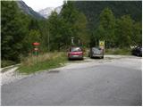
From the Bovec - Predel road, an asphalt road branches off to the right at the Kluže fortress into the Bavšica valley. Head onto the mentioned road, which we follow with a moderate ascent to the parking lot in Bavšica (the parking lot is located by the TNP sign).
Route description:
From the parking lot, head left onto the poorer road towards the Shelter below Špička and Planina Bala (right Bavški Grintavec) and follow it for just under 5 minutes to the point where the markers direct left onto an initially wide footpath. The path soon narrows and leads to a small junction, where the markers direct sharply right onto a gradually steeper trail. The path soon levels out and takes us to the abandoned village of Logje (drinking water is just a few meters off the path).
From the village of Logje, continue on the marked trail, which continues across a gentle grassy slope. Further on, the path ascends somewhat more steeply and transitions to a partly rocky area (scree overgrown with tall grass). The path then levels out again and enters dense forest, continuing all the way to the abandoned Planina Bala.
From the alpine pasture, continue further on the marked path, which then leads through a strip of forest to the last spring along the path. Just some 10 m beyond the spring, we notice the Bala hunting hut.
At the hunting hut, continue straight ahead and then ascend through the forest for a while longer. A short ascent follows across a grassy slope (Jezerce, 1389 m), then another ascent through the forest. When we emerge from the forest for the last time, only a short ascent remains to the indistinct saddle of Prevala, 1560 m.
From the saddle, where there is also a poorly visible junction, continue straight along the valley, while a less trodden path branches off to the right towards Vrhu Osojnika. Here, we first descend a few steps and then continue along the initially very flat valley. Further on, the path becomes steeper and begins to ascend towards the saddle Čez Brežice.
At the saddle, leave the marked path and head left westwards onto an unmarked trail. The trail initially runs along the right side of a short steep ridge. Then it veers slightly left and begins to ascend a fairly steep grassy slope. The path is quite poorly trodden, but can still be followed with some effort. Due to the steep terrain, considerable caution is required. In the final section, the path turns right and ascends towards the ridge. Once on the ridge, continue right and in a few steps reach the panoramic grassy summit.
Bavšica - Logje 0:25, Logje - Planina Bala 1:05, Planina Bala - lovska koča 0:20, lovska koča - Prevala 0:45, Prevala - Čez Brežice 1:10, Čez Brežiče - Plešivec 0:35.

Photos:
 1
1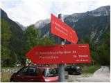 2
2 3
3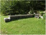 4
4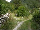 5
5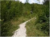 6
6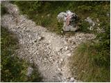 7
7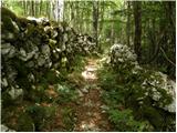 8
8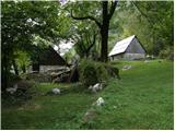 9
9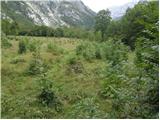 10
10 11
11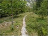 12
12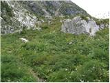 13
13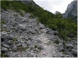 14
14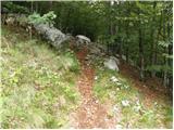 15
15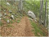 16
16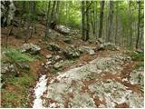 17
17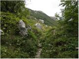 18
18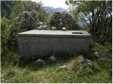 19
19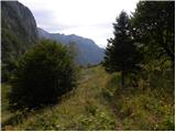 20
20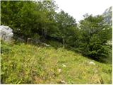 21
21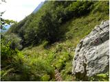 22
22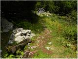 23
23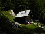 24
24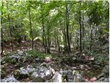 25
25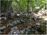 26
26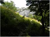 27
27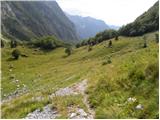 28
28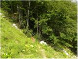 29
29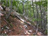 30
30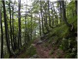 31
31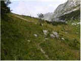 32
32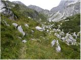 33
33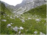 34
34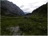 35
35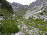 36
36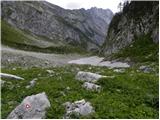 37
37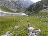 38
38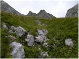 39
39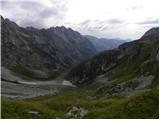 40
40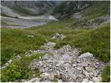 41
41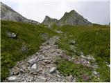 42
42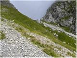 43
43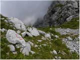 44
44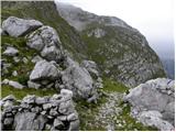 45
45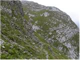 46
46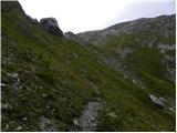 47
47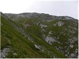 48
48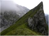 49
49 50
50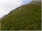 51
51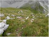 52
52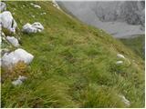 53
53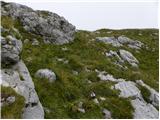 54
54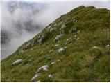 55
55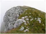 56
56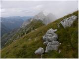 57
57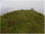 58
58
Discussion about the trip Bavšica - Plešivec (Loška stena)
|
| damijanp21. 08. 2013 |
After trips to Špik, Špik Hude police and (especially) Mangart, where there were crowds of people, for the end of our Bovec vacation we wished for something more solitary. We chose Plešivec and we didn't regret it. Wonderful nature, peace and beautiful views. We'll return here. 
Photos are at:
Plešivec
|
|
|
|
| darinka46. 01. 2018 |
Has anyone gone on this path to Plešivec last year? I went once, a few years ago, but I don't remember the path well. We went up from Loška Koritnica and descended this one. It's probably a nice hike if you have good weather.
|
|
|
|
| turbo6. 01. 2018 |
@darinka4
Wonderful hike, but not in wet conditions. The secured section is slippery when wet, especially downhill, and above it there's a "primeval forest" part, all overgrown, which is no problem when dry, but in wet you're "soaked to the skin" after a few meters! Also not in extreme heat, not just because of reptiles 
If you find someone, it's great to ascend Plešivec via this path and descend to Bavšica. Really "totally cool".
Something from a few years ago:
http://www.hribi.net/trenutnerazmere.asp?slo=1&gorovjeid=1&id=3772&stran=1
|
|
|
|
| turbo6. 01. 2018 |
@darinka4
Oh, sorry... I was wrong... I thought you were asking about the secured part from Koritnica up 
This path is wonderful also in winter, too bad you don't ski touring in summer it's a beautiful "walk". Especially end of spring when everything blooms In winter some touring skier goes up here, or doable on snowshoes high under the summit, in good conditions right to the top. Or ice axe and crampons for the very top if it's hard.
You won't regret hiking it
|
|
|
|
| darinka46. 01. 2018 |
It was beautiful already then. But it was a few years ago. We went with two cars, I remember. Up the climbing one. I'll go when the snow melts. You don't meet many people there. Maybe I'll go earlier. I'm used to walking in wet. Last year I was properly soaked several times. No problem.
|
|
|
|
| ljubitelj gora6. 01. 2018 |
Go to Briceljk, but early summer there might still be snow in the gully right under the summit, which you can't cross without winter gear. Once in autumn I turned back there at 2200m, descended and drove to Rabeljsko jezero then up Jerebica. Vrh Krnice is not bad either, but constant steepness, have to use all 4. Now that you'll have more time you'll probably browse forums and find my pictures too. I hiked those ends above Tolmin and Bovec a lot, because I set myself to discover new paths and new summits.
|
|
|
|
| dprapr7. 01. 2018 |
And why must I go exactly through that gully to Briceljk? You can approach the ridge via steep grass and then to the summit.
Anyway, this is about the path through Bala. As @turbo already mentioned, even on the marked path among the grass it's good to watch for reptiles. Last time on descent I almost stepped on one.
|
|
|
|
| ljubitelj gora7. 01. 2018 |
The steep grasses were all frozen and hard as concrete, so I turned back and returned a couple of months later with full gear.
|
|
|
|
| darinka47. 01. 2018 |
I found the date Plešivec 3. 8. 2012, where was that. and Briceljk 21. 10. 2012. Need to repeat. Once someone told us, when you mentioned reptiles, they avoid me, that they walked through tall grass and grabbed it to help themselves. And accidentally grabbed a viper with the grass. He was lucky to drop it quickly before it bit him from fright.
|
|
|
|
| turbo7. 01. 2018 |
It's great to combine the ascent to Plešivec with a descent over the Vrh Osojnika saddle and past Planina Bukovec back to Bavšica. For a seasoned female hiker or hiker, definitely nothing too much. From Plešivec, descend back to Prevala, then catch the path left uphill to the Vrh Osojnika saddle. The path is quite traceable, sometimes there are cairns here and there, and when you reach the saddle, it's worth the effort to climb to the nearby summit Vrh Osojnika. Then down the path to the other side towards Planina Bukovec, where the path around the pasture is densely overgrown even at peak summer season - nettles! There's water at the pasture, lower a stream, and even lower Bavšica, where with some luck you quench your thirst at the mountain hut of more "closed" nature, i.e. for educational purposes and similar. Those corners are beautiful, magnificent!
|
|
|
|
| ločanka7. 01. 2018 |
turbo, I wouldn't recommend that part from Vrh Osojnika to pl.Bukovec, because the lower part is really overgrown, unless of course you have someone with you who will clear the path ahead of you.
Otherwise a twisted ankle won't escape you
|
|
|
|
| turbo7. 01. 2018 |
@ločanka
You're right, it is wild. But it's also true that I walked there often years ago, even in heavy rain and hellish heat, and it always worked. Most summits in Loška stena have similar terrain - admittedly not overgrown, but the ground is terribly uneven, full of "dips and bumps", where you have to watch every step just as much
My humble opinion is that if you want to get to know the peaks and paths above Bavšica, traversing from Bala over Osojnik to Bukovec and back down to Bavšica is a must!
|
|
|
|
| dprapr7. 01. 2018 |
@turbo, maybe better in the opposite direction.
Overgrown is only a short section at the beginning, when you descend into the valley from Bukovec. At least that's how it was last year. And even there there was a trodden path.
|
|
|
|
| darinka47. 01. 2018 |
How much walking is it from Plešivec to Špička?
|
|
|
|
| turbo7. 01. 2018 |
Officially from Bavšica to the shelter is about 5h, so it could be that from Plešivec up takes 2h. This part, through Brežice to Špička I still lack
|
|
|
|
| piotr7. 01. 2018 |
@ločanka, I absolutely agree with this about twisted ankle in more or less pathless terrain.
It happened to me in the Lašt area, so I barely made it to Bavšica and last year's main hiking season went wrong too.
|
|
|
|
| B29. 01. 2018 |
The path from the saddle through Brežice towards Špička is extremely demanding. Although fairly well secured, it is full of scree both on the Bala side and on the descent to the shelter. At one point there is (was secured) an about eight meters high overhanging chimney, now especially from the Bala side due to pulled-out pegs and torn steel cable extremely difficult to pass (difficult climbing hanging exclusively on the arms). Here we must by no means allow a slip or fall! In that case we will end up on the screes in Bala...
From the Špička direction it can somehow be "cheated" of course hanging on arms. Before this dangerous spot there also threatens us a short very dangerous (active) rockfall that "hangs" over our heads... Renovation of the protections on the entire path is planned for this year - of course in summer...
I don't mean to scare. This is just information...
|
|
|
|
| darinka49. 01. 2018 |
In 2012 I remember, when we were on Plešivec, one hiker went this path. He said he was going first time and didn't know what the path would be like. Maybe everything was still fine then.
|
|
|
|
| B29. 01. 2018 |
It is vertical, inclined, overhanging, torn protections and beside it also active rockfall. Under us a 100-meter drop! In the current state of the critical spot, the passage is extremely dangerous. If I had to choose, I personally would rather choose the Špička - Bala direction. That spot I mentioned is passable with a rope, because there is one peg at the top around which you can fix the rope and descend on it to the bottom of the overhang. We need about 20m of rope (double rope for descent).
|
|
|
|
| B29. 01. 2018 |
Although this spot looks "very tame" on the picture, it is in reality "very tricky". It contains all previously mentioned elements. On the upper left rockfall threatens us and on the lower right a 100-meter abyss. Before this spot however a slanted smooth slab full of scree...
|
|
|
|
| B29. 01. 2018 |
I have problems with pictures...
|
|
|
|
| darinka49. 01. 2018 |
Send pictures regarding current conditions.
|
|
|
|
| mirank9. 01. 2018 |
I descended there more than a decade ago and in my memory remained the section from Škrbina behind the ruin to Brežice mainly along ugly worn-out protections and locally loaded, locally slippery and exposed little path. I don't remember any really demanding even overhanging passages.
|
|
|
|
| B29. 01. 2018 |
Yes, unfortunately almost everything is as you remember. There is also (admittedly only one) ugly and jammed overhang...
|
|
|
|
| jax10. 01. 2018 |
I walked there this autumn. The passage is really awkward, but for experienced mountaineers it's not so terribly demanding. Yes, it's vertical and exposed, and yes, a couple of pegs are pulled out. The sling was still okay last time, so the self-belay kit could in principle do its job (so I recommend it, definitely). And it's not entirely true that you hang only on your arms, with a bit of feel you can place your feet somewhere too. And in my opinion, the thing is harder in the direction Špička-Brežice than the other way, when you have to climb down. But my impression was that mountaineers with enough experience in rough terrain and with self-belaying as needed will get through, although it won't be very elegant.
|
|
|
|
| B210. 01. 2018 |
Yes, everything is for people...
|
|
|
|
| darinka410. 01. 2018 |
Is that part harder than, similar to going over Sedlo Kanja. There it's quite airy. Especially if you look under your feet.
|
|
|
|
| B210. 01. 2018 |
I think the thing is quite a bit harder than Kanja because of that part...
|
|
|
|
| rok.si10. 01. 2018 |
I also walked here in the summer (Špička-through Brežice-Koritnica) and it was very uncomfortable for me, first scree and collapsed terrain, then that three, four meter high wall with the pulled-out peg that held the cable. I agree more with jax than B2 - if you have the mileage it goes - but you really need to be careful, until they fix it don't take anyone on this path who is new to the mountains!
|
|
|
|
| Grenaleva11. 08. 2020 |
For all mountain lovers, this summit is really a super choice. The path is now marked all the way to the saddle, where there's a junction to the shelter under Špička, which goes right. The path to the summit turns far left. Straight ahead is the path to Loška Koritnica. Peace and magnificent view of Mangart and Jalovec.
|
|
|
|
| ppegan11. 08. 2020 |
I fully endorse your comment @Grenaleva. We visited it 3 years ago. It was during the week, so we didn't meet a living soul, well, at least not on two legs. There were lots of marmots, a herd of ibex that curiously watched us, and for the icing on the cake, a close encounter with a large ibex that got my blood pumping, as I didn't know what it would do. Oh, I was with two dogs and we surprised it a bit. It watched us for a while, then elegantly turned and went the other way. Obviously the dogs didn't bother it much either, luckily 
|
|
|
|
| darinka421. 05. 2022 21:37:07 |
Today, Saturday, Maks and I walked this trail. Known to both. A nice day turned out. Close encounter with a viper on the trail. Maks went past it and then watched it from the top of the trail. It let me take a picture. At Sedlo Brežice there was a herd of ibex. Didn't need winter gear. There's still one snow patch on the pathless section to the summit. But it won't be there in a couple of days. What could be seen, there's still snow from Loška Koritnica. I met a couple who were already descending. Two years ago we met when we went with Marijan to Vrh Krnic. Behind me a runner came. He took two hours from Bavšica to the top. I learned that to Rombon he takes 1:46 from Bovec. Everyone in their own way.
|
|
|
|
| darinka428. 05. 2023 20:06:56 |
We were there today with Maks. There is still quite a bit of snow on Brežice saddle and below the saddle. And from Loška Koritnica there is also quite a lot of snow visible.
|
|
|
|
| darinka47. 09. 2024 20:16:47 |
We were there today with Maks. The only ones at the summit. Behind us three foreign hikers went to the Brežice saddle. Then they turned back as the summit shrouded in gray. No rain.
|
|
|
|
| darinka415. 06. 2025 07:46:22 |
We were there yesterday. On Jezercih there is a large snow patch left. More like an avalanche. But it doesn't pose problems. The path ahead is snow-free. On sedlu Brežice there is a large snow patch that can be bypassed. To the top of Plešivca it's snow-free. Yesterday there were high temperatures. We were the only hikers. We checked where the path goes from planina Bala to Stador. The neighbors of Plešivca, Bavh, Goleževica and Bedinji vrh from Prevale were nicely visible.
|
|
|
To post a comment you must log in:
If you do not yet have a username, you must first
register.