Starting point: Bavšica (698 m)
| Latitude/Longitude: | 46,3699°N 13,6299°E |
| |
Walking time: 5 h
Difficulty: difficult unmarked way
Elevation gain: 1648 m
Elevation difference along the route: 1648 m
Map: Julijske Alpe - zahodni del 1:50.000
Recommended equipment (summer): helmet
Recommended equipment (winter): helmet, ice axe, crampons
Views: 35.523
 | 2 people like this post |
Access to starting point:
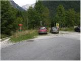
From the Bovec - Predel road, an asphalt road branches off to the right into the Bavšica valley at the Kluže fortress. Head onto this road and follow it with a moderate ascent to the parking lot in Bavšica (the parking lot is located by the TNP sign).
Route description:
From the parking lot, head left onto the poorer road towards the Shelter below Špička and Planina Bala (right Bavški Grintavec) and follow it for just under 5 minutes to the point where the markers direct you left onto an initially wide footpath. The path soon narrows and leads to a small junction, where the markers direct you sharply right onto a gradually steeper trail. The path soon levels out and takes you to the abandoned village of Logje (drinking water is just a few meters off the path).
From the village of Logje, continue along the marked trail, which continues across a gentle grassy slope. Further on, the path ascends somewhat more steeply and transitions to a partly rocky area (scree overgrown with tall grass). The path then levels out again and enters dense forest, continuing all the way to the abandoned Planina Bala.
From the alpine pasture, continue along the marked path, which leads through a belt of forest to the last spring along the path. Just a few dozen meters beyond the spring, you will notice the Bala hunting hut; between the water trough and the hunting hut, look for a clearly visible trail on the left side that leads to Briceljk (at the beginning of the path, notice a faded sign "Briceljk" on a tree). Although you will see some faded markers at the start (they are rare higher up), the path ahead is unmarked.
From the hunting hut, the path enters dense forest and ascends steeply, except for the initial gentle section. Higher up, the path turns slightly left and exits the forest onto steep slopes covered with tall grass, which we ascend along an occasionally less visible trail. A very steep path, especially slippery when wet; higher up it crosses short belts of forest a few times, then levels slightly and enters the valley Between the Peaks (valley west of Stador (2015 m)). Higher up, tall grass gradually gives way to scree, and at a small indistinct pass, the path turns sharply left onto scree where the trail is lost for a short time. Continue across the scree towards the head of the valley, then a short step blocks the path, which you climb over rugged rock. The step ends with a short exposed traverse, after which the path enters steep grassy slopes, turning even more to the left. The path continues along an indistinct valley, up which in a few minutes you reach a steep gully that remains snow-covered well into summer. Usually by mid-summer, passage is possible along the edge of the remaining patch, where you ascend rugged rock to the top of the gully (due to the considerable steepness, there is a high risk of falling rocks in the gully). At the top of the gully, continue right and after a few more minutes of walking, step onto the highest peak of Loška stena.
Bavšica - Logje 0:25, Logje - Planina Bala 1:05, Planina Bala - hunting hut 0:20, hunting hut - Briceljk 3:10.

Photos:
 1
1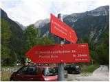 2
2 3
3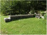 4
4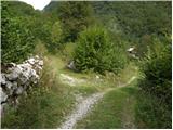 5
5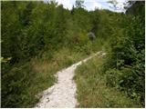 6
6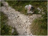 7
7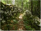 8
8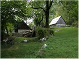 9
9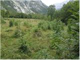 10
10 11
11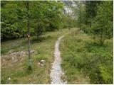 12
12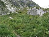 13
13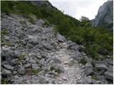 14
14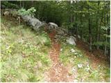 15
15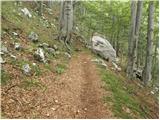 16
16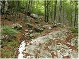 17
17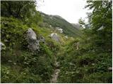 18
18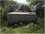 19
19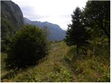 20
20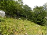 21
21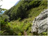 22
22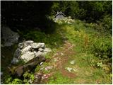 23
23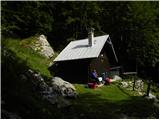 24
24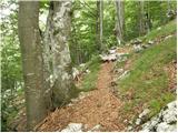 25
25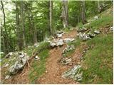 26
26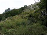 27
27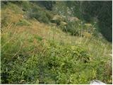 28
28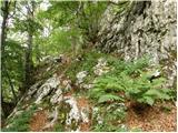 29
29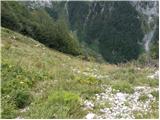 30
30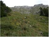 31
31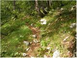 32
32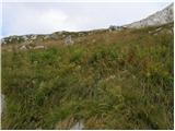 33
33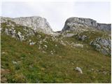 34
34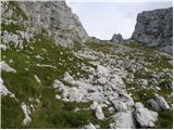 35
35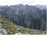 36
36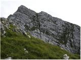 37
37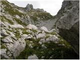 38
38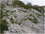 39
39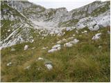 40
40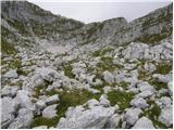 41
41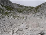 42
42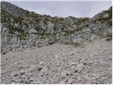 43
43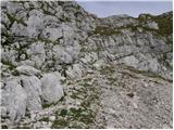 44
44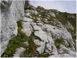 45
45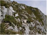 46
46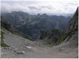 47
47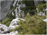 48
48
Discussion about the trip Bavšica - Briceljk
|
| visokogorc27. 06. 2013 |
Very, very nice pictures. It's precisely because of such views, panoramas and high mountain solitary nature that it's worth going to the mountains. Really very nice pictures!!! 
|
|
|
|
| amaister9331. 07. 2014 |
On Sunday 27.07.2014, on the way back from Briceljk towards Planina Bala above Bavščica, I lost a turquoise Great Escapes windbreaker. Finder please call me at 041 662 102. David
|
|
|
|
| ljubitelj gora31. 07. 2014 |
...but you didn't write anything about the conditions, there's still snow in the gully below the summit.
|
|
|
|
| amaister931. 08. 2014 |
It's true... there's still quite a bit of snow, but you can reach the summit without additional gear. I crossed it only with hiking poles.
|
|
|
|
| dumo4. 08. 2014 |
amaister93 - in the above description it says that about 10m before the Bala hunting lodge there's a spring (also in picture 23 there's a trough). Wondering if it works  ? ?
|
|
|
|
| francimedved4. 08. 2014 |
It has always worked, otherwise they gladly give you water at the hunting lodge.
|
|
|
|
| B24. 08. 2014 |
I've never encountered it being open. The tap next to it is dry...
|
|
|
|
| davidka6. 10. 2014 |
amaister93: Thanks to Mrs. Marjeta from Horjul who found my windbreaker on the pathless terrain under Briceljek and delivered it to me by post. I wish her many more beautiful hikes!
David from Šempeter pri Gorici
|
|
|
|
| wavemaker27. 12. 2016 |
On 26.12.2016 I attempted the summit of Briceljk, but snow got in the way in the last 200 m of elevation, so I only reached the saddle between Briceljk and Morež. No issues with orientation up to "dolinica Med vrhovi", where I lost the trail, but I saw where to ascend further, yet I gave up due to snow.
Otherwise, beautiful uninhabited wilderness where a herd of about 20 chamois frolics.
|
|
|
|
| IgorZlodej27. 12. 2016 |
One person was there though and there are only 19 chamois left 
|
|
|
|
| viharnik27. 12. 2016 |
Šibrovko is only for hunters
|
|
|
|
| sinplanin5. 08. 2018 |
On Wednesday 8.8.2018 I did the tour to Briceljk. Thanks to the author for the tour description, with the help of the description and placed cairns I managed quite well and reached the summit without problems. I must note only that there is no described water along the path. So water in the backpack from the valley. From the summit I continued along the ridge and climbed with the help of faded markers also to Oltarje and then returned and descended back to the valley.
|
|
|
|
| darinka415. 07. 2020 |
Yesterday to Briceljk from Bavšica. Let me tell you, now there are high grasses and you need to be careful regarding snakes, because I noticed two adders, otherwise male specimens, very nice grayish color. They withdrew from the path even before I stepped there. I managed to photo one, the other was faster and hid in its home. No issues with orientation, although the path is not maintained. There isn't even one safety device the whole path to the top. Someone brought a bouquet of flowers to the top. It's a real rose garden the whole path. You just look how beautiful it is. We met one hiker below the summit, a bit lower, and chatted with him. He described to us where to go below the summit, because there's still snow there. And he told us about that path where you go from Mali Grintavec to Bavški Grintavec. We told him we were there last week and that part where the path descends is very demanding and you have to watch out not to get swept into Trento. He was also of the opinion that they could put a few meters of cables there, especially now when there's a landslide over Kanja. That he wanted to lead two there, but one didn't decide, the other was gripped by fear and they rather turned back.
|
|
|
|
| raubšic15. 07. 2020 |
The path is not maintained because it is not marked! That's why there are no safety devices either! Let it remain that way. If someone doesn't like it, let them find other paths. 
|
|
|
|
| 12a3bc2. 10. 2021 17:33:36 |
Is it possible from the summit to climb to the neighboring peaks Oblico and Morež? 
|
|
|
|
| funnyboy2. 10. 2021 18:24:32 |
It is possible, but the ascent to both mentioned peaks is very demanding, much more demanding than this path to Briceljk.
|
|
|
|
| dprapr2. 10. 2021 20:47:12 |
To Morež it's much easier than along the ridge from below behind Stadorj diagonally to the right upwards through the grass to the ridge.
|
|
|
|
| ločanka3. 10. 2021 13:10:24 |
Yesterday they rescued someone there - on Morež.
|
|
|
|
| 12a3bc6. 10. 2021 00:39:58 |
@funnyboy
Aha... By very demanding you mean climbing?
|
|
|
|
| funnyboy6. 10. 2021 08:32:10 |
Yes. If you want to go from Briceljk along the ridge towards Oblica or towards Morež, you need to know that it's an alpine ascent.
If you want to visit Oblica, the easiest way (but still very demanding) is from Vrh Krnice (locally very exposed, sections I-II), the ascent to Morež you can do as @dprapr wrote, and if you find the passages, it won't be harder than a few sections of grade I.
Most peaks in Loška stena are very demanding, the terrain is often very exposed and steep. If you're not used to such terrain, I would recommend ascending Briceljk and Plešivec for starters, as these two peaks are easier, then continue. I also recommend looking at some guidebook, e.g. Brezpotja or here on this site in the forum, to see what it looks like when hiking these peaks.
|
|
|
|
| jax6. 10. 2021 13:11:53 |
As for Morež, I've heard very scary reports myself and yes, I'm still somehow gathering courage to try it. So, the fact that it's nothing harder than "a few sections of grade I" doesn't say everything. Especially on the Primorska side.
So yes, there are many nicer mountains, but this one will have to be tried someday too ...
|
|
|
|
| lijaneja8. 10. 2021 09:01:37 |
@jax, believe me, Morež is no big deal, I really don't know why it's mentioned everywhere as difficult. As Drago already mentioned, if you tackle it from the east there are practically no difficulties, just make sure the grass is dry. Of the fourteen peaks of Loška stena, Votli vrh and Vrh Rup, Bedinji vrh, and also Oltarji if you approach them wrong, are more demanding. Just courage, @jax, you'll see, Loška stena is one of the nicer pathless hikes in our mountains.
The water in front of the hunting hut in Bali has never disappointed me.
|
|
|
|
| darinka430. 10. 2021 21:08:36 |
Quite different in autumn, when the path is at least somewhat visible. Today with the dog we had no problems regarding the path. Not even in the gully. There's no snow on the path anyway. The views from the top are really beautiful.
|
|
|
|
| Jakacius19. 10. 2022 10:11:48 |
Yesterday I was on Briceljk. The path is nicely traceable in this autumn time, the weather was even too warm for mid-October, no sign of clouds and visibility was wonderful.
By the way, on the summit there is now the Aljažev stolpiček, which the Skalarji erected on 6.10. this year (as written in the logbook), and of course there is also a stamp in it.
|
|
|
|
| sst22. 07. 2023 16:27:53 |
I advise against this trail in summer when the grasses are high. There are loads of nettles along the path that sting you from all sides. It's also hard to follow the trail at times because everything is overgrown and you don't know exactly where to step best.
|
|
|
|
| jprim22. 07. 2023 18:35:36 |
Yes, I agree, you can also step on a viper and you might run out of water. We turned back about 100 elevation meters below the summit. Heat and thirst.
Cheers!
|
|
|
|
| dprapr23. 07. 2023 18:38:35 |
3l of water is enough for the whole ridge. Tested.
|
|
|
|
| darinka423. 07. 2023 18:46:02 |
You just need to drink as often as possible because if you're dehydrated, the drink won't quench your thirst at all. I remember in 2020 when Marijan and I met a hiker who described the path to us, I asked him if he was from Bohinj. He looked at me surprised and then said how do I know his surname? I didn't. I thought he was from Bohinj, but that was his surname.
|
|
|
|
| turbo23. 07. 2023 19:36:21 |
3l is relative, people are different. I know one who might even manage the whole ridge with one liter, and quite a few who would drink ten liters too if someone carried it for them. Then also more or less hot day, humidity, daily form, everything counts, it's impossible to guess for others based on oneself 
|
|
|
|
| dprapr23. 07. 2023 19:55:49 |
For those who always carry a flask with them, 3l really won't be enough.
In my youth, my climbing partner and I usually carried together 1l in a leather container. And maybe a 0.33 beer in a can if we managed to buy it somewhere across the border. That was for the top of the wall.
With joining TO I was already richer with a plastic canteen.
When plastic bottles appeared, it was easier and more liquid available.
|
|
|
|
| darinka412. 08. 2023 06:48:23 |
Yesterday's ascent to Briceljk from Bavšica. On the known path. In tall grass. The day was warm. With beautiful views. On the descent there was a black adder at 1270 m by the path. Otherwise, except for marmots and us three, no one on the path.
|
|
|
|
| darinka422. 09. 2024 18:52:07 |
Sunday Briceljk. Known route for both. Some snow still there under the gully. But no problems. Beautiful day.
|
|
|
To post a comment you must log in:
If you do not yet have a username, you must first
register.