Starting point: Bašelj (590 m)
| Latitude/Longitude: | 46,321°N 14,4002°E |
| |
Walking time: 4 h
Difficulty: difficult marked way
Elevation gain: 1542 m
Elevation difference along the route: 1542 m
Map: Karavanke - osrednji del 1:50.000
Recommended equipment (summer):
Recommended equipment (winter): ice axe, crampons
Views: 24.952
 | 1 person like this post |
Access to starting point:
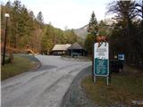
a) From the Ljubljana - Jesenice motorway, take the Kranj - east exit, then continue driving towards Jezersko. When arriving in Preddvor, leave the main road and continue left towards the centre of the mentioned place, from there follow the signs to the Bašelj settlement. When reaching Bašelj, at the place where the main road makes a long left bend, leave it and continue straight towards Gamsova pot. Continue driving on the narrow asphalt road that leads between houses and along the Belica stream. Park at the parking lot next to the Bašelj Tourist Association.
b) From the Jesenice - Ljubljana motorway, take the Kranj - west exit and at the first intersection continue left. Then drive through the underpass under the motorway, then arrive at a roundabout, from which continue driving towards Golnik. The road ahead leads through the settlement of Mlaka pri Kranju, but at the end of the settlement we continue right towards the Srakovlje settlement. We then drive through Srakovlje, Spodnja Bela, Srednja Bela, Zgornja Bela (in Zgornja Bela we join the road from Preddvor) to Bašelj, where the main road makes a long left bend, leave it and continue straight towards Gamsova pot. Continue driving on the narrow asphalt road that leads between houses and along the Belica stream. Park at the parking lot next to the Bašelj Tourist Association.
Route description:
From the parking lot, continue towards the source of Belica, Kališče and Storžič (left Gamsov raj) along the gravel road closed to public traffic, which bypasses the hut of the Belica Sports and Tourism Park on the right side. The road, from which we first get a nice view of Storžič, leads past the football and basketball courts and brings us in about 10 minutes to a marked junction at the road turning area.
From the turning area, continue right towards Kališče along the marked path (left to Kališče via forest road, also to Gradišče (Pustinjak) and Kališče past the Partizanska bolnica Košuta), which begins to ascend along the left tributary of Belica. The path further leads through the forest, first along the left side of the gully, then crosses it and switches to the right side, where after a short ascent we reach a poorer forest road or track. We follow the track for a few minutes, then the markers direct us right into the forest through which we ascend quite steeply. Higher up, we cross an overgrown clearing or old clearing, then step back onto a wide track. Along the track we walk only a few steps this time, as at the first bend we continue straight along a gradually less steep path. A bit further, we cross another track and above it we approach a wide track completely. At the place where we fully approach the track, there is a mountaineering signpost indicating the path downhill. Here we continue straight and after a minute or two of further walking we join the more trodden path from Mač.
From the mentioned junction, continue left towards Kališče (straight to Mače via road, right to Mače via footpath) and continue the path through a short stretch of dense forest. The dense spruce forest ends quickly and we step onto a poorer forest road leading from the valley of the Belica stream. We ascend along the road, which soon makes a left bend, for a few minutes, then on the right side we notice the continuation of the mountaineering path (the branch is well marked). The path further moves to a steeper slope and ascends quite steeply in numerous switchbacks. Higher up, the forest thins temporarily and a nice view opens to the south. In the area of sparse forest, a wooden bench provides a pleasant rest, a little further we are "surprised" by a still functioning clock on a tree. Continuing, we traverse more to the right to reach the forested southern ridge of Kališče. On the mentioned ridge, the path turns sharply left, then ascends in a few switchbacks to Spodnje Kališče, or Planina Kališče, from where a nice view of Storžič opens.
When above Spodnje Kališče the path returns to the forest, the path from Laški (also the path from Bašelj past Partizanska bolnica Košuta) joins us from the left. A few more minutes of walking through the forest follow and we arrive at a nice viewpoint, from which a nice view opens towards the nearby Dom na Kališču, Mali Grintovec, the ridge of Lanež, Krvavec... From the viewpoint, only a short ascent follows and we are at Dom na Kališču.
Behind Dom na Kališču, we notice a mountaineering signpost with numerous options for continuing the path. We continue along the gentle and scenic ridge path towards Storžič, Bašeljski vrh..., which continues northwards. After a few minutes of easy walking with nice views reaching all the way to the Julian Alps, we arrive at a junction where the path to the church of sv. Lovrenc above Bašelj, Planina Javornik and Kriška gora branches left, the path to Bašeljski vrh and Mali Grintovec branches right, we continue straight towards Storžič. A few minutes of traversing mostly the western slopes of Bašeljski vrh follow, then we arrive at the grassy Bašeljski preval, where the path from Jezersko (starting point Jekarica in descriptions) joins us from the right.
Again, continue straight towards Storžič, this time along a path that begins to ascend steeply through a belt of dwarf pines. After about 30 minutes of ascent from the saddle, we step onto the ridge of Storžič, which we soon leave as the path moves to the southern slopes of the mountain. Over the quite steep southern slopes, we ascend along a steep path that is slippery in several places, especially when wet. Higher up, the path levels somewhat and returns to the ridge, along and beside which it continues. To the increasingly scenic path, a little below the summit, paths from sv. Lovrenc, Planina Javornik and the path over Psica and through Žrelo join from the left. Here we continue slightly right and in a few steps reach one of the most visited two-thousanders in Slovenia.
Start - end of road 0:15, end of road - za Goro 0:50, za Goro - Spodnje Kališče 1:10, Spodnje Kališče - Dom na Kališču 0:15, Dom na Kališču - junction at Kališče 0:10, junction above Kališče - Bašeljski preval 0:10, Bašeljski preval - Storžič 1:10.

Photos:
 1
1 2
2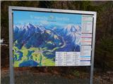 3
3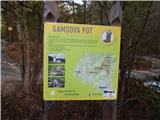 4
4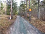 5
5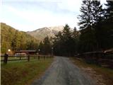 6
6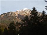 7
7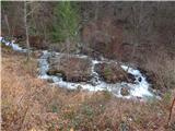 8
8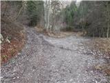 9
9 10
10 11
11 12
12 13
13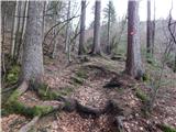 14
14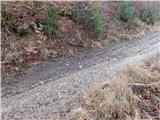 15
15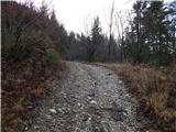 16
16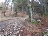 17
17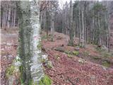 18
18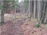 19
19 20
20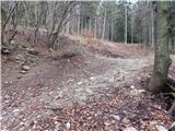 21
21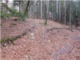 22
22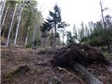 23
23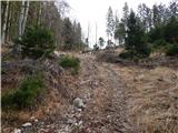 24
24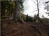 25
25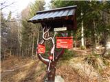 26
26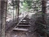 27
27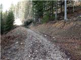 28
28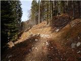 29
29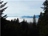 30
30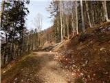 31
31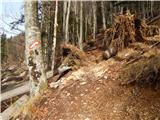 32
32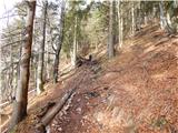 33
33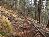 34
34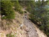 35
35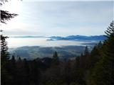 36
36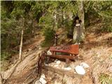 37
37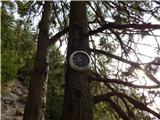 38
38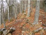 39
39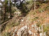 40
40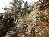 41
41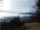 42
42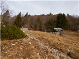 43
43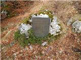 44
44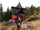 45
45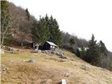 46
46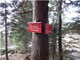 47
47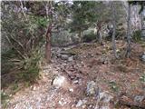 48
48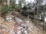 49
49 50
50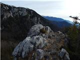 51
51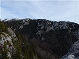 52
52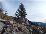 53
53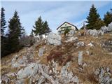 54
54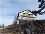 55
55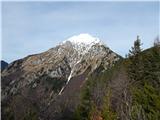 56
56 57
57 58
58 59
59 60
60 61
61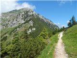 62
62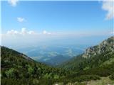 63
63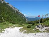 64
64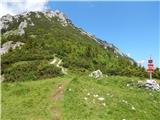 65
65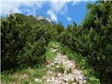 66
66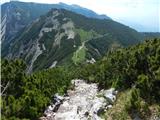 67
67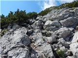 68
68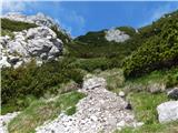 69
69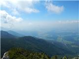 70
70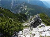 71
71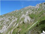 72
72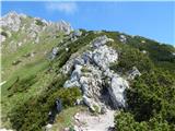 73
73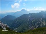 74
74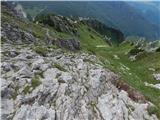 75
75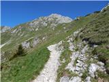 76
76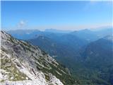 77
77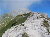 78
78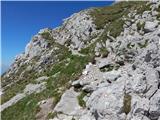 79
79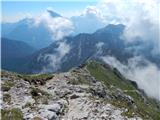 80
80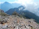 81
81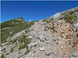 82
82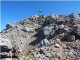 83
83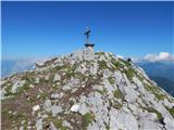 84
84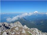 85
85 86
86
Discussion about the trip Bašelj - Storžič
|
| Žiga Šubic21. 11. 2021 19:36:19 |
From the starting point to the Dom Kokrškega odreda on Kališče, the path is marked or visible somewhat poorly. In places, markers are missing and you need to follow the footsteps of predecessors if visible. A bit of ingenuity and improvisation, otherwise you get lost easily. Otherwise, an interesting path, and you can stop by the Partizanska bolnica Košuta along the way 
|
|
|
|
| trdi22. 11. 2021 17:27:59 |
You probably mean Planinski dom na Kališču, as this hut has been called since 1992....
|
|
|
|
| turbo23. 11. 2021 07:10:14 |
|
|
|
|
| GreenAngel24. 05. 2024 14:27:58 |
Has anyone been there recently? Is it a difficult tour?
|
|
|
|
| Po Hodnik24. 05. 2024 16:30:16 |
It is not technically demanding, maybe below the summit. Of course, this is subjective. To the saddle without problems.
|
|
|
|
| jprim27. 05. 2024 18:45:49 |
When I read these interesting questions like whether the path is difficult,... it says in the description - difficult. We can trust the difficulty descriptions on this site.
Regards
|
|
|
To post a comment you must log in:
If you do not yet have a username, you must first
register.