Bašelj - Dom na Kališču (via hospital Košuta)
Starting point: Bašelj (590 m)
| Latitude/Longitude: | 46,321°N 14,4002°E |
| |
Route name: via hospital Košuta
Walking time: 2 h 40 min
Difficulty: easy marked way
Elevation gain: 944 m
Elevation difference along the route: 950 m
Map: Karavanke - osrednji del 1:50.000
Recommended equipment (summer):
Recommended equipment (winter): ice axe, crampons
Views: 8.205
 | 1 person like this post |
Access to starting point:
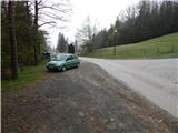
a) From the Ljubljana - Jesenice motorway, take the Kranj - east exit, then continue driving towards Jezersko. Upon arriving in Preddvor, leave the main road and continue left towards the centre of the mentioned town, from there follow the signs to the Bašelj settlement. When we arrive in Bašelj, at the place where the main road makes a long left bend, leave it and continue straight towards Gamsova pot. Continue driving on the narrow asphalt road that leads between houses and along the Belica stream. Park at the parking lot next to Turistično društvo Bašelj.
b) From the Jesenice - Ljubljana motorway, take the Kranj - west exit and in the first intersection continue left. Then drive through the underpass under the motorway, then arrive at a roundabout, from which continue driving towards Golnik. The road ahead leads through the Mlaka pri Kranju settlement, we at the end of the settlement continue right towards the Srakovlje settlement. This is followed by driving through Srakovlje, Spodnja Bela, Srednja Bela, Zgornja Bela (in Zgornja Bela we join the road from Preddvor) to Bašelj, where the main road makes a long left bend, leave it and continue straight towards Gamsova pot. Continue driving on the narrow asphalt road that leads between houses and along the Belica stream. Park at the parking lot next to Turistično društvo Bašelj.
Route description:
From the starting point at the wooden hut of the Turistično društvo Bašelj, we continue along the forest road closed to public traffic, which leads along the Belica stream. Initially, we walk past the football and basketball courts, then we soon reach the first junction of the Gamsova pot, where the path to the church of St. Lovrenc, Dom pod sv. Lovrencem branches off to the left, it is also possible to continue towards Storžič, Krničarjeva koča na Planini Javornik, Mali and Veliki Poljani...
From the mentioned junction, we continue the ascent along the gravel road, which moderately ascends through the forest or partially through bushes. After a few minutes, we reach the turning point of the forest road, where the footpath to Kališče continues right across the stream, and slightly to the left the Gamsova pot continues, leading to Gradišče and further to sv. Lovrenc as well as the path to Kališče along the forest road, Kališče past the Partizanska bolnica Košuta and Kališče along the Kisovec ridge. We continue along the wide track, which ascends towards the nearby water intake. Before the intake, we leave the wide track and again continue slightly left on the path where the Gamsova pot continues. Then we ascend for a few minutes along a steeper track, when it ends we continue right along a less pronounced but relatively well-trodden path that ascends through the forest. Higher up, the trail partially disappears in places, but we follow the otherwise rare yellow-white markers indicating the Gamsova pot. We ascend through the forest for a few minutes, then at one bend we reach another forest road, which we follow to the right (left Laško). We walk along the gravel road for about 10 meters and we are already at the next junction, where the path to sv. Lovrenc branches off to the left, a few steps further also to the right to the top of Gradišče. We continue along the road for another about 10 minutes, then we reach a small parking lot and a few steps further the turning point at the end of the road.
From the end of the road, we continue left onto the track in the direction of Kališče and Storžič. The track then moderately ascends along the bed of the Belica stream and after about 10 minutes splits into two parts. We continue along the left track, which ends after a few meters. At this point, we leave the vicinity of the stream bed and continue somewhat left along the path that steeply ascends through the forest. The steepness soon eases and the path brings us to the Partizanska bolnica Košuta.
After the hospital, we cross two consecutive gullies, then the path becomes steeper again. The path ahead still continues through the forest, crossing one steeper slope, where special caution is needed especially when wet. Above the steep section, we reach the side ridge of Kališče, where an unmarked path from Bašelj joins us from the right, leading along the Kisovec ridge.
Here we continue left and continue the ascent along the still steep path that continues through gradually sparser forest. After the bench and after some views of the nearby Storžič, the path turns right and returns to dense forest. A less steep path follows, which quickly takes us to the first hut on Spodnje Kališče. After the hut, the forest ends, then along a pleasant grassy base in a few minutes we reach the central part of the pasture, where we also join the usual path from Mač.
From Spodnje Kališče, we continue slightly left in the direction of Dom na Kališču, from which a few minutes of walking through the forest follow, then we reach a beautiful viewpoint from which a nice view opens towards the nearby Dom na Kališču, Malemu Grintovcu, the Lanež ridge, Krvavec... From the viewpoint, only a short ascent follows and we are at Dom na Kališču.
Starting point - end of road 0:15, end of road - road under Gradišče 0:25, road under Gradišče - turning point 0:10, turning point - Partizanska bolnica Košuta 0:25, Partizanska bolnica Košuta - Kisovec 0:25, Kisovec - Planina Kališče 0:45, Planina Kališče - Dom na Kališču 0:15.

Along the route: Konec ceste (679m), Cesta pod Gradiščem (825m), Obračališče (852m), Partizanska bolnica Košuta (1016m), Kisovec (1152m),
Planina Kališče (1450m)
Photos:
 1
1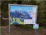 2
2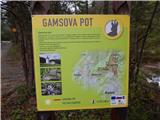 3
3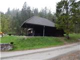 4
4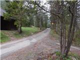 5
5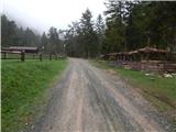 6
6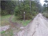 7
7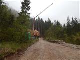 8
8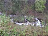 9
9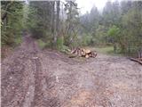 10
10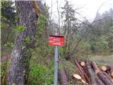 11
11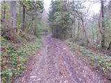 12
12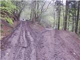 13
13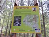 14
14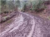 15
15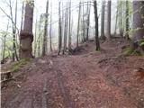 16
16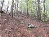 17
17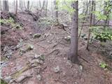 18
18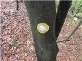 19
19 20
20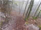 21
21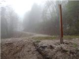 22
22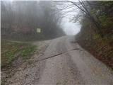 23
23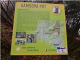 24
24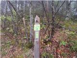 25
25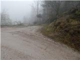 26
26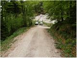 27
27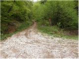 28
28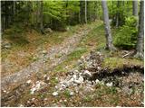 29
29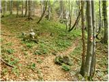 30
30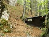 31
31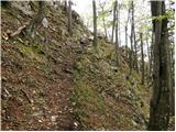 32
32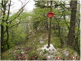 33
33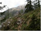 34
34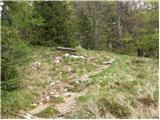 35
35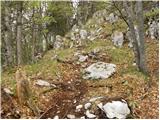 36
36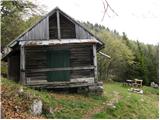 37
37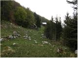 38
38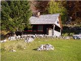 39
39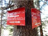 40
40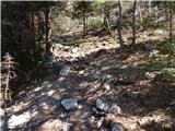 41
41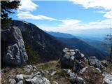 42
42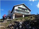 43
43 44
44 45
45
Discussion about the trip Bašelj - Dom na Kališču (via hospital Košuta)
|
| Enka5. 08. 2018 |
Beautiful, well-marked path. More interesting and varied than the classic approach, by which we ascended from Bašelj to Kališča.
|
|
|
|
| ppegan26. 04. 2021 09:44:17 |
The path to Kališče is completely dry, regardless of the approach direction (from Mač or Bašelj), checked yesterday. You still step on a patch of snow a little below the hut, that's all. At Spodnje Kališče crocuses are already sprouting, which draw a smile on the face 
|
|
|
|
| hočo26. 04. 2021 14:17:18 |
I didn't get it right away, I think we met yesterday somewhere around Gradišče. Ana's 2 dogs
|
|
|
|
| ppegan26. 04. 2021 14:30:28 |
Hočo, yes I had both with me, the old one and the young one, but I don't know if we met around Gradišče. Were you there? There were quite a few people around these parts yesterday. Was I going down or up?
|
|
|
|
| hočo26. 04. 2021 14:50:10 |
Me down you up, at about 8:30
|
|
|
|
| ppegan26. 04. 2021 15:08:07 |
Aha, it was below Gradišče, yes. I remember you You were among the early and fast ones 
|
|
|
To post a comment you must log in:
If you do not yet have a username, you must first
register.