Bašelj - Dom na Kališču (on forest road)
Starting point: Bašelj (590 m)
| Latitude/Longitude: | 46,321°N 14,4002°E |
| |
Route name: on forest road
Walking time: 2 h 30 min
Difficulty: easy marked way
Elevation gain: 944 m
Elevation difference along the route: 944 m
Map: Karavanke - osrednji del 1:50.000
Recommended equipment (summer):
Recommended equipment (winter): ice axe, crampons
Views: 6.281
 | 1 person like this post |
Access to starting point:
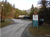
a) From the Ljubljana - Jesenice motorway, take the Kranj - east exit, then continue driving towards Jezersko. When we arrive in Preddvor, leave the main road and continue left towards the centre of the mentioned place, from there follow the signs to the Bašelj settlement. When we arrive in Bašelj, at the place where the main road makes a long left bend, leave it and continue straight towards Gamsova pot. Continue driving on the narrow asphalt road that leads between houses and along the Belica stream. Park at the parking lot next to the Bašelj Tourist Association.
b) From the Jesenice - Ljubljana motorway, take the Kranj - west exit and in the first intersection continue left. Then drive through the underpass under the motorway, then arrive at the roundabout, from which continue driving towards Golnik. The road ahead leads through the Mlaka pri Kranju settlement, we at the end of the settlement continue right towards the Srakovlje settlement. Follows the drive through Srakovlje, Spodnja Bela, Srednja Bela, Zgornja Bela (in Zgornja Bela we join the road from Preddvor) to Bašelj, where the main road makes a long left bend, leave it and continue straight towards Gamsova pot. Continue driving on the narrow asphalt road that leads between houses and along the Belica stream. Park at the parking lot next to the Bašelj Tourist Association.
Route description:
From the parking lot continue towards the Belica spring, Kališče and Storžič (left Gamsov raj) along the gravel road closed to public traffic, which bypasses the hut of the Športno turistični park Belica on the right side. The road, from which a nice view of Storžič opens up at first, leads past the football and basketball courts and brings us to a marked junction at the road's turning point in about 10 minutes.
From the turning point continue left towards Kališče along the forest road (right to Kališče on the marked path). Continue along the poorer forest road, from which a cart track soon branches off slightly to the left towards Gradišče, sv. Lovrenc and Kališče past Partizanska bolnica Košuta; we continue slightly right along the poorer road, which shortly afterwards crosses the Belica stream. After the stream, the road turns into a wide cart track, which begins to ascend more steeply. The cart track crosses several gullies during the ascent, from it we occasionally get some views, but mostly we ascend through the forest. On a few short sections, the marked path from Bašelj joins us (the path that turned right at the turning point), higher up an even more trodden path from Mač joins us.
From the point where the path from Mač joins, we walk along the road only a short time longer, as a large arrow on a tree then directs us right into the forest. The path then moves onto a steeper slope and ascends relatively steeply in numerous switchbacks. Higher up, the forest temporarily thins out and a nice view opens to the south. On the section of sparse forest, a wooden bench offers a pleasant rest, a little further a still functioning clock on a tree "surprises" us. Continuing, we traverse more to the right for a while, reaching the forested southern ridge of Kališče. On this ridge, the path turns sharply left, then ascends in a few switchbacks to Spodnje Kališče, or Planina Kališče, from where a nice view of Storžič opens up.
When the path above Spodnje Kališče returns to the forest, the path from Laški (also the path from Bašelj past Partizanska bolnica Košuta) joins from the left. A few more minutes of walking through the forest follow and we arrive at a nice vantage point, from which a nice view opens towards the nearby Dom na Kališču, Malemu Grintavcu, the Lanež ridge, Krvavec... From the vantage point, only a short ascent remains and we are at Dom na Kališču.
Starting point - end of road 0:15, end of road - to the mountain 0:50, to the mountain - Spodnje Kališče 1:10, Spodnje Kališče - Dom na Kališču 0:15

Photos:
 1
1 2
2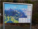 3
3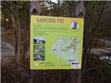 4
4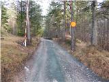 5
5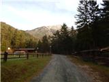 6
6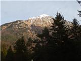 7
7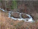 8
8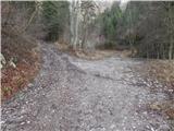 9
9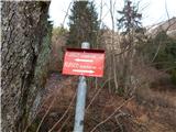 10
10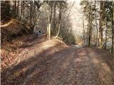 11
11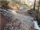 12
12 13
13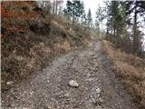 14
14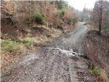 15
15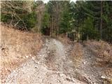 16
16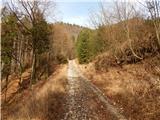 17
17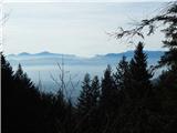 18
18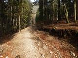 19
19 20
20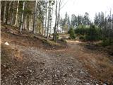 21
21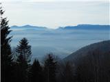 22
22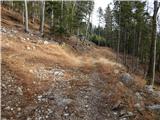 23
23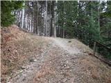 24
24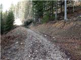 25
25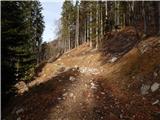 26
26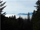 27
27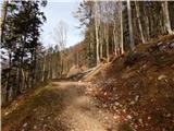 28
28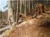 29
29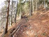 30
30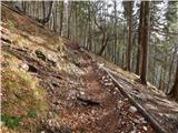 31
31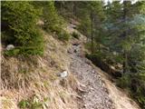 32
32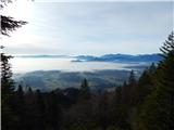 33
33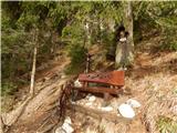 34
34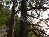 35
35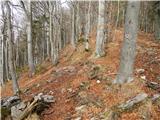 36
36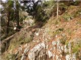 37
37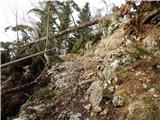 38
38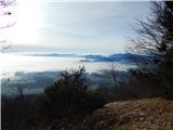 39
39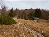 40
40 41
41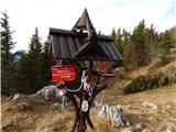 42
42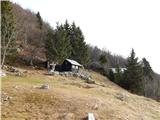 43
43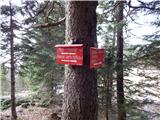 44
44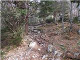 45
45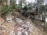 46
46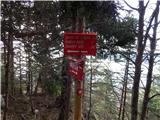 47
47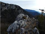 48
48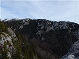 49
49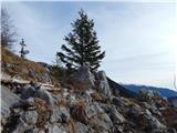 50
50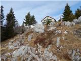 51
51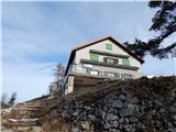 52
52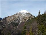 53
53
Discussion about the trip Bašelj - Dom na Kališču (on forest road)
To post a comment you must log in:
If you do not yet have a username, you must first
register.