Andrejci - Sveti Benedikt (Kančevci)
Starting point: Andrejci (340 m)
| Latitude/Longitude: | 46,7305°N 16,2423°E |
| |
Walking time: 40 min
Difficulty: easy marked way
Elevation gain: 18 m
Elevation difference along the route: 55 m
Map:
Recommended equipment (summer):
Recommended equipment (winter):
Views: 2.441
 | 1 person like this post |
Access to starting point:
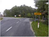
We leave the Pomurska motorway at the exit for Murska Sobota, and then we continue driving in the direction of Moravske Toplice. When we get to Martjance, we leave the main road which leads towards Moravske Toplice and further towards Lendava and we continue driving left in the direction of Sebeborci and Križevci. At the end of Sebeborci, a road towards Križevci branches off to the left, and we continue straight on the main road, which we follow to the sign which marks the end of the settlement Andrejci. We park at an appropriate place at the triangular junction, which is located immediately behind the sign which marks the end of the place.
Route description:
From the starting point, we continue on the left road in the direction of Dom duhovnosti Benedikt in Kančevci, wine route Goričko and astronomical observatory "kmica". The road on which we continue quickly brings us to the village Ivanovci, which at first runs without large changes in altitude. After a few-minute gentle descent, a short moderate ascent follows, and then again descent. After a few minutes of descent, we get to a somewhat larger crossroad, where we leave the main road which turns to the right and continues towards Prosenjakovci, Berkovci, Ratkovci and Kančevci and we continue straight on a somewhat narrower, but still asphalted road. The road further gently ascends and with nice views on surrounding hills quickly brings us to the Home of Spirituality Benedikt and a few steps ahead to the church of St. Benedikt.
Photos:
 1
1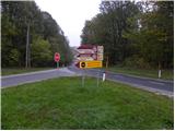 2
2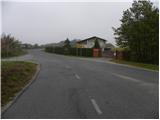 3
3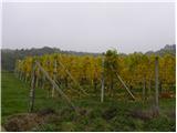 4
4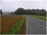 5
5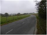 6
6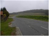 7
7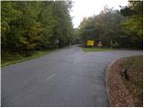 8
8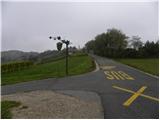 9
9 10
10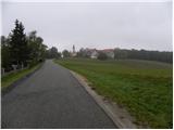 11
11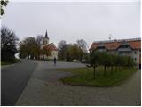 12
12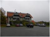 13
13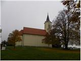 14
14
Discussion about the trip Andrejci - Sveti Benedikt (Kančevci)
To post a comment you must log in:
If you do not yet have a username, you must first
register.