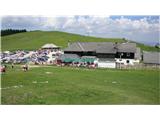
Altes Almhaus - Rappoldkogel (circular path)
Starting point: Altes Almhaus (1649 m)
Route name: circular path
Walking time: 4 h 30 min
Difficulty: easy marked way
Elevation gain: 279 m
Elevation difference along the route: 385 m
Map:
Recommended equipment (summer):
Recommended equipment (winter): ice axe, crampons
Views: 1.168
 | 3 people like this post |
Access to starting point:
A) From the Štajerska side we drive on the highway to Graz, where we turn left in the direction of Klagenfurt (A2). We drive to the exit for Mooskirchen, where we follow the signs for Voitsberg and then for Köflach. From the settlement Köflach we continue in the direction of Maria Lankowitz. In this settlement we follow the signposts for Altes Almhaus. From the settlement Maria Lankowitz an asphalt road leads us to the starting point.
B) From the Koroška side we drive over the border crossing Vič to the settlement Šentandraž / St. Andrä, where we enter the highway in the direction of Graz. We take the exit Packsattel (exit 231). We follow the signs for the settlement Köflach. From the settlement Köflach we continue in the direction of Maria Lankowitz. In this settlement we follow the signposts for Altes Almhaus. From the settlement Maria Lankowitz an asphalt road leads us to the starting point.
Route description:
From the parking lot in front of the mountain hut Altes Almhaus we go on path no. 505, direction Salzstiegel. On the macadam road we walk approximately 20 minutes, then we arrive at a junction, where we go in the direction of Salzstiegel über Rappoldkogel (path: 505b). There we gradually ascend for a good 30 minutes to reach the end of the forest edge. We continue the path along the ridge all the way to the summit, which is less than 30 minutes away. On the summit of Rappoldkogel (1928 m) stands a metal cross with a summit logbook.
From the summit the path directs us south towards the mountain hut Salzstiegel. Along the rocky ridge we descend all the way to the pastures above the hut. After a good hour we arrive at the mentioned hut.
From the hut we follow path 505 in the direction of the mountain hut Altes Almhaus. The path continues along the forest road below the foot of Rappoldkogel. After one hour of walking we arrive at the signpost that directed us to Rappoldkogel.

Along the route: Wölkerkogel (1706m)
Photos:
 1
1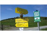 2
2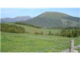 3
3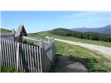 4
4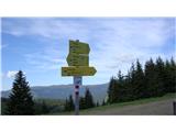 5
5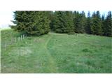 6
6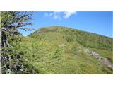 7
7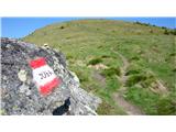 8
8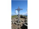 9
9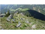 10
10 11
11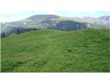 12
12 13
13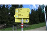 14
14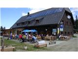 15
15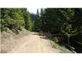 16
16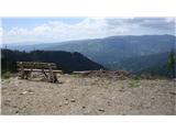 17
17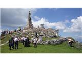 18
18
Discussion about the trip Altes Almhaus - Rappoldkogel (circular path)
To post a comment you must log in:
If you do not yet have a username, you must first
register.