Aljažev dom v Vratih - Gubno (above Kriška stena)
Starting point: Aljažev dom v Vratih (987 m)
| Latitude/Longitude: | 46,4128°N 13,8466°E |
| |
Walking time: 4 h 40 min
Difficulty: easy pathless terrain
Elevation gain: 1416 m
Elevation difference along the route: 1430 m
Map: TNP 1:50.000
Recommended equipment (summer):
Recommended equipment (winter): ice axe, crampons
Views: 15.954
 | 5 people like this post |
Access to starting point:
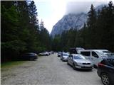
We drive to Mojstrana, then follow the signs for Vrata valley. We continue along the toll road, which is closed to public traffic in winter time, following it to the large parking lot located a few minutes before Aljažev dom v Vratih.
Route description:
From the parking lot we continue along the gravel road closed to public traffic, passing Šlajmerjev dom to quickly reach Aljažev dom v Vratih.<br> At Aljažev dom we head right towards Škrlatica, Dolkova špica, Stenar, Križ and Kriška stena (straight Triglav, Luknja, Bovški Gamsovec, Pogačnikov dom via Sovatna, Stenar, Križ and Razor) on the path that takes us across the meadow into the forest. The path ahead first ascends along a gentle cart track, higher up turning into a gradually steeper footpath which brings us to the bed of a mountain torrent, though we do not follow it for long. Higher up the path temporarily turns right and ascends steeply through the forest, later beginning to turn left where we also cross a short scree slope, and the path increasingly approaches the slopes below the mighty Stenar. We quickly reach these slopes and ascend through dwarf pines and past individual larches. Upon leaving the dwarf pine belt we reach a small valley separating Stenar from Križ, which we ascend briefly, then the marked path turns right (straight to Stenarska vratca and Križ and Stenar via the mentioned gates).<br> A short further ascent follows in increasingly high-alpine terrain and some 100 elevation meters higher we arrive at a somewhat larger junction, where the path to Škrlatica continues right, while we go left towards the nearby bivouac Na rušju, Križ and Kriška stena.<br> From the junction only a short easy ascent remains and we reach bivak Na rušju, also called bivak IV Na rušju.<br> The marked path bypasses the bivouac on the right side and behind it ascends steeply for a short time, then the steepness eases, and the path leads us through karst terrain full of sinkholes, cracks and pits. A beautiful high-alpine path offering nice views especially on the mighty surrounding mountains brings us higher to the next junction.<br> We continue left towards Pogačnikov dom na Kriških podih (right Dolkova špica and Škrlatica via Rdeča škrbina) along the path that higher up brings us to the edge of Kriška stena, i.e. to Križki prelaz.<br> We continue left towards Križ (right Krnica via Kriška stena) and the path, transitioning onto a wide ridge, quickly brings us to Bovška vratica, from which a view opens onto Kriške pode, where we can see the highest-lying Slovenian lake, Zgornje Kriško jezero, located at 2159 m above sea level.<br> We continue right towards Krnica (straight Križ and Pogačnikov dom), but only to the point where the marked path via Kriška stena turns left downwards. At this spot we notice a somewhat larger cairn located a few meters off the marked path. We walk to the cairn, then survey the further ascent direction. Due to the large number of large cracks and sinkholes the initial part is somewhat orientationally more difficult, but in fine weather not particularly challenging. Once we push through this labyrinth we reach the foot of Gubno. Next we ascend a relatively steep slope, keeping to the right passages as it is less steep there. After a few minutes' ascent the slope flattens, and we proceed onto the summit grassy slope of the mountain, which we then follow to the panoramic peak.<br> Start - Aljažev dom 0:05, Aljažev dom - Bivak Na rušju 2:55, Bivak Na rušju - Na rušju 0:45, Na rušju - Vrh Kriške stene 0:15, Vrh Kriške stene - Gubno 0:40.

Photos:
 1
1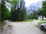 2
2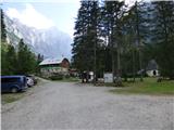 3
3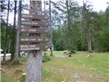 4
4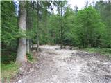 5
5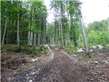 6
6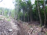 7
7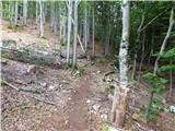 8
8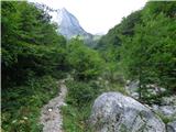 9
9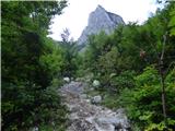 10
10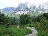 11
11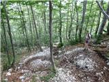 12
12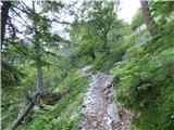 13
13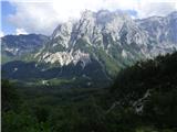 14
14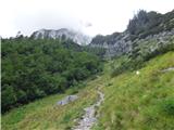 15
15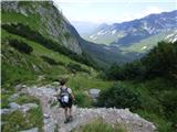 16
16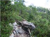 17
17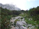 18
18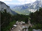 19
19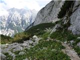 20
20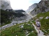 21
21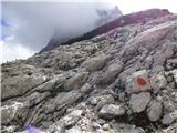 22
22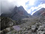 23
23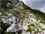 24
24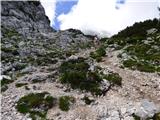 25
25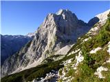 26
26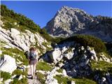 27
27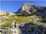 28
28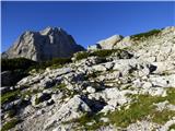 29
29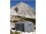 30
30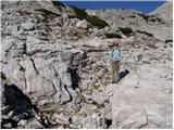 31
31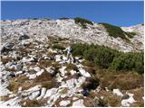 32
32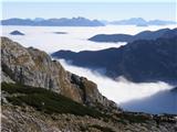 33
33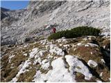 34
34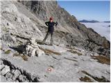 35
35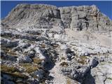 36
36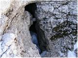 37
37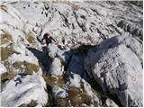 38
38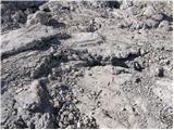 39
39 40
40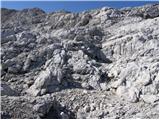 41
41 42
42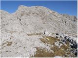 43
43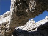 44
44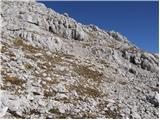 45
45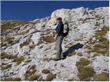 46
46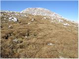 47
47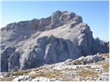 48
48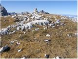 49
49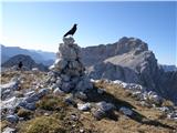 50
50
Discussion about the trip Aljažev dom v Vratih - Gubno (above Kriška stena)
|
| ločanka23. 08. 2015 |
I wonder that in all this period since the description no opinion has been written. Really, first-class trip, first-class destination, exceptional summit where you just can't get enough of the beautiful views, and a real luxury of greenery on the top. Definitely a summit worth repeating!
I would shorten the ascent time a bit. I'm not a fast hiker, yet I needed 4 hours and 20 minutes for the ascent.
|
|
|
|
| golica15. 08. 2019 |
Lady, I would ask, is the path exposed anywhere here, so it wouldn't be just for those who get dizzy, regardless that it's an easy marked path? Thanks
|
|
|
|
| Daaam15. 08. 2019 |
If you don't have extreme vertigo then there won't be a problem. (the path itself is not exposed, but occasionally there are a bit deeper views). But I would add that from photo 35 onwards it's pathless...here and there a cairn. In good weather fully doable, but in fog I wouldn't go to the top if it were my first time there. Regards
|
|
|
|
| golica15. 08. 2019 |
thanks for the info, regarding the pathless part, we'll be a group, so I think there won't be problems.
|
|
|
|
| tango21. 08. 2020 |
Beautiful day to visit a truly excellent viewpoint. The morning crowds in Vrata surprised us a bit, but the majority went towards Triglav, some also towards the bivouac Na rušju, from the bivouac onwards we were pretty much alone. For the approach, you don't need to go all the way to the exit from Kriška stena, but it's more convenient earlier, about 50m higher, at the cairn, to turn right from the marked path towards the summit. Recommended!
|
|
|
|
| magroman17. 10. 2022 12:41:48 |
Yesterday's visit to a super viewpoint. Parking lot in Vratih was full, only a handful went in the direction of bivouac IV. The approach to Gubno itself is not complicated, keep more to the right on the grass, there are plenty of cairns so orientation is not problematic. Of course this applies in good weather. From Gubno a quick hop to the neighboring Križ and descent via Sovatna to Vrata.
Best, and safe travels
|
|
|
|
| kolosej8. 07. 2024 15:41:16 |
Gubno and its cousin in the Karavanke belong to the peaks that our relatives haven't even heard of, let alone been up...
Gubno 2403m is an easy off-trail from the marked path before Kriška stena, helped by cairns along the way, in fog it can easily become unmanageable. Good luck
|
|
|
To post a comment you must log in:
If you do not yet have a username, you must first
register.