Aljažev dom v Vratih - Dolkova špica (western way)
Starting point: Aljažev dom v Vratih (987 m)
| Latitude/Longitude: | 46,4128°N 13,8466°E |
| |
Route name: western way
Walking time: 5 h 15 min
Difficulty: difficult marked way
Elevation gain: 1604 m
Elevation difference along the route: 1630 m
Map: Triglav 1:25.000
Recommended equipment (summer): helmet
Recommended equipment (winter): helmet, ice axe, crampons
Views: 53.342
 | 7 people like this post |
Access to starting point:
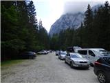
We drive to Mojstrana, then follow the signs for the Vrata valley. We continue along the toll road, which is closed to public traffic in winter, following it to the large parking lot located a few minutes before Aljažev dom v Vratih.
Route description:
From the parking lot continue along the gravel road closed to public traffic, passing Šlajmerjev dom to quickly reach Aljažev dom v Vratih.
At Aljažev dom turn right towards Škrlatica, Dolkova špica, Stenar, Križ and Kriška stena (straight Triglav, Luknja, Bovški Gamsovec, Pogačnikov dom via Sovatno, Stenar, Križ and Razor) onto the path leading us across the meadow into the forest. The path then ascends first along a gentle cart track, higher up transitioning into a gradually steeper footpath that brings us to the bed of a torrent, which we do not follow for long. Higher up the path temporarily turns right and steeply ascends through the forest, later beginning to turn left, crossing a short scree slope, with the path increasingly approaching the slopes below the mighty Stenar. We quickly reach these slopes and ascend through dwarf pines and past individual larches. Upon leaving the dwarf pine belt we reach a small valley separating Stenar from Križ, ascending it briefly, then the marked path turns right (straight to Stenarska vratca and Križ and Stenar via the mentioned gates).
A short ascent in increasingly high-mountain terrain follows, and about 100 elevation meters higher we arrive at a somewhat larger junction where the path to Škrlatica continues right, while we go left towards the nearby bivouac Na rušju, Križ and Kriška stena.
From the junction only a short easy ascent remains and we reach bivouac Na rušju, also called bivak IV Na rušju.
The marked path bypasses the bivouac on the right side and steeply ascends behind it for a short time, then the steepness eases, with the path leading through karst terrain full of sinkholes, cracks and pits. A beautiful high-mountain path offering nice views especially on the mighty surrounding peaks brings us higher to the next junction.
Continue right towards Škrlatica and Dolkova špica (left Križ, Pogačnikov dom, Razor and Kriška stena) along the path crossing the slopes below the walls of the lesser-known peak Gubno, on this section without major changes in elevation, upon reaching the slopes of Dovški Gamsovec we begin to ascend traversely through scree, upon reaching the slopes of Dolkova špica we begin steeply ascending towards Rdeča škrbina, the notch separating Rogljica and Dolkova špica.
From Rdeča škrbina head right towards Dolkova špica (straight down the marked path leads to Zadnji Dolek from where the path continues towards Škrlatica or towards Bivak na Rušju) along the path that becomes technically more demanding, leading us along the northwest ridge of Dolkova špica.
The difficult spots on the ridge are not secured but are routed through natural passages so that there are no serious difficulties, the summit reached after approximately 15 minutes of walking from Rdeča škrbina.
Starting point - Aljažev dom 0:05, Aljažev dom - Bivak Na rušju 2:55, Bivak na Rušju - Na rušju 0:45, Na rušju - Rdeča škrbina 1:15, Rdeča škrbina - Dolkova špica 0:15.

Photos:
 1
1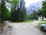 2
2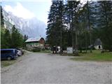 3
3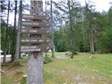 4
4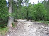 5
5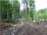 6
6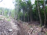 7
7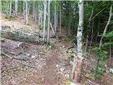 8
8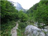 9
9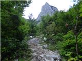 10
10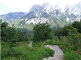 11
11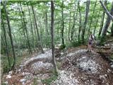 12
12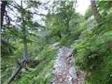 13
13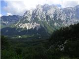 14
14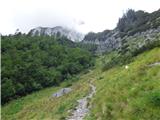 15
15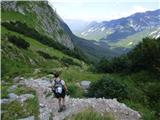 16
16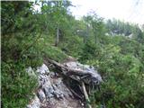 17
17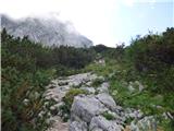 18
18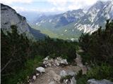 19
19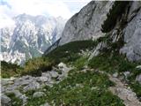 20
20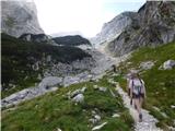 21
21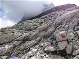 22
22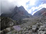 23
23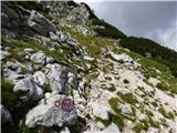 24
24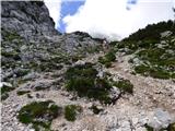 25
25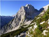 26
26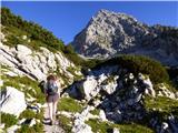 27
27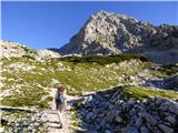 28
28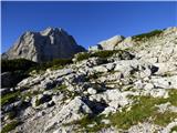 29
29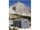 30
30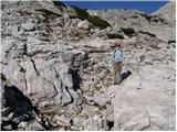 31
31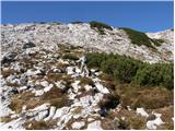 32
32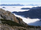 33
33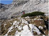 34
34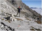 35
35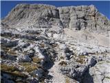 36
36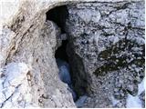 37
37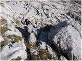 38
38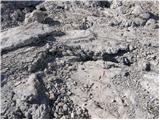 39
39 40
40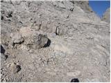 41
41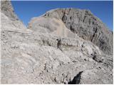 42
42 43
43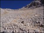 44
44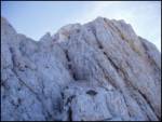 45
45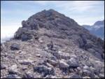 46
46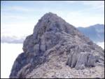 47
47 48
48
Discussion about the trip Aljažev dom v Vratih - Dolkova špica (western way)
|
| Kriška31. 10. 2008 |
On the third picture from the end (with caption: path to Dolkova špica) I don't see the path (?)
|
|
|
|
| Tadej31. 10. 2008 |
The path runs along that smaller gully visible in the middle of the picture. Orientation in the upper part in good weather is not difficult.
The path isn't visible because the terrain is rocky and the summit is little visited.
|
|
|
|
| bm20. 07. 2009 |
Last weekend I walked the path from Pogačnikov dom to Škrlatica. After descending from Križ, the newly marked path descends to Bivak IV. Towards Dolkova špica there are no more markings. But when you reach the intersection below Škrlatica, the new marking directs you towards Pogačnikov dom via Dolkova špica. I'm wondering if the path via Dolkova špica is passable because descending to Bivak IV loses a lot of time and elevation, and in the end you don't climb Dolkova špica?
|
|
|
|
| lukk5. 08. 2014 |
Hello, I'm interested in the conditions on the path and how demanding the path is.
|
|
|
|
| Stefano9111. 08. 2015 |
Hi
I have the same question
Has anyone been up the short one recently?
Thanks.
|
|
|
|
| mailman11. 08. 2015 |
Hello. The ascent to Bivak IV is nothing special, from there you can go straight up and at the junction to Pogačnikov dom turn right, or from the bivouac right towards Škrlatica into the Zadnji Dolek gully and at the fork left (right Škrlatica)! Everything is well marked and signed, but in my opinion (I was there last week) the path below Škrlatica is noticeably physically harder, especially the passage through Rdeča škrbina is very uncomfortable. At the top of this notch, the passage to the short ridge is clearly visible, watch the cairns so you don't get off track, because everything looks passable, about 10 min and you're at the top.
|
|
|
|
| Stefano9111. 08. 2015 |
Hello,
Aha....yes, we are not experienced for via ferrata and such, I don't have gear...but I have stamina, I like walking where it's not "difficult"
I don't know if you know, yesterday I went to Ojstrica via Mala Ojstrica, and if the path is "nice" like there, it's no problem for me...but if it's as difficult as you say through Rdeča škrbina, then better not go
But I wanted to go to Stenar..don't know what's better...
I haven't been to any mountain that "lies in Vrata" so I was interested
Thanks!!!
|
|
|
|
| mailman12. 08. 2015 |
So for you it's the path from Bivak IV straight past it to the junction, left is the turn-off to Pogačnikov dom, right to Škrlatica and Dolkova špica. From this side the approach to the top of Rdeča škrbina is not so difficult, at the top immediately right into the rocks. The approach to the summit is not difficult, just watch your step for the cairns!
|
|
|
|
| Stefano9112. 08. 2015 |
Oh good
So the name of the path is Western (difficult marked path)
I'll try it thanks for the info!!
|
|
|
|
| mailman12. 08. 2015 |
Exactly, you won't regret it!
|
|
|
|
| Stefano9112. 08. 2015 |
Hhehe I'll report when we manage to conquer it  hope so... hope so...
|
|
|
|
| mailman13. 08. 2015 |
Of course you will! If you doubt success, you probably won't make it up!!! Just go for it and to the top.
|
|
|
|
| Stefano9113. 08. 2015 |
Hheheh you're right! we'll see, I'll let you know next week
|
|
|
|
| darinka428. 07. 2019 |
Is it possible to bypass Rdeča škrbina from Dolkova Špica when going towards Škrlatce? Last year it was quite annoying through Rdeča škrbina. Apparently there is another trail from Dolkova špica. Probably longer.
|
|
|
|
| djimuzl28. 07. 2019 |
For hikers, the notch is the only direct passage towards Škrlatica. The other option, descent to bivouac IV and from there along the "standard" path from Vrata, adds a good two hours.
|
|
|
|
| darinka428. 07. 2019 |
Thanks, two hours is not little. There are some fixed cables at the beginning, on the descent, then just freely along Prešeren. Slowly and carefully. It works.
|
|
|
|
| bo_zl4. 09. 2019 |
Today on Dolkova špica. The path from the last junction for Škrlatica onwards towards Dolkova špica IS NOT MARKED. At the junction it still says dolkova špica and straight ahead sign. Soon you're in front of a rock over which you have to go straight up. But left of the rock every 10 meters there's a well-trodden path. Don't be misled. You have to follow the cairns. And also, the summit stamp is completely useless. No way to stamp anything other than a smudge that's not at all readable.
|
|
|
|
| BorStenar19. 11. 2022 18:01:02 |
Is there a stamp at the summit?
|
|
|
|
| nejcf19. 11. 2022 18:47:49 |
It was there in July, but completely illegible.
|
|
|
To post a comment you must log in:
If you do not yet have a username, you must first
register.