Alba di Canazei - Punta Penia (Marmolada)
Starting point: Alba di Canazei (1486 m)
| Latitude/Longitude: | 46,45751°N 11,78814°E |
| |
Walking time: 6 h 15 min
Difficulty: very difficult marked way
Via ferrata: B/C
Elevation gain: 1857 m
Elevation difference along the route: 1870 m
Map: Tabacco 06 1:25.000
Recommended equipment (summer): helmet, self belay set
Recommended equipment (winter): helmet, self belay set, ice axe, crampons
Views: 11.715
 | 3 people like this post |
Access to starting point:
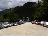
A) From Kranjska Gora over Korensko sedlo to Austria, where at the first larger crossroad we continue left towards Podklošter / Arnoldstein and Trbiž / Tarvisio. At the end of the settlement Podklošter signs for Šmohor / Hermagor point us right onto a regional road, on which past the mentioned settlement we drive to the end of the Gailtal valley, or more precisely to the settlement Kötschach-Mauthen, where we turn right towards the settlement Oberdrauburg. The route ahead leads us over the Alpine pass Gailbergsattel (982 m), after which we descend into the mentioned settlement. After crossing the bridge over the river Drau, we continue left towards the settlement Lienz. In the main roundabout in Lienz we continue "left" in the direction of the settlement Sillian and Italy. Further, we cross the state border between Austria and Italy, and we follow the main road to the settlement Dobbiaco / Toblach, where we turn left towards Cortina d'Ampezzo. When we arrive in Cortina d'Ampezzo, we follow the signs for the Alpine pass Passo Falzarego. At Passo Falzarego (2105 m) there is a crossroad, where we continue straight downhill in the direction of Marmolada and pass Passo Fedaia. At the next crossroads we follow the road in the direction of Marmolada and the mentioned pass. After Passo Fedaia (2057 m), which is located by the artificial lake Lagho di Fedaia, the road starts descending again, and we follow it to the beginning of the settlement Alba, where we will notice the Ciampac cableway on the left side. We park on the large parking lot by the lower station of the mentioned cableway. From Kranjska Gora to the starting point is approximately 280 km.
B) From Kranjska Gora over the border crossing Rateče to Trbiž / Tarvisio and further on the highway towards Videm / Udine. We leave the highway at the settlement Tolmezzo, from where we continue driving towards the settlement Ampezzo and further towards the Alpine pass Passo della Mauria (1298 m). The road then starts descending and brings us into the Cadore valley, where we continue right towards the settlement Auronzo di Cadore. At the next crossroads we follow the signs for Cortina d'Ampezzo. When we arrive in Cortina d'Ampezzo, we follow the signs for the Alpine pass Passo Falzarego. At Passo Falzarego (2105 m) there is a crossroad, where we continue straight downhill in the direction of Marmolada and pass Passo Fedaia. At the next crossroads we follow the road in the direction of Marmolada and the mentioned pass. After Passo Fedaia (2057 m), which is located by the artificial lake Lagho di Fedaia, the road starts descending again, and we follow it to the beginning of the settlement Alba, where we will notice the Ciampac cableway on the left side. We park on the large parking lot by the lower station of the mentioned cableway. From Kranjska Gora to the starting point is approximately 270 km.
C) From Nova Gorica we drive into Italy and further on the highway to the settlement Portogruaro, where at the highway junction we turn in the direction of Belluno. We follow the highway to the exit for Belluno, and after the settlement Belluno we follow the road in the direction of the settlement Agordo and then Marmolada and the Alpine pass Passo Fedaia. After Passo Fedaia (2057 m), which is located by the artificial lake Lagho di Fedaia, the road starts descending, and we follow it to the beginning of the settlement Alba, where we will notice the Ciampac cableway on the left side. We park on the large parking lot by the lower station of the mentioned cableway. From the border with Slovenia to the starting point is approximately 245 km.
Route description:
At the end of the parking lot, we continue slightly left following the signs »Locia de Contrin« on the forest road which is closed to public traffic. The road mostly runs through the forest and only occasionally opens up a view on the nearby peaks. The road then soon crosses a bridge and brings us to a marked junction, where from the left joins the footpath from the settlement Penia. Further on, the road ascends mostly in zigzags and higher up from the road also some cart tracks branch off. We always continue straight on the well-maintained road. Later the road turns left and soon to the right branches off a footpath towards the ski area Ciampac. We continue on the road and after a short ascent we arrive at the hut Locia de Contrin.
From the hut we continue on a flat macadam road, which then soon crosses a barrier. The road continues to lead us through the valley along the stream Ruf de Contrin and past the pastures brings us to a junction.
To the right upwards branches off the path towards the saddle Forcia Neigra and summit Colac, we continue on the road which then starts to descend slightly. Soon we arrive again at a junction, where to the right branches off the path towards the hut Rifugio Passo San Nicolò.
We continue on the road which here turns left and crosses a bridge. The scenic road starts ascending again and brings us to the hut Baita Cianci.
From the hut Baita Cianci we continue on the road which soon brings us into the forest and starts to ascend somewhat more steeply. Along the path forest strips and meadows alternate, from which increasingly beautiful views open up on the surrounding peaks. Such a path then brings us to the hut Rifugio Contrin.
From the hut we continue on the macadam road which quickly brings us to a marked junction. We continue left on the footpath following the signs Forcella Marmolada and Passo Ombretta, right ahead on the road leads path 607.
The path from the junction first ascends gently on grassy slopes and an increasingly beautiful view towards the summit Punta Penia starts to open up. Later the path crosses a stream and starts to ascend somewhat more steeply in the valley named Val Rosalia. For some time we ascend on mostly grassy slopes below the sheer walls of peaks Gran Vernel and Ombretta, then the path brings us to a junction at 2400 m.
To the right leads the path to the bivouac on saddle Ombretta, we continue left following the signs Forcella Marmolada. The path continues ascending on a grassy slope with a magnificent view on the sheer walls of surrounding peaks. Grassy slopes later give way to scree and from the right an unmarked path from saddle Ombretta joins us. Higher the scree becomes steeper and brings us below the wall, where is the entry into the climbing section of the path.
In the initial section the climbing path ascends steeply on the right side of the gully aided by numerous staples. A relatively short initial ascent brings us to the col Forcella Marmolada, where from the left joins the path from lake Lago di Fedaia.
At the col we continue right and start ascending the steep slope with the aid of staples. The path then turns slightly right and leads us briefly along the ridge, where a view opens to the south side. Further on the path withdraws from the ridge slightly to the left and then ascends for some time along a steel cable on numerous staples and pegs. Such a path brings us again to a well-protected ridge along which we then ascend towards the east. In the final section the path becomes less steep and a short crossing of a gentle snowfield follows. The snow here is usually already soft enough that the use of crampons is not necessarily required.
A short easy ascent to the shelter follows, where from the left side also a path over the glacier joins. From here we have only a few steps of easy walking to the highest peak of the Dolomites.

Photos:
 1
1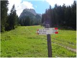 2
2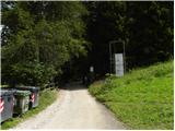 3
3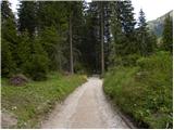 4
4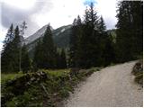 5
5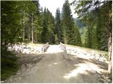 6
6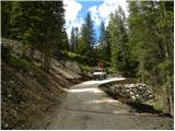 7
7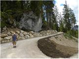 8
8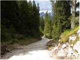 9
9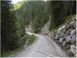 10
10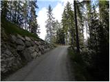 11
11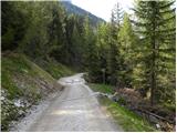 12
12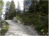 13
13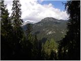 14
14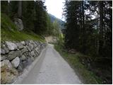 15
15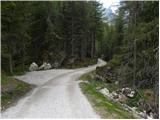 16
16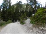 17
17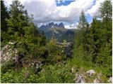 18
18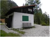 19
19 20
20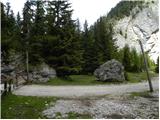 21
21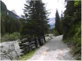 22
22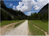 23
23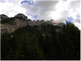 24
24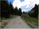 25
25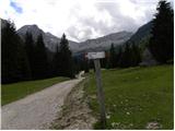 26
26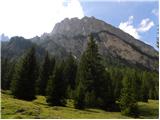 27
27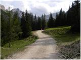 28
28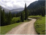 29
29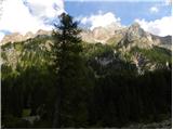 30
30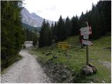 31
31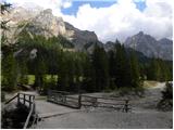 32
32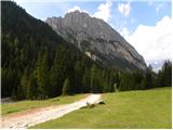 33
33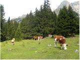 34
34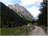 35
35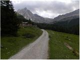 36
36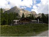 37
37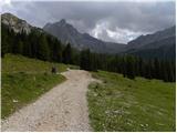 38
38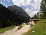 39
39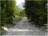 40
40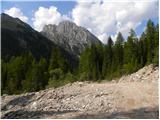 41
41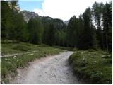 42
42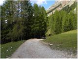 43
43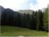 44
44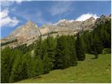 45
45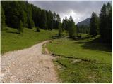 46
46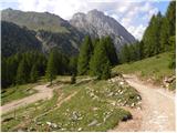 47
47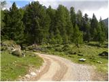 48
48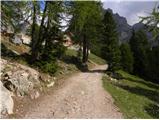 49
49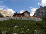 50
50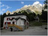 51
51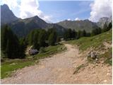 52
52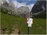 53
53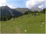 54
54 55
55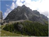 56
56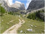 57
57 58
58 59
59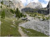 60
60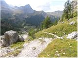 61
61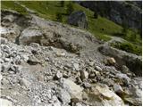 62
62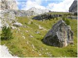 63
63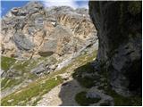 64
64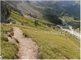 65
65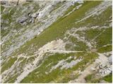 66
66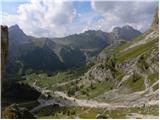 67
67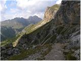 68
68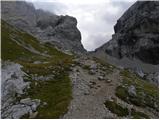 69
69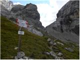 70
70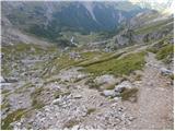 71
71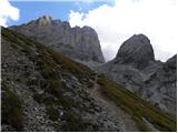 72
72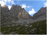 73
73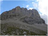 74
74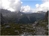 75
75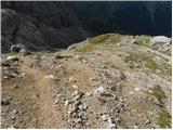 76
76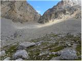 77
77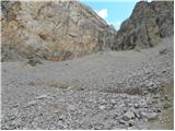 78
78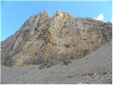 79
79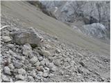 80
80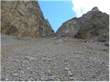 81
81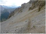 82
82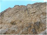 83
83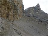 84
84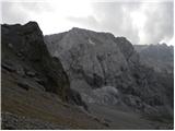 85
85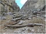 86
86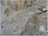 87
87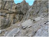 88
88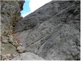 89
89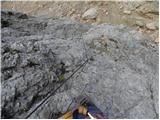 90
90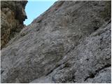 91
91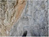 92
92 93
93 94
94 95
95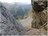 96
96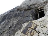 97
97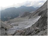 98
98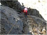 99
99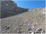 100
100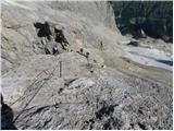 101
101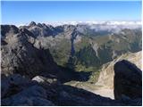 102
102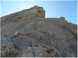 103
103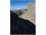 104
104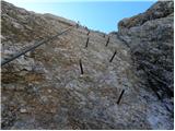 105
105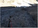 106
106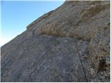 107
107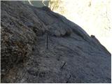 108
108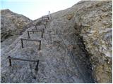 109
109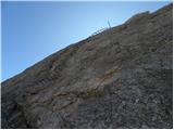 110
110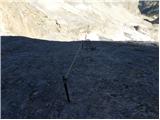 111
111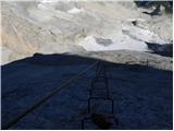 112
112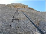 113
113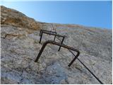 114
114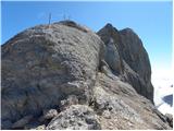 115
115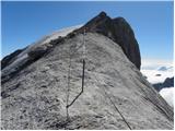 116
116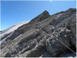 117
117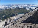 118
118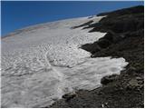 119
119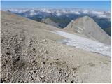 120
120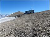 121
121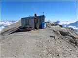 122
122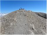 123
123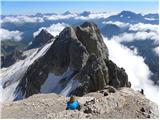 124
124 125
125
Discussion about the trip Alba di Canazei - Punta Penia (Marmolada)
|
| MajaDenis24. 04. 2019 |
Hi. I'm wondering if this is the most beautiful route to Marmolada and when should I go so that no ice axe and rope are needed?
|
|
|
|
| Rok25. 04. 2019 |
In late summer, there is usually only a small snowfield below the summit (picture 119). If it's not icy, you can cross it without an ice axe.
The same applies to the route from the starting point at Malga Ciapela, which joins this path just below Forcella Marmolada.
|
|
|
|
| MajaDenis27. 04. 2019 |
Thanks. Just this... is it really mandatory to have climbing gear with you and hire a guide?
|
|
|
|
| Rok27. 04. 2019 |
Helmet and via ferrata kit are good to have. But if you're used to high mountain hiking, I think you don't need a guide. Similarly difficult routes are also in the Slovenian high mountains. I'd say it's comparable in difficulty to Kopiščarjeva on Prisojnik.
|
|
|
|
| Janez Seliškar28. 04. 2019 |
Not only is it good to have a helmet and via ferrata kit, both are MANDATORY! Above Forcella Marmolada the via ferrata is steep, exposed and long. You'll need the helmet well before approaching the notch.
|
|
|
To post a comment you must log in:
If you do not yet have a username, you must first
register.