Rudno polje - Viševnik (via Kačji rob)
Starting point: Rudno polje (1347 m)
| Latitude/Longitude: | 46,3458°N 13,9236°E |
| |
Route name: via Kačji rob
Walking time: 2 h 30 min
Difficulty: partly demanding marked way
Elevation gain: 703 m
Elevation difference along the route: 745 m
Map: Triglav 1:25.000
Recommended equipment (summer):
Recommended equipment (winter): ice axe, crampons
Views: 78.952
 | 6 people like this post |
Access to starting point:
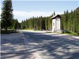
From the Ljubljana - Jesenice motorway we take the Lesce exit and continue on the road towards Bled. In Bled, at the traffic lights, the signs for Pokljuka direct us to the right. We continue driving through Gorje and past the abandoned Zatrnik ski resort to Rudno polje on Pokljuka (large parking lot, military barracks and shooting range).
Route description:
At the end of the parking lot a gravel road branches off to the right with signposts for Triglav. We head onto this road which ascends gently and brings us after ten minutes to the ski slope.
On the other side of the ski slope, next to the ski lift we will notice a marked hiking path which continues to the right from the road. We take the mentioned path which leads us in moderate ascent through a belt of forest to a gravel road (possible also by road to here), which we follow to the right but only a few steps. Just before the road crosses the ski slope a marked hiking path branches off to the left which first crosses a pasture fence and then ascends along the edge of the ski slope. At the top of the first ski lift the marked path turns left and begins to ascend more steeply along the edge of the second steeper ski slope. The second ski lift also ends soon and we continue along the path which enters a smaller relatively steep valley. Towards the top of the mentioned valley the path ascends relatively steeply then suddenly levels out and leads us past an abandoned hunting lookout to a junction.
At this point we leave the usual path to Viševnik and turn right onto a poorly visible trail which ascends gently upwards across the meadow. Somewhat higher the trail becomes more noticeable and enters the dwarf pine. The path ahead crosses the side ridge of Viševnik named Kačji rob and then enters the high mountain world. A beautiful path with numerous karst phenomena then leads us to a junction where we continue on the left path towards Srenjski preval (right to Blejska koča) which we reach after a few minutes of further walking.
From Srenjski preval we continue left (straight down Jezerce, right Studorski preval and Mali Draški vrh) along the path which ascends transversely across a relatively scree-covered slope (risk of slipping). Higher up the path crosses to the western side of the ridge and levels out somewhat. This is followed by a transverse ascent along the path running along the main ridge of Viševnik. Just a few meters below the summit the path crosses another short exposed ledge then we step onto the summit of Viševnik without major difficulties.
We can descend via the easier and shorter usual path.
Rudno polje - Planinski taborni prostor 0:10, Planinski taborni prostor - Planina Krasca 0:05, Planina Krasca - Zlata voda 0:50, Zlata voda - razpotje nad Srenjskim jezercem 0:45, razpotje nad Srenjskim jezercem - Srenjski preval 0:15, Srenjski preval - Viševnik 0:25.

Along the route: Planinski taborni prostor (1369m), Planina Krasca (1402m), Zlata voda (1717m), Kačji rob (1809m), Srenjsko jezerce (1864m), Razpotje nad Srenjskim jezercem (1904m), Srenjski preval (1959m)
Photos:
 1
1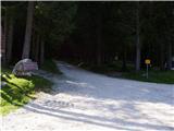 2
2 3
3 4
4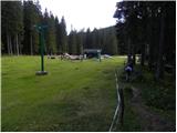 5
5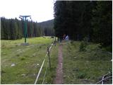 6
6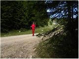 7
7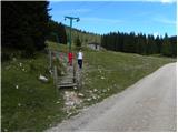 8
8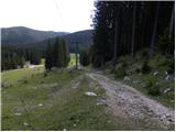 9
9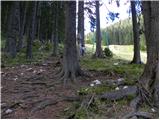 10
10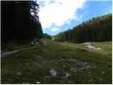 11
11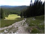 12
12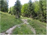 13
13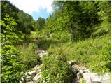 14
14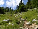 15
15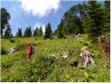 16
16 17
17 18
18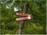 19
19 20
20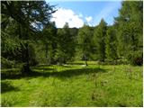 21
21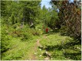 22
22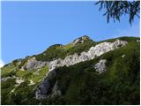 23
23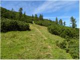 24
24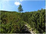 25
25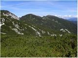 26
26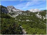 27
27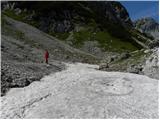 28
28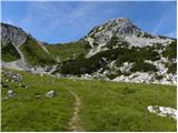 29
29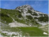 30
30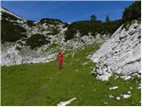 31
31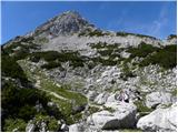 32
32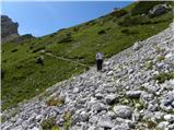 33
33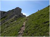 34
34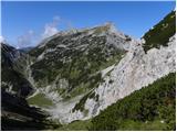 35
35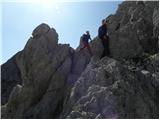 36
36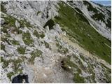 37
37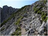 38
38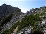 39
39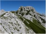 40
40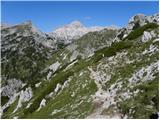 41
41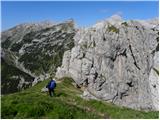 42
42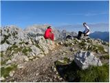 43
43
Discussion about the trip Rudno polje - Viševnik (via Kačji rob)
|
| Gost29. 09. 2007 |
Sure I'll go because it's awesome
|
|
|
|
| Gost29. 12. 2007 |
today was on Viševnik, seriously recommend crampons or even skates 
|
|
|
|
| Gost29. 12. 2007 |
As far as I know, there is some difference between crampons and skates. So what do you recommend? Be more serious, guy. Best, Fran 
|
|
|
|
| efes26. 08. 2009 |
Here, today we were with friends at Viševnik. Anyway, nice hike.
|
|
|
|
| efes27. 08. 2009 |
We forgot to write yesterday, mandatory equipment-PIPS, because there are lots of flying ants. SERIOUSLY NO JOKE!!!
|
|
|
|
| marjana06119. 09. 2011 |
hello
yesterday I was at the top of Viševnik, path from Rudno polje and back via Kačji rob. Although it was foggy and we could hardly see anything, the path is beautiful. Recommend visiting in clear weather, as the view of Triglav and all the major peaks of the Julian Alps is stunning then.
|
|
|
|
| thomas15. 11. 2011 |
Efes, do you spray yourself with a babe all over your body?
|
|
|
|
| FLEKSARCA15. 11. 2011 |
Check the date, two years ago he was spraying.
|
|
|
|
| rjurca17. 06. 2013 |
Does anyone know if the path is snow-free?
|
|
|
|
| otiv17. 06. 2013 |
Some larger snow patch is probably still on the path, which will serve well for refreshment in this June heat.
|
|
|
|
| Majdag15. 06. 2014 |
...Story with a happy ending... Probably many have already experienced slipping on snow. Then you realize how important good footwear and other equipment is, even though price usually decides when buying. May your steps be safe, there's still plenty of snow in the mountains:
http://www.gore-ljudje.net/novosti/107807/
|
|
|
|
| marych23. 05. 2017 |
Does anyone know if there's still any snow on this path?
|
|
|
|
| anazala21. 07. 2018 |
Was on Viševnik. You need to be very focused. I don't claim it's a very dangerous path. Good footwear, good equipment. Don't forget the poles. Weather can change in one hour or even sooner. If you're not experienced, go on the easier non-demanding path. This path is beautiful and well maintained.
|
|
|
|
| kekec127. 09. 2018 |
This path is nicer than the more crowded direct path. But right after Srenjski preval there is a 30 m uninsured transverse ascent above a steep scree slope. My wife started to feel dizzy and nauseous, but she still climbed through. The label "partly demanding path" is therefore justified.
|
|
|
|
| Keki9. 11. 2018 |
Is there any snow on Viševnik, or on the northern side on the approach, via Kačji rob?
|
|
|
|
| seinfeld24. 06. 2019 |
Yesterday, unplanned, I took this path to Viševnik. Nice, easy path, caution required right after Srenjski preval, where it is crumbly. There is still quite some snow on the path (on the flat), but it does not pose an obstacle.
I went down the easier path, total less than 8km in 2h40.
|
|
|
|
| Majdag3. 06. 2020 |
Viševnik... Ascent to the mountain along the usual path, past Plesišiča. Nice trail, only the wind was blowing strongly, no more snow. I descended via Kačji rob. Down in the valley there is still snow, it's nice to walk on it, no flowers yet. In the initial part of the ascent there is a lot of blooming alpine hairy cinquefoil and edelweiss.Have a nice day.
https://jelenkamenmajdag.blogspot.com/2020/06/visevnik.html
|
|
|
|
| Majdag11. 07. 2021 13:54:35 |
Oh, thanks, Laščan.
|
|
|
|
| nejcf24. 05. 2023 00:19:08 |
Debela Peč and Lipanca south of Viševnik. Velska valley with Koča na Uskovnici. One of the more known peaks where you can enjoy solitude. Just a few pieces of nonsense among many that you wrote
|
|
|
|
| ločanka24. 05. 2023 05:31:44 |
I was also surprised by what was written, far from an expert
|
|
|
|
| jprim24. 05. 2023 16:35:57 |
How happy some people are when some criticism appears, they immediately join in with agreement.
Personally, I think the report is very good, if there are any mistakes, just point them out, not this self-righteous commenting "far from an expert".
You, the author, weren't such an expert a few years ago either.
Just that from my side.
Safe steps.
LP!
|
|
|
|
| Kraški modras23. 06. 2023 14:56:37 |
I'm interested in how long it takes from Viševnik to Vodnikov dom.
Thanks
|
|
|
|
| ppegan23. 06. 2023 16:05:46 |
Depends on how fast you hike it, but in principle you should be at the hut in 2 hours.
|
|
|
|
| Kraški modras23. 06. 2023 21:34:10 |
Ppegann thanks for the answer
Half of it will hold
Pokljuka Viševnik via Kačji greben 2.5 hours
Viševnik - Vodnikov dom 2 hours
And Vodnik - Pokljuka 3 hours. Let someone correct me.
|
|
|
|
| BorStenar13. 09. 2024 18:15:57 |
hey, is there any snow up there now
|
|
|
|
| Majdag1. 08. 2025 19:46:04 |
Yesterday.. Ascent via Kačji rob, descent via the normal path. In the valley below Viševnik, all sorts of alpine flowers line up. Wonderful. Below the dance platform, the path is muddy and due to heavy rain, it's slippery accordingly. Dangerous for slips and injuries.
At the top there were many visitors, mountains foggy and no views. Nice to enjoy the flowers and nature.
https://jelenkamenmajdag.blogspot.com/2025/08/na-visevnik-grem-rozce-gledat.html
|
|
|
To post a comment you must log in:
If you do not yet have a username, you must first
register.