Rifugio Nordio - Osternig (Ojstrnik) (via Lom)
Starting point: Rifugio Nordio (1210 m)
| Latitude/Longitude: | 46,5506°N 13,4824°E |
| |
Route name: via Lom
Walking time: 2 h 15 min
Difficulty: easy marked way
Elevation gain: 842 m
Elevation difference along the route: 842 m
Map: Julijske Alpe - zahodni del 1:50.000
Recommended equipment (summer):
Recommended equipment (winter): ice axe, crampons
Views: 14.405
 | 2 people like this post |
Access to starting point:
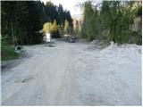
Drive to Tarvisio, which is just a few kilometers past the state border on the Italian side of the Rateče border crossing. You can also reach Tarvisio from Austria by first driving to Villach and then across the Thori-Coccau border crossing to Tarvisio. In Tarvisio, follow the signs for Udine on the old road (not the motorway). Shortly after Tarvisio, enter the village of Ugovizza, turning right into the village center. In the middle of the village, reach a stream where a mountain road branches uphill along the stream, asphalted. Drive this road to a junction, heading straight (right), immediately after which is the next junction where you turn left. Follow this mostly asphalted road to Rifugio Nordio, parking in the lot by the hut.
Route description:
From the parking lot, head to the left road passing by the dilapidated Rifugio Nordio hut. The road begins to ascend moderately, leading us in switchbacks to a spot exposed to falling rocks. Despite the mesh protection placed slightly above the road, caution is required. Best to leave this section as quickly as possible. Then cross the stream and continue ascending north to the junction. Right branches the direct path to Ojstrnik, but we proceed straight on the forest road, which soon turns into a footpath. The path then leads to a meadow, across which we walk to the state border. Here we already see the pasture, just a few steps away.
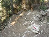
From the pasture, return to the state border information board and a few meters above it find the marked path to Planina Bistrica. The junction is marked only with Austrian markers. The path enters a dark forest, initially crossing the slopes almost horizontally, then joining the direct path from Rifugio Nordio.
The path continues steeply uphill through the forest. The gradient eases, and the path leads out of the forest onto the pastures of Planina Bistrica. Followed by ten minutes of walking on a gentle meadow to the huts on the pasture, already visible ahead.
On the pasture reach a road, turning left. Follow the road just a few dozen meters to the signs for Osternig. Head left onto the footpath, which ascends transversely across the steep grassy slopes of the mountain. After about 15 minutes from the road, the path steepens and joins the old military mule track, continuing right. The steepness of the path and slopes eases, leading to a fork of two paths. The right goes to the summit past the cross, the left directly to the summit. I recommend the right path, less than five minutes longer but more scenic. The gently ascending path passes the meteorological station to the cross on the eastern forepeak. At the cross, head left and continue along the scenic summit ridge. Summit reached in five minutes from the cross.
Rifugio Nordio - Lom 45 minutes, Lom - Planina Bistrica 45 minutes, Planina Bistrica - Ojstrnik 45 minutes.

Photos:
 1
1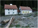 2
2 3
3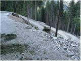 4
4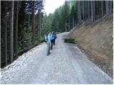 5
5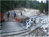 6
6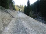 7
7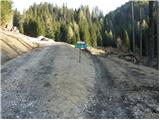 8
8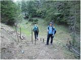 9
9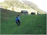 10
10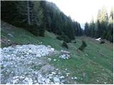 11
11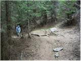 12
1213
 14
14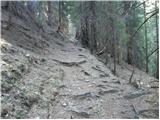 15
15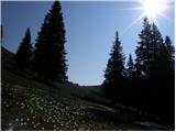 16
16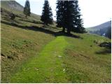 17
17 18
18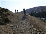 19
19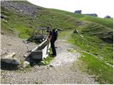 20
20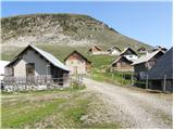 21
21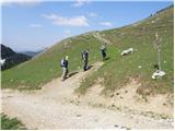 22
22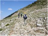 23
23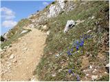 24
24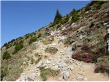 25
25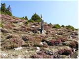 26
26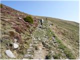 27
27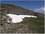 28
28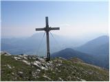 29
29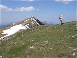 30
30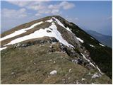 31
31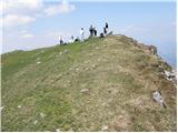 32
32
Discussion about the trip Rifugio Nordio - Osternig (Ojstrnik) (via Lom)
|
| johanh15. 08. 2012 |
Rif. Nordio has been newly built a bit higher. Right at the junction of the direct path to Bistriška planina (not open yet this year)
|
|
|
|
| darh8. 09. 2013 |
In mid-August we also ascended Ojstrnik via this path. The hut is now open. On the descent we detoured all the way to Zahomska planina. A more detailed path description with photos is published here.
|
|
|
|
| Kokta1. 11. 2013 |
The path through Lom (forest section) is impassable. Fallen trees.
|
|
|
|
| slavkovoda12. 07. 2014 |
The starting point is still at the parking lot at 1210 meters, the new, nice hut is located much higher at 1406 meters, good 10 minutes before the Lom alpine pasture. At the hut you can turn towards Lom and then on the border with Austria right, or at the hut right a bit downhill and then uphill, the paths soon merge and then cheerfully through the forest to the Bistrice alpine pasture. At the top of Ojstrnik there is a divine panoramic view in all directions.
|
|
|
To post a comment you must log in:
If you do not yet have a username, you must first
register.