Ravenska Kočna - Jenkova planina
Starting point: Ravenska Kočna (1000 m)
| Latitude/Longitude: | 46,3847°N 14,5364°E |
| |
Walking time: 1 h 30 min
Difficulty: easy marked way
Elevation gain: 495 m
Elevation difference along the route: 500 m
Map: Kamniške in Savinjske Alpe 1:50.000
Recommended equipment (summer):
Recommended equipment (winter):
Views: 17.770
 | 1 person like this post |
Access to starting point:
From the Gorenjska motorway, Kranj or Preddvor, we drive to Zgornje Jezersko, then approximately 1 km after the Petrol filling station, we turn right in the direction of Planšarsko jezero and Češka koča. Further, we drive past the mentioned lake, then the road leads us through a larger meadow, where the asphalt ends and from which a beautiful view opens up on the surrounding mountains, then the road returns into the forest, where it first crosses a torrent. A little further, the road splits, and we continue on the right road (left Gorniški center Davo Karničar and also the footpath to Jenkova planina and former starting point for the mentioned mountain pasture), on which we quickly reach a large marked parking lot, where we park.
Route description:
Somewhere in the middle of the large parking lot a passage opens to the left, by which there are signposts for Velika Baba, Goli vrh and a sign for the hunting path to Ledine. We start on a cart track which brings us to the edge of a meadow, where we will notice the Gorniški center on the left side. We continue straight to the well-visible signposts at the nearby junction, from which we continue straight in the direction of Velika Baba and Goli vrh (right Ledine). The path ahead still leads us along a cart track, which soon turns left, then ascends diagonally. Higher up, the path from the old starting point joins from the left, i.e., the marked path from Planšarsko jezero. The cart track on which we walk then changes into a footpath, which ascends relatively steeply through the forest. After approximately an hour and a half of walking, we step out of the forest onto the abandoned and quite overgrown Jenkova planina, where there is also a junction.
We continue straight (left Goli vrh - Slovenian path, right Velika Baba) to the "sign" (after Slovenia's entry into the Schengen area only a metal pole remains), which marks the border crossing. At the pole we will notice on the left side a smaller wooden cottage, to which only a few steps of walking separate us.

Photos:
 1
1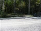 2
2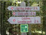 3
3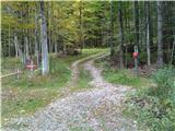 4
4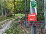 5
5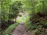 6
6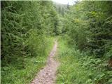 7
7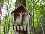 8
8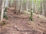 9
9 10
10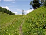 11
11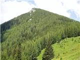 12
12 13
13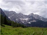 14
14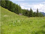 15
15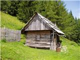 16
16
Discussion about the trip Ravenska Kočna - Jenkova planina
|
| Gost24. 06. 2007 |
Brane V. -Note: from Jenkova planina there is a nice marked path to Velika Baba, which unfortunately is not in this list. This is the longest variant. Shorter from Ledine on our side climbing-very demanding and easy on the Austrian side via Jezersko saddle.
|
|
|
|
| velkavrh10. 08. 2009 |
Yesterday I was just there for a short walk. From the junction where you leave the car, my son and I walked only fifty minutes, slowly rather than fast. Really suitable for every day to build fitness. The hut is really nice, all in flowers and even has a small vegetable garden. Really suitable to go up here after morning work, when we can't go further but want to go a bit uphill and into nature. On the way back we also saw the Jezerski praznik-Shepherd's ball, which was taking place at the lake. There was really a lot of visitors.
|
|
|
|
| joža x24. 11. 2009 |
From Ancelja to Jenkova planina is 1.5 hours of walking, the view from Jenkova planina is wonderful.
|
|
|
To post a comment you must log in:
If you do not yet have a username, you must first
register.