Dom na Smrekovcu - Krnes (direct way)
Starting point: Dom na Smrekovcu (1375 m)
| Latitude/Longitude: | 46,4131°N 14,8997°E |
| |
Route name: direct way
Walking time: 1 h 20 min
Difficulty: easy marked way
Elevation gain: 238 m
Elevation difference along the route: 285 m
Map: Kamniške in Savinjske Alpe 1:50.000
Recommended equipment (summer):
Recommended equipment (winter): ice axe, crampons
Views: 8.391
 | 2 people like this post |
Access to starting point:
From Mozirje, Gornji Grad or Luče we drive to Ljubno ob Savinji, from there we follow the signs for Smrekovec. Through Ljubno ob Savinji, we initially drive on an occasionally narrower road to Rastke, at the crossroads among the houses we follow the signs for Smrekovec. After the settlement the road widens, then it mostly gently to moderately ascends to Ljubenske Rastke, from here on it gradually becomes narrower and steeper. We follow the mentioned road at the crossroads in the direction of the signs for Dom na Smrekovcu, and we park on the parking lot somewhat before the mountain hut.
Route description:
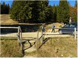
From the parking lot, we first walk to the mountain hut, bypass it on the left side, and continue toward Smrekovec and Raduha, then diagonally ascend through a strip of forest. A few minutes higher, the path splits, and we choose the slightly left path, marked with signs for the mountain huts Koča na Loki and Koča na Travniku (right, the peak Smrekovec). Next follows a light to moderate ascent, then we reach the pastures of Krumpaška planina, where the path flattens further, and we continue crossing the slopes of Smrekovec. A little farther, we reach the indistinct ridge of the Smrekovec mountain range, where an unmarked path from the right, leading over the peak of Smrekovec, joins us.
We continue on the marked path heading west, mostly ascending gently with occasional beautiful views. Later, we arrive at a junction before a strip of dense spruce forest, where we leave the wide, well-trodden path and continue right toward the peak Krnes.
Here, we first walk a few dozen steps on pathless terrain. At the edge of the forest, a footpath appears, leading us left into the forest (straight ahead on the other side of the ridge is lake Črno jezero (Končnikova mlakuža)). Through a strip of forest, we ascend slightly more for a while, then continue a gentle ascent along the edge of the forest. When a passage to an indistinct peak opens slightly further to the right, we notice the inscription Krnes on a rock, marking the aforementioned peak.
Description and pictures (except the first, which is older) refer to the condition in June 2024.

Along the route: Krumpaška planina (1488m)
Photos:
 1
1 2
2 3
3 4
4 5
5 6
6 7
7 8
8 9
9 10
10 11
11 12
12 13
13 14
14 15
15 16
16 17
17 18
18 19
19 20
20 21
21 22
22 23
23 24
24 25
25 26
26 27
27 28
28
Discussion about the trip Dom na Smrekovcu - Krnes (direct way)
To post a comment you must log in:
If you do not yet have a username, you must first
register.