| IgorZlodej10. 10. 2015 08:16:37 |
Starting point Plan dei Spadovai in the upper part of Dunja valley.
Opposite the parking lot path 605 starts, initially a forest track, which higher up turns into a trail along which I go to the large screes under the Two Spits. At the start of the screes I leave the mentioned path and go left, the trail is visible but less trodden, in the initial part there is even some freshly cut brushwood. The path takes me in zigzags to a scenic promontory, where the path to the valley branches left, right it goes around the edge, where a cable is installed on a somewhat awkward ledge. The further course of the path is marked with red dots and goes upwards to the ruins of military objects.
The short further ascent to the summit itself is best done along the SE slopes to the top (easy climbing I+), as I somehow didn't trust the old cables installed above the ruins.
I descended to the ruins along the ascent direction, the trail marked with dots from the summit runs along the eastern slope and splits somewhat below the summit, left to the saddle under Velika Spica, right to the ruins. I also checked the western summit, where there are also ruins of military objects, returned under Gosadon and descended to the scenic promontory. From there directly down the former mule track (unmarked), which soon brings me to a large cave in which there was probably once a military object that burned down. I continue along the path, which is somewhat less visible in places, lower down it turns into a proper wide mule track, which brings me to the Dunja - Rudni vrh road at Zachi chapel. From there back to the parking lot less than 20 minutes.
 1 1 2 2 3 3 4 4 5 5 6 6 7 7 8 8 9 9 10 10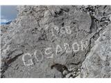 11 11 12 12 13 13 14 14 15 15 16 16 17 17
| (+3) |  | |
|
|