Planina pri Sevnici - Skalica (Bohor) (via Veliki Javornik)
Starting point: Planina pri Sevnici (588 m)
| Lat/Lon: | 46,10116°N 15,41185°E |
| |
Name of path: via Veliki Javornik
Time of walking: 3 h 30 min
Difficulty: easy marked way
Altitude difference: 363 m
Altitude difference po putu: 615 m
Map:
Recommended equipment (summer):
Recommended equipment (winter): ice axe, crampons
Views: 150
 | 2 people like this post |
Access to the starting point:
a) Drive to Sevnica (to get here from Radeče, Mokronogo or Krško), then take the road in the direction of Planina pri Sevnici. When you reach the Petrol station located near Planina pri Sevnici, turn right in the direction of Montpreis and park in the large asphalt parking lot next to the cemetery just after the intersection.
b) Drive to Šentjur (to get here from Celje, the Štajerska motorway exit Dramlje or Šmarij pri Jelšah), then follow the signs for Kozje and Mountain pasture near Sevnica. At the end of Šentjur go right towards Planina pri Sevnici (slightly left Kozje and Podsreda). Continue mostly uphill, then when the road levels out and you see a Petrol station on the right hand side, located in the immediate vicinity of Planina pri Sevnici, go left towards Montpreis and then just after the crossroads park in the cemetery parking lot.
Path description:
From the parking lot, return to the main road and head towards Sevnica from the nearby crossroads. For about 20 minutes, we descend along the edge of the main road, which offers beautiful views of the surrounding hills, and then we reach the village of Stara Žaga, where signs direct us left onto a side road. The way forward climbs past a few houses and arrives at a marked crossroads where the marked path splits.
Continue along the road in the route Koča na Bohorju (right Skalica), which becomes macadam at the end of the settlement and leads into the gorge of the Belega potok. Higher up, the road makes two serpentines, and from the junction after the second serpentine go left. Continue up the road for a while, and then, when the road turns right, continue left along the stream, where a short steep section is helped by a rope (there is a greater risk of slipping, especially in wet conditions and if it is frosty). A little further on we are helped by another rope, and then we climb crosswise to the saddle north of Kamnega vrh (833 m), where we return to the road and where there is a marked crossroads.
A sharp left fork leads to the partisan hospital, a left turn on the road leads to the eastern part of Bohor, and we continue straight on the marked road in the direction of the Cottage on Bohor. Continue along the macadam road, which leads us a little further to the next crossroads.
This time we continue sharp left (if we continue straight we can reach Hunting lodge Bohor and the saddle between Veliki and Mali Javornik) and continue our ascent along the road that leads us through the forest. There is a longer cross-climb to the left, and when you reach the pass between Koprivnik on the left and Veliki Javornik on the right, you arrive at a marked crossroads.
Continue to the right in the direction of Veliki Javornik (slightly left Koprivnik, straight Koča na Bohorju) and continue along the gently sloping road. After a few minutes, the road ends at a turning point and we continue our ascent along cart track, which soon splits. Continue slightly right in the direction of Veliki Javornik (straight ahead Skalica - the path that bypasses the top of Javornik) and gradually start climbing steeper, following the signs at a few crossroads. Higher up, we leave the forest and in a few steps reach the highest point of Veliki Javornik.
From Veliki Javornik, continue straight ahead and head south-west, walking along the edge of the forest. After a short, steep descent, the signs direct you to the left into the forest, through which you begin to descend steeply. Lower down, a slightly shorter path joins us from the left, bypassing the summit of Veliki Javornik, and we continue to the right, following cart track to reach a dirt road.
Continue slightly right towards Lisca and Skalica (to the left Grmada, Partisan Hospital and Koča na Bohorju over Travni laz) and continue along the road, which slowly climbs and after a few minutes leads to a crossroads, where you go right (the road to the left descends to the nearby settlements of Zalog, Mrzla mountain pasture. . . ) and in a few steps arrive at the pass between Mali and Veliki Javornik. Here we take a sharp left, onto a side road with signs for Lisca, and we continue along a slightly narrower road, which turns into cart track after the meadow, which we pass on the lower side. The way ahead leads us along cart track, which descends gently for the most part, and at crossroads we follow it in the direction of the markings. After a while, pass the cross and arrive at a marked crossroads, where you take a sharp right in the direction of Skalica and Planina pri Sevnici (to the left Lisca).
There is some more descent and we reach a small pass to the east of Skalica, where the path to Planina pri Sevnici continues to the right, and we continue straight on to Skalica, where we first cross a short steep slope and then climb an undistinguished ridge, which in a few minutes takes us to the top of Skalica, from which we get some views.
Planina pri Sevnici - Stara Žaga 0:20, Stara Žaga - Veliki Javornik 2:10, Veliki Javornik - Skalica 1:00.
Description and pictures refer to the situation in March 2022.

Pictures:
 1
1 2
2 3
3 4
4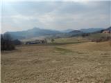 5
5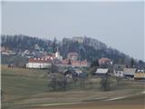 6
6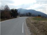 7
7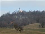 8
8 9
9 10
10 11
11 12
12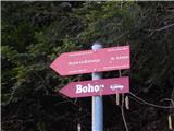 13
13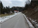 14
14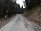 15
15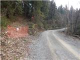 16
16 17
17 18
18 19
19 20
20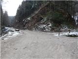 21
21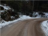 22
22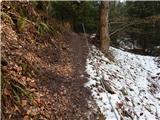 23
23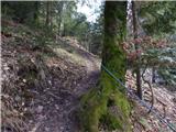 24
24 25
25 26
26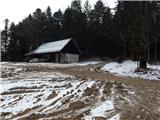 27
27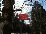 28
28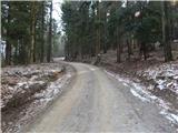 29
29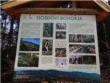 30
30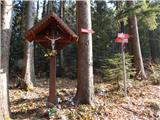 31
31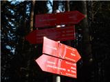 32
32 33
33 34
34 35
35 36
36 37
37 38
38 39
39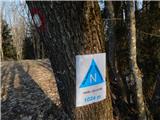 40
40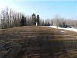 41
41 42
42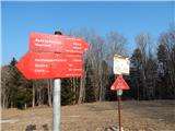 43
43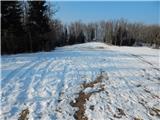 44
44 45
45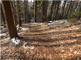 46
46 47
47 48
48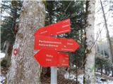 49
49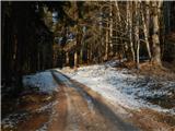 50
50 51
51 52
52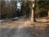 53
53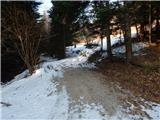 54
54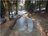 55
55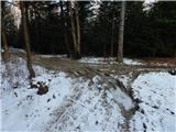 56
56 57
57 58
58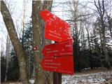 59
59 60
60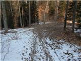 61
61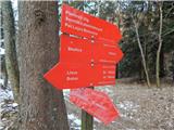 62
62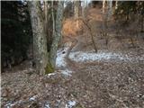 63
63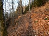 64
64 65
65 66
66 67
67 68
68 69
69
Discussion about the trail Planina pri Sevnici - Skalica (Bohor) (via Veliki Javornik)