Nemilje - Sveti Primož in Felicijan (Jamnik) (on marked path)
Starting point: Nemilje (505 m)
| Lat/Lon: | 46,26109°N 14,22048°E |
| |
Name of path: on marked path
Time of walking: 50 min
Difficulty: easy unmarked way
Altitude difference: 326 m
Altitude difference po putu: 340 m
Map: Škofjeloško in Cerkljansko hribovje 1:50.000
Recommended equipment (summer):
Recommended equipment (winter): ice axe, crampons
Views: 6.190
 | 1 person likes this post |
Access to the starting point:
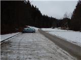
a) Drive to Kranj, then follow the signs for Besnica (the turnoff from the old Ljubljana - Kranj road is before the bridge over the Sava River, or after the bridge if coming from Kranja). Continue through Spodnja, Zgornja Besnica and Njivica. A little further on, you arrive in Nemilje, where from the crossroads by the Na Razpokah Inn you turn right towards Kropa and Dražgoše, then after the bus station turn right onto the dirt road towards Jamnik and Bela Peča. From the crossroads, drive for about 200 m and then park in the parking lot on the left side of the road.
b) From Železniki, drive to Dražgoše, then continue towards Kropa. Follow the cross-country drive on the slopes of Jelovica, then reach a crossroads where the road to Kranj turns sharp right (the turn-off for Kranj is only from the opposite direction). Here, take a sharp right (if the turn is too sharp, there is a turning point about 50 metres further on), then descend to Podblica and on to the settlement of Nemilje (the road to Kranj is from the opposite direction). Nemilje is a short distance from the Jelovica. When you reach Nemilje, go left before the bus station and then left before the Na Razpokah Inn onto the dirt road, along which there are signs for Jamnik and Belo Peć. From the crossroads, drive for about 200 m and then park in the parking lot on the left side of the road.
Path description:
At the end of the parking lot, the signs for Jamnik and Bela peč direct us to the right, where we cross the Potoščica stream over a bridge. After the bridge, the road turns left, and just a little further on it turns sharp right. From the right-hand bend continue straight on to cart track, at which there are also signs for Jamnik. After cart track, which gives us some views, we climb to the ridge in a few minutes, where the path is laid, and we follow the occasional markings at a few small crossroads. Higher up, the ridge gives way to the right, and after a small pass we descend to another trail from the village of Nemilje, which is not marked.
Continue straight ahead and follow the path cart track, which climbs gently to moderately, only occasionally ascending over a short steeper section. Higher up, the path from Njivica joins us from the right, and we continue the traverse to the left. When a little further on, sharply to the right, cart track branches off, we continue along it, and it leads us quite gently past two goats already visible from a little lower down. There is a cross-climb and we reach the eastern ridge Jamnik, where the path from Rovt joins us from the right. Here, continue sharp left and follow the increasingly scenic cart track, which leads to the left of the church. When you reach the other side of the church, take a sharp right and walk a few steps to the Church of St Primož and Felicijan in Jamnik.
Description and pictures refer to the situation in December 2020.

Pictures:
 1
1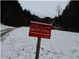 2
2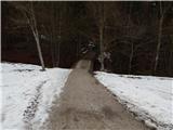 3
3 4
4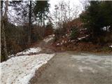 5
5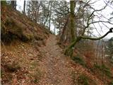 6
6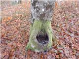 7
7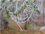 8
8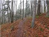 9
9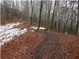 10
10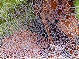 11
11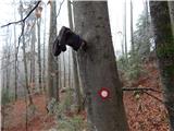 12
12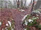 13
13 14
14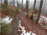 15
15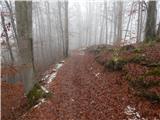 16
16 17
17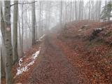 18
18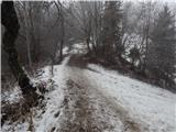 19
19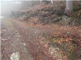 20
20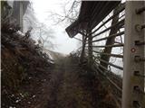 21
21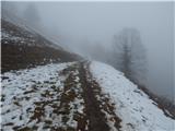 22
22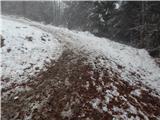 23
23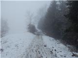 24
24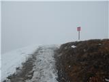 25
25 26
26
Discussion about the trail Nemilje - Sveti Primož in Felicijan (Jamnik) (on marked path)