Lake Gradišče - Sveti Mohor on Mohorjev hrib (via Vinje pri Moravčah)
Starting point: Lake Gradišče (355 m)
| Lat/Lon: | 46,1621°N 14,708°E |
| |
Name of path: via Vinje pri Moravčah
Time of walking: 1 h 35 min
Difficulty: easy marked way
Altitude difference: 156 m
Altitude difference po putu: 215 m
Map:
Recommended equipment (summer):
Recommended equipment (winter):
Views: 1.720
 | 1 person likes this post |
Access to the starting point:
From the motorway Ljubljana - Maribor, take the exit Lukovica, and then continue driving towards Moravče. After crossing Radomlje, you will reach the beginning of the settlement Spodnje Prapreče, where at the crossroads turn left towards Gradiška jezera. After a short climb, you reach a junction with a priority road, where you continue right towards Lake Gradišče (left Gradišče), and then just a little further, from the priority road, left towards Lake Gradišče (right Preserje pri Lukovici), in front of which you park in a larger parking lot.
Path description:
From the starting point, continue along the marked path in the direction of Limbarska gora, which continues along the northern coast of Lake Gradišče. The trail, which continues along a dirt road closed to public traffic, soon turns right and crosses to the east side of the lake, where the marked trail to Limbarska gora turns left into the forest.
Continue towards Limbarska gora, where you first climb steeply and then the path, which follows cart track, quickly flattens out. Higher up, out of the woods, a fine view opens up to the Church of St. Mohor on Mohorje Hill to the right, and the path descends in a few minutes to the settlement Vinje pri Moravčah, where there is a marked crossroads.
Continue downhill to the right towards St. Mohorje (Limbarska gora on the left), where you will first pass a few houses and then reach the Drtijščica stream. Continue along the stream for a few minutes, then pass in front of a small dam and where there are a few houses on the other side of the stream, over a footbridge to the other side of the stream, passing the houses on the right.
When you reach the macadam road by the houses, go right and climb through the meadows and past the cross to the Rožek homestead, where there is a marked crossroads.
The path to Rožek Castle branches off to the right, straight ahead to Lake Gradišče, and we continue left in the direction of St. Mohorje. Above the farmhouse, the path turns into the forest and the markings become more frequent again. Higher up, the path becomes more difficult and soon another unmarked path from Lake Gradiška joins us from the right.
Continue to the left, following the markings, and you can see the Church of St. Mohor quite close up. A few minutes further on, you reach a macadam road, where you go left (right Imenje and Tuštanj), and the path continues past a few stations of the cross. When you reach a nearby house, go slightly left, then climb the stairs to the Church of St.
Starting point - Vinje pri Moravčah 0:45, Vinje pri Moravčah - St. Mohor 0:50.
Description and pictures refer to the situation in 2018 (November).

Pictures:
 1
1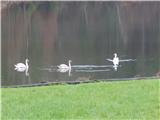 2
2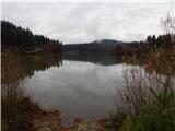 3
3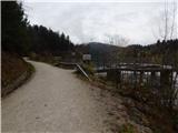 4
4 5
5 6
6 7
7 8
8 9
9 10
10 11
11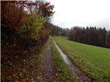 12
12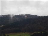 13
13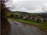 14
14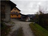 15
15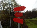 16
16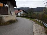 17
17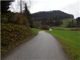 18
18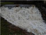 19
19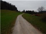 20
20 21
21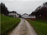 22
22 23
23 24
24 25
25 26
26 27
27 28
28 29
29 30
30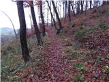 31
31 32
32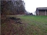 33
33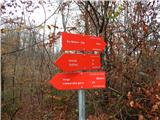 34
34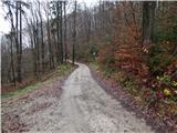 35
35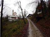 36
36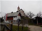 37
37 38
38
Discussion about the trail Lake Gradišče - Sveti Mohor on Mohorjev hrib (via Vinje pri Moravčah)