Koprivnik v Bohinju - Spodnji Goreljek (Pokljuka) (via model of windmill)
Starting point: Koprivnik v Bohinju (971 m)
| Lat/Lon: | 46,3059°N 13,9832°E |
| |
Name of path: via model of windmill
Time of walking: 1 h 10 min
Difficulty: easy unmarked way
Altitude difference: 251 m
Altitude difference po putu: 260 m
Map: TNP 1:50.000
Recommended equipment (summer):
Recommended equipment (winter):
Views: 1.210
 | 2 people like this post |
Access to the starting point:
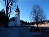
a) From the motorway Ljubljana - Jesenica, take the exit Lesce and then continue to Bled and then Bohinj. After Bitnje, which the main road passes on the left, take a sharp right in the direction of Jereka and Pokljuka. The road then climbs steeply at first, and then gradually flattens out after Koriti, leading to a crossroads by the bus station, where you turn right in the direction of Pokljuka, Koprivnik and Jereka (straight ahead to Srednja vas). Just after the crossroads we arrive at Jereka, and from the crossroads in front of the church we continue straight on towards Pokljuka (left Podjelje). After Jereka the road starts to climb steeply again, and higher up it levels off and continues along the Mrzle potok. At the bus stop, the signs for Koprivnik direct us to the left, and we drive another 200 m from the junction, then park in the parking lot near the parish church.
b) From Železniki or Podbrdo, drive to Bohinjska Bistrica, then continue in the direction of Bled. Shortly after the Petrol station, which is located just after Bohinjska Bistrica, turn left in the direction of Pokljuka and Jereka. The road climbs steeply at first, then gradually flattens out behind Koriti, leading to a junction by the bus station, where you continue right in the direction of Pokljuka, Koprivnik and Jereka (straight ahead Srednja vas). Just after the crossroads we arrive at Jereka, and from the crossroads in front of the church we continue straight on towards Pokljuka (left Podjelje). After Jereka the road starts to climb steeply again, and higher up it levels off and continues along the Mrzle potok. At the bus stop, the signs for Koprivnik direct us to the left, and we drive another 200 m from the junction, then park in the parking lot near the parish church.
Path description:
From the church parking lot continue in the direction of the model of the windmill, and after just 50 metres we reach a crossroads by the Pr Senekar guesthouse, where we continue straight on (left on the carriageway towards Zgornje Goreljko). A little further on, at the crossroads behind the transformer, we continue left, and then after a while we turn slightly left again. The way ahead leads over a bridge with a green fence, and at the first crossroads after the bridge, go right in the direction of the mock windmill. The asphalt road leads past a few more houses and a chapel, and then you reach the model windmill, next to which there is an information board.
From the mock-up, continue along the road, which begins to climb steeply after the "last" permanently inhabited house. After a short climb, you reach the next house, after which you follow the cart track, which leads you across a meadow to the left. After a few minutes, you reach the next hamlet, where the path first leads you through the yard of a nearby house, and behind the house you enter an asphalt road. At the first crossroads, turn right and then pass a few more inhabited houses, straight on to cart track, which continues the climb through the hay meadows. Occasionally the path still leads past a hut, but when you reach a narrower tarmac road, you have two options for continuing.
You can continue slightly left on the asphalt road, but it is preferable to take a sharp right onto the road, which soon loses its asphalt coating. The way ahead leads us along the edge of the hay meadow, and the path turns into woods behind the waterworks, while we follow the ever narrower cart track past individual huts, then mainly vertical. Further on, the cart track turns into an increasingly faint path, and when it is no longer possible to follow it, we continue upwards to the left and in a minute or two reach the asphalt road leading to Zgornje Goreljko (here we also merge with the trail, if we would have continued on the asphalt road lower down).
The asphalt road ascends and then, at a higher altitude, it becomes a bit more level and leads to individual huts on the outskirts of Lower Goreljko, where there is also a turn-off to the central part of the settlement. Continue along the right-hand road in the direction of Spodnje Goreljko (along the main road Zgornji Goreljek), which leads us past a few huts to a small pass, from which we quickly descend to the "central" part of Spodnje Goreljko, where there are a few more huts.
Description and pictures refer to the situation in 2017 (March).

Pictures:
 1
1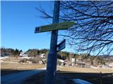 2
2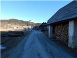 3
3 4
4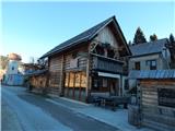 5
5 6
6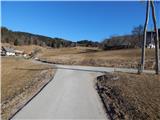 7
7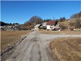 8
8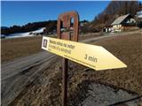 9
9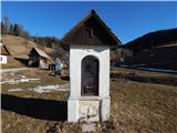 10
10 11
11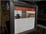 12
12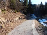 13
13 14
14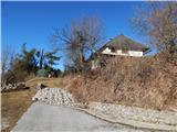 15
15 16
16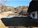 17
17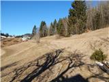 18
18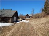 19
19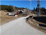 20
20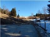 21
21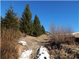 22
22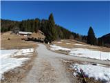 23
23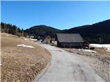 24
24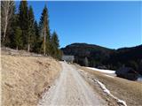 25
25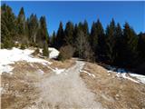 26
26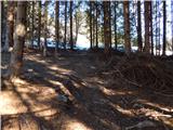 27
27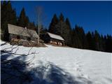 28
28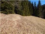 29
29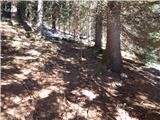 30
30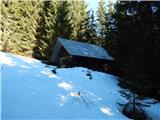 31
31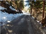 32
32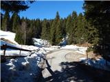 33
33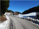 34
34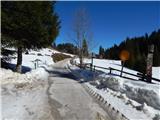 35
35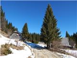 36
36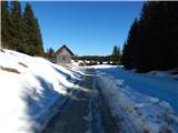 37
37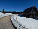 38
38 39
39 40
40
Discussion about the trail Koprivnik v Bohinju - Spodnji Goreljek (Pokljuka) (via model of windmill)